

INDIANAPOLIS (WRTV) — The extreme heat warning has been extended for another day as temperatures continue to soar into the 90s. Another hot and humid afternoon. We will finally see a pattern change for the holiday weekend. This will bring several thunderstorm chances through next week.
TODAY
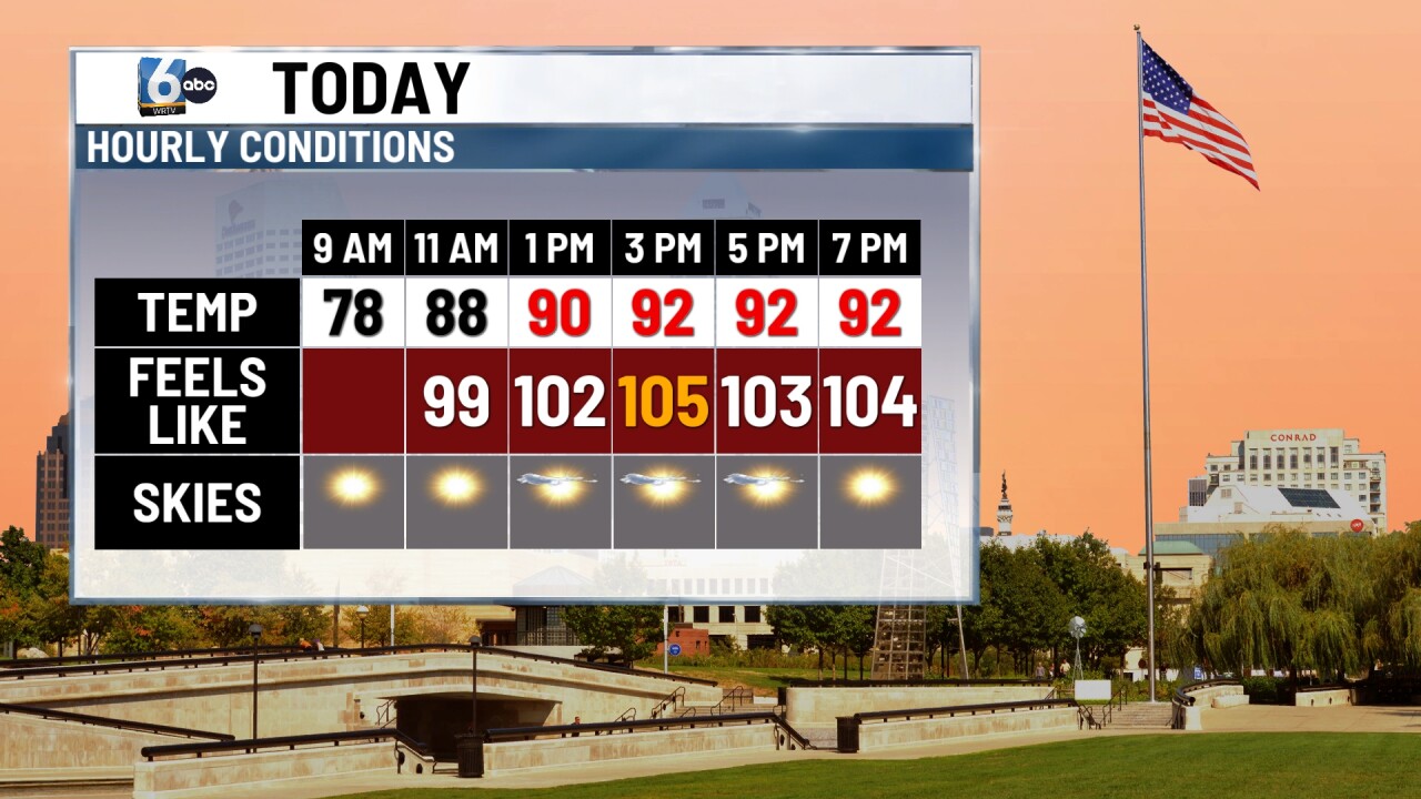
Extreme heat continues with high temperatures into the lower 90s. Heat indices or feels like temperatures will climb to 105 or higher during the afternoon. It will be sunny and dry again today.
TONIGHT

Mild and muggy once again tonight with temperatures only dropping into the 70s.
TOMORROW

Partly cloudy conditions for the afternoon with a pattern change. This pattern change will allow for the ridge of high-pressure in the upper levels of the atmosphere to shift a little bit further southward. This will bring several storm chances on Friday afternoon and also into the holiday weekend. There is a level one out of five risk that some of the thunderstorms could reach severe criteria Friday afternoon. Main threats will be heavy rainfall and some gusty winds.
7 DAY EXTENDED FORECAST
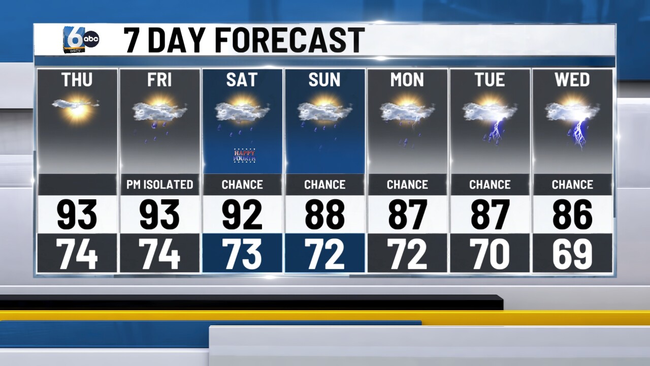
Another marginal risk of strong to severe thunderstorms is possible on Saturday. During the peak of the day, showers and storms will develop some of which may contain some heavy rainfall in gusty winds. High temperatures will still be into the lower 90s. Although humidity values begin to drop a little bit stretching into the weekend. More rain chances will be possible on Sunday. Scattered showers and thunderstorms will be possible through parts of next week as well. High temperatures will be into the mid upper 80s.
