

INDIANAPOLIS (WRTV) — A slow-moving front brings central Indiana a couple of rain chances in the coming days. Widespread rain is anticipated on Friday. Indiana's first heat wave is on the way next week.

TONIGHT:
Spotty showers and storms are possible this evening into early tonight. There is an isolated chance of a strong, gusty storms south of I-70. Low temperatures in the mid-60s.
TOMORROW:
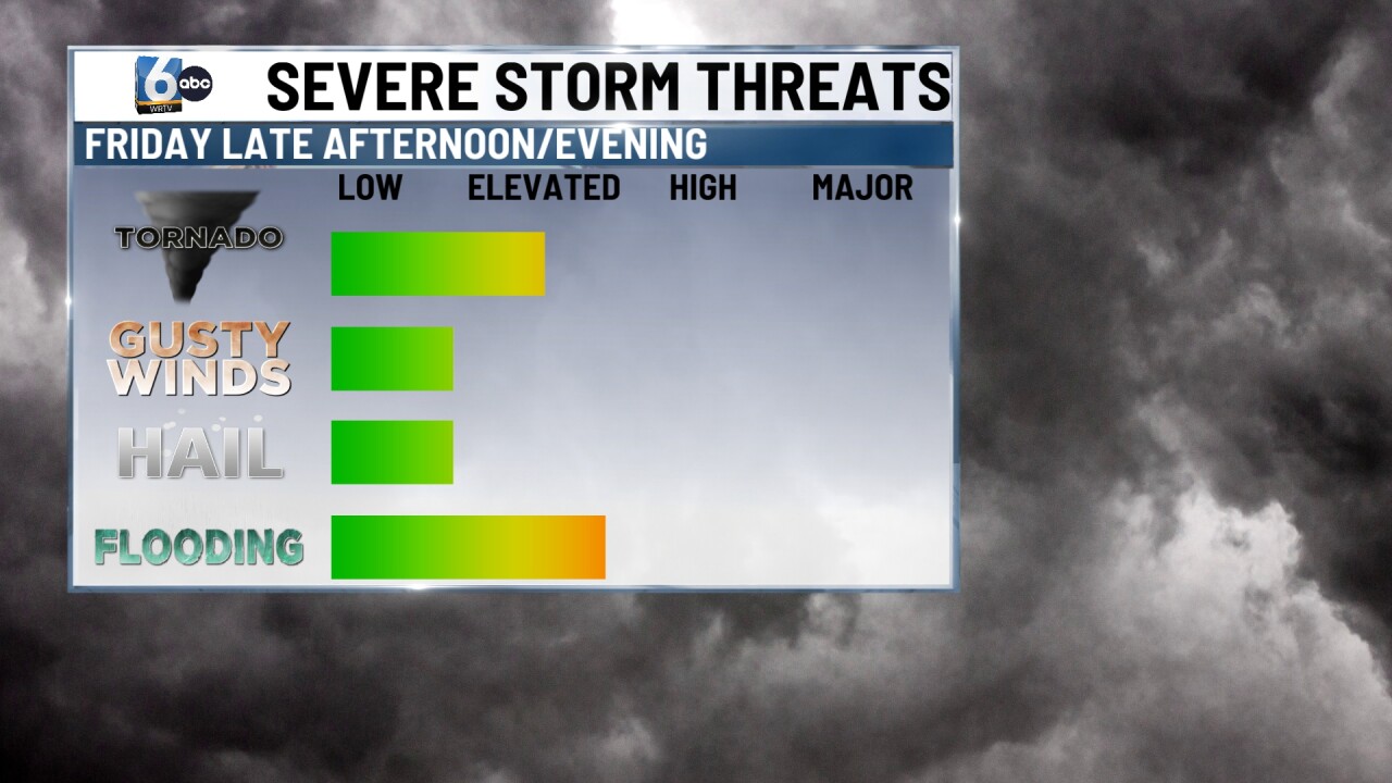

Showers and storms are likely on/off throughout the day. A slight (2/5) risk of severe storms is in place for SW Indiana, mainly late in the day. An isolated chance of spin-up tornadoes along with damaging winds is on the table. Flooding is something to monitor in SW Indiana as well, with a FLOOD WATCH in place. High temperatures in the mid-70s.


SATURDAY:

Partly cloudy skies. Isolated showers/storms could still pop up south of I-70. High temperatures in the low 80s.
7-DAY FORECAST:

A warm front lifts north, and Sunday PM will begin our warm-up with high temperatures in the upper 80s. Next week will feature multiple days in the 90s. When you factor in a humid air mass, the peak heat index values will be in the triple digits for multiple days.
