

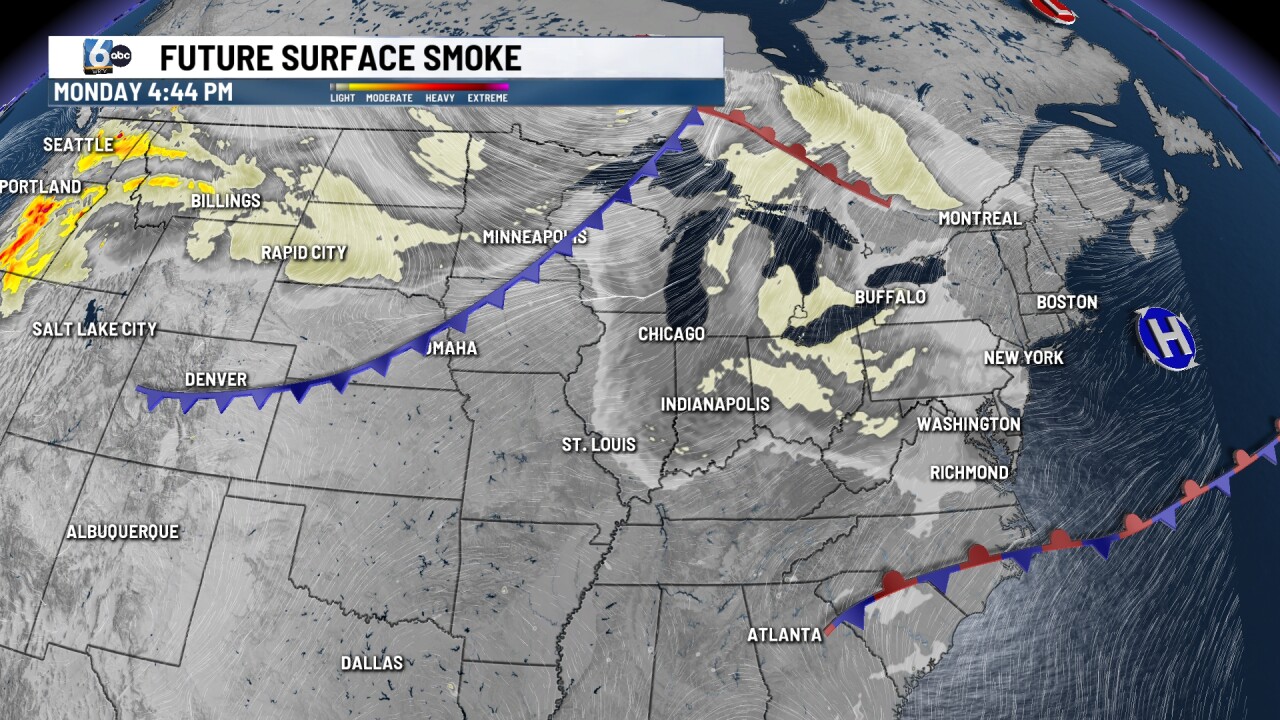

INDIANAPOLIS — Another hazy day across parts of Indiana. Showers and thunderstorms overnight and into Tuesday will usher in less humid air and cooler temperatures for the middle part of the work week.
TODAY:
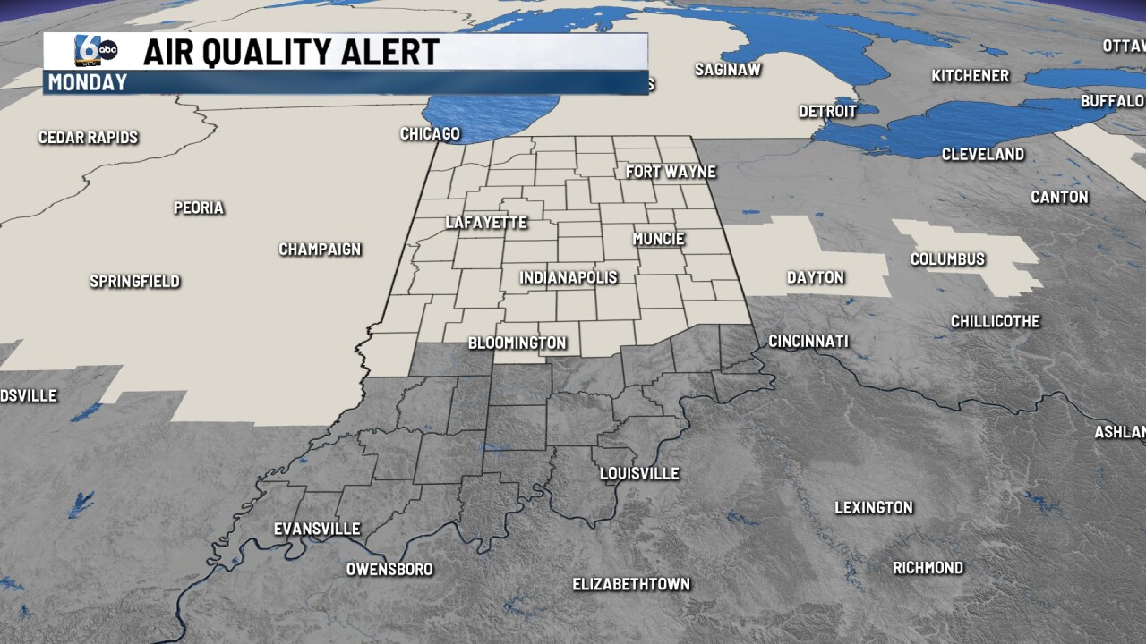
Air Quality Alert in place all day today thanks to hazy conditions from Canadian wildfire smoke. If you have respiratory illnesses, this might not be the greatest day for you to spend an extended period of time outside. High temperatures will climb into the upper 80s with uncomfortable, humidity values. Much of the day will be dry with rain chances arriving later tonight.
TONIGHT:
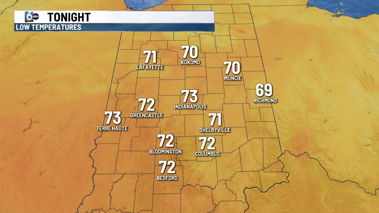
Showers and thunderstorms possible overnight with temperatures falling into the 70s. There is a level one risk that some of the thunderstorms could reach severe criteria across parts of Central in Northwestern, Indiana.
TOMORROW:
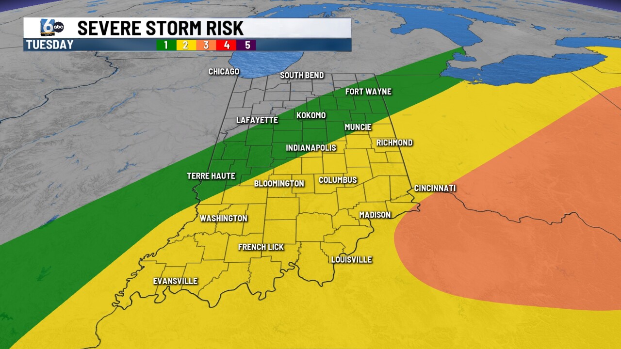
Showers and thunderstorms will be possible on your Tuesday. Some of the thunderstorms could be on the stronger side with gusty winds and heavy rainfall. High temperatures will be climbing into the upper 80s.
7 DAY EXTENDED FORECAST:
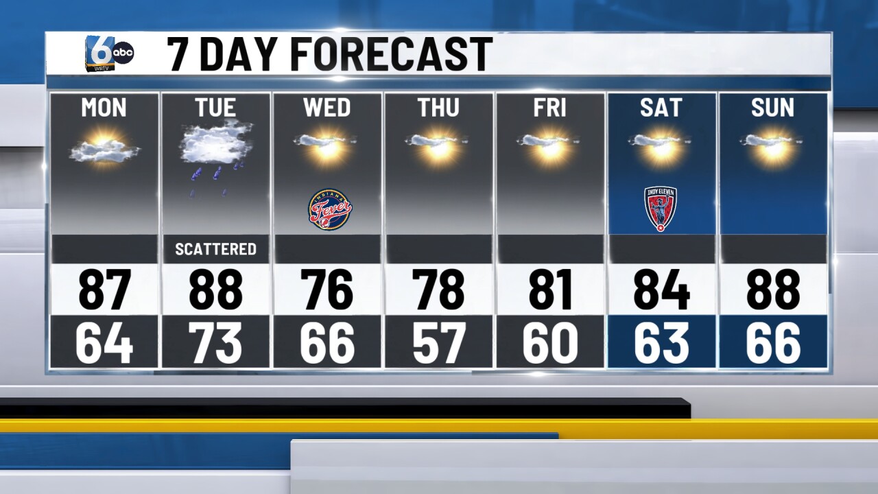
Less humid, and comfortable temperatures move in across parts of the state for the middle part of the work week. Wednesday and Thursday high temperatures will be into the 70s with sunny skies and low humidity. Early Thursday morning temperatures will drop into the upper 50s.
Temperatures returned back into the 80s for the weekend. Much of the rest of the week will be dry with sunny skies throughout the weekend.
