


INDIANAPOLIS (WRTV) — Hot and humid conditions expected for the next couple of days. Spotty rain chances will be possible through the first part of the weekend.
TODAY:
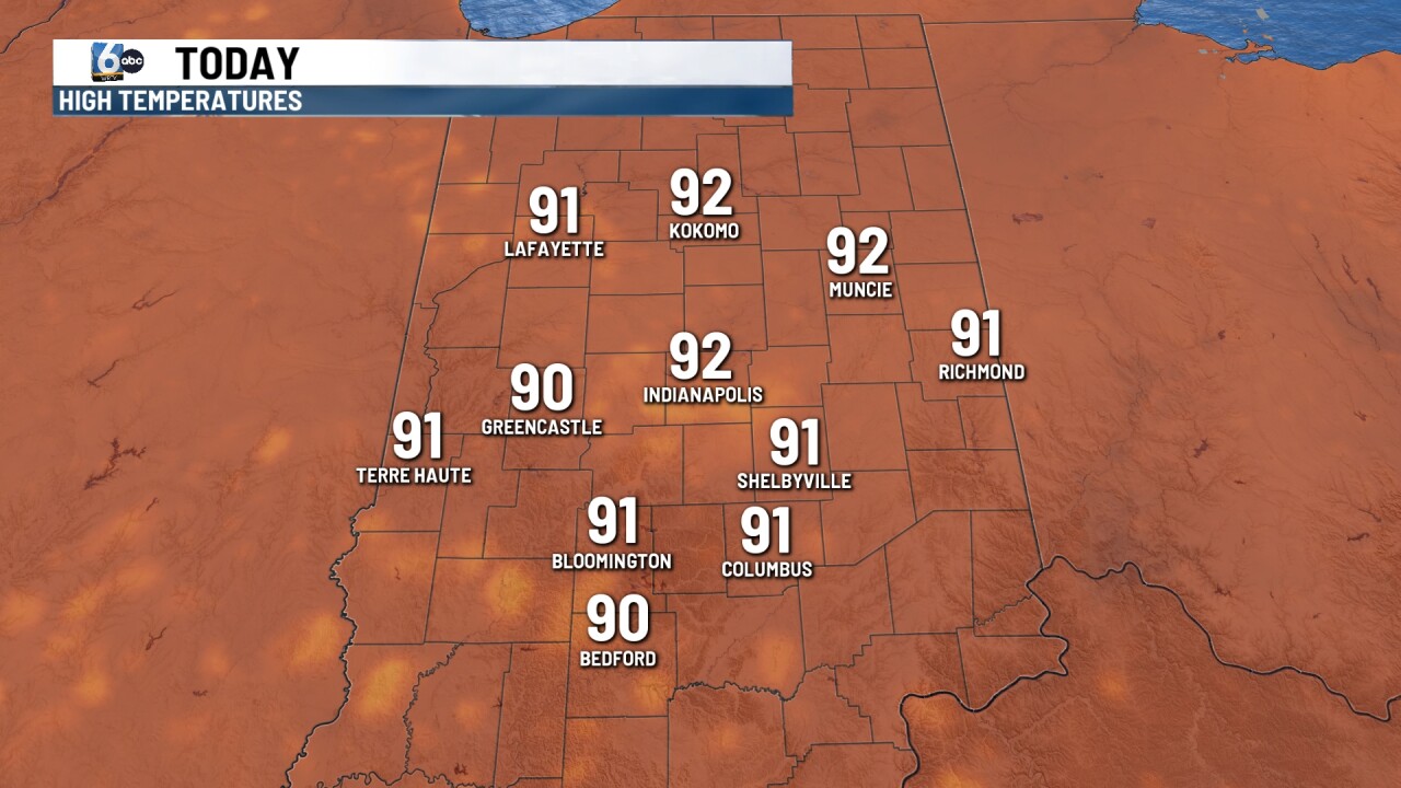
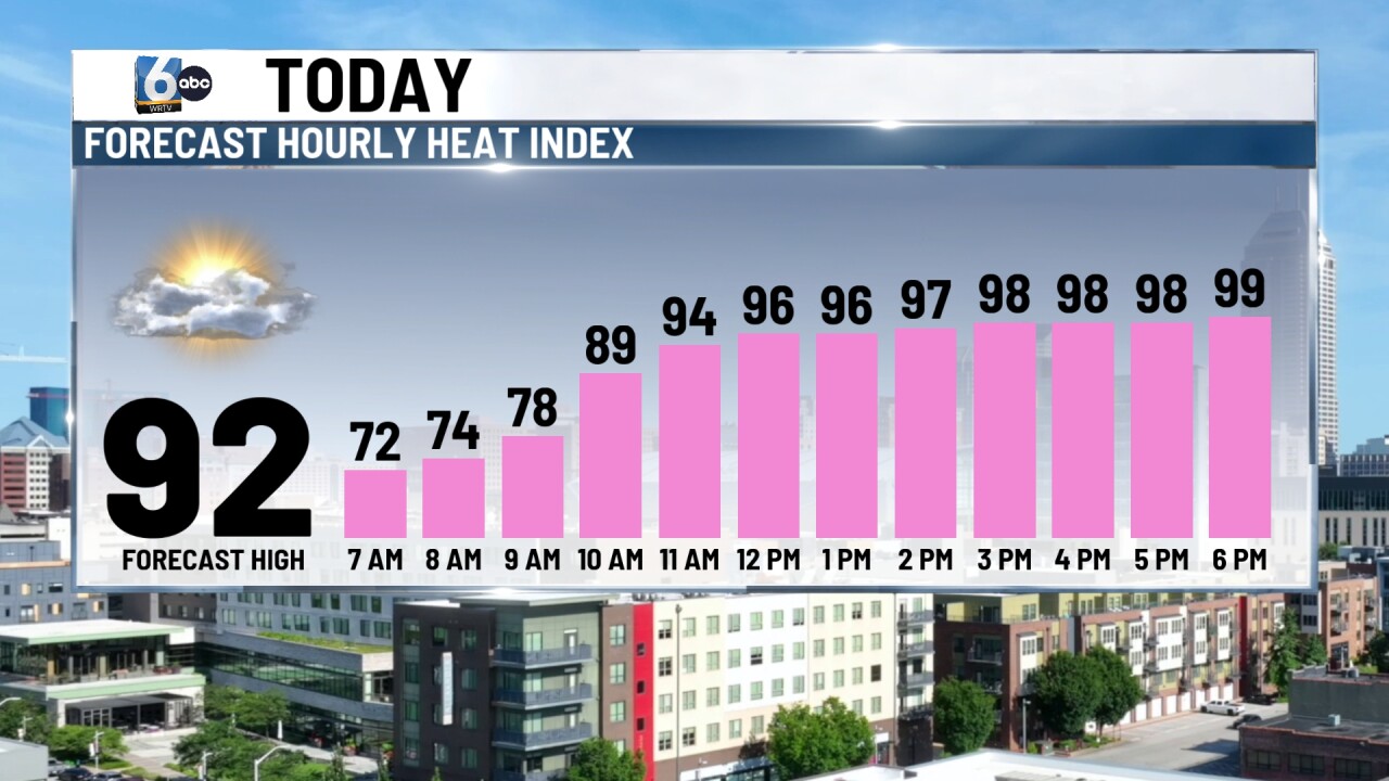
A Heat Advisory in place for today from noon until 8:00 p.m. Heat indices will be into the upper 90s and lower triple digits. Highs today will climb into the lower 90s with mostly sunny conditions. A few clouds develop into the afternoon and there is a slight chance for an isolated shower or storm possible later today. We will also be dealing with air quality issues thanks to wildfire smoke from parts of Canada.
TONIGHT:

Mild and muggy conditions tonight with low temperatures falling into the lower 70s.
TOMORROW:
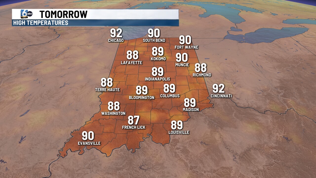
Hot and humid again for your Friday with highs approaching 90. We will see the chance for some scattered showers and thunderstorms into the afternoon. Moderate to heavy rainfall may be possible with some of these thunderstorms.
7 DAY EXTENDED FORECAST:
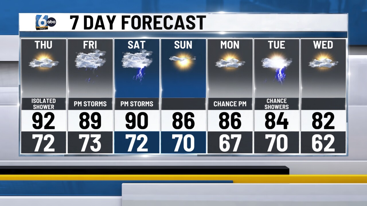
Dry conditions for the first part of the weekend with highs approaching 90 on Saturday. A line of showers and thunderstorms develops Saturday afternoon and evening. Some of these thunderstorms may contain some heavier rainfall.
More showers and storms are possible Monday and Tuesday. Highs stay into the middle 80s.
