

INDIANAPOLIS (WRTV) — Another day with high heat and humidity across parts of Indiana. Our pattern begins to shift a little and brings us more rain chances for the end of the week into the holiday weekend.
TODAY

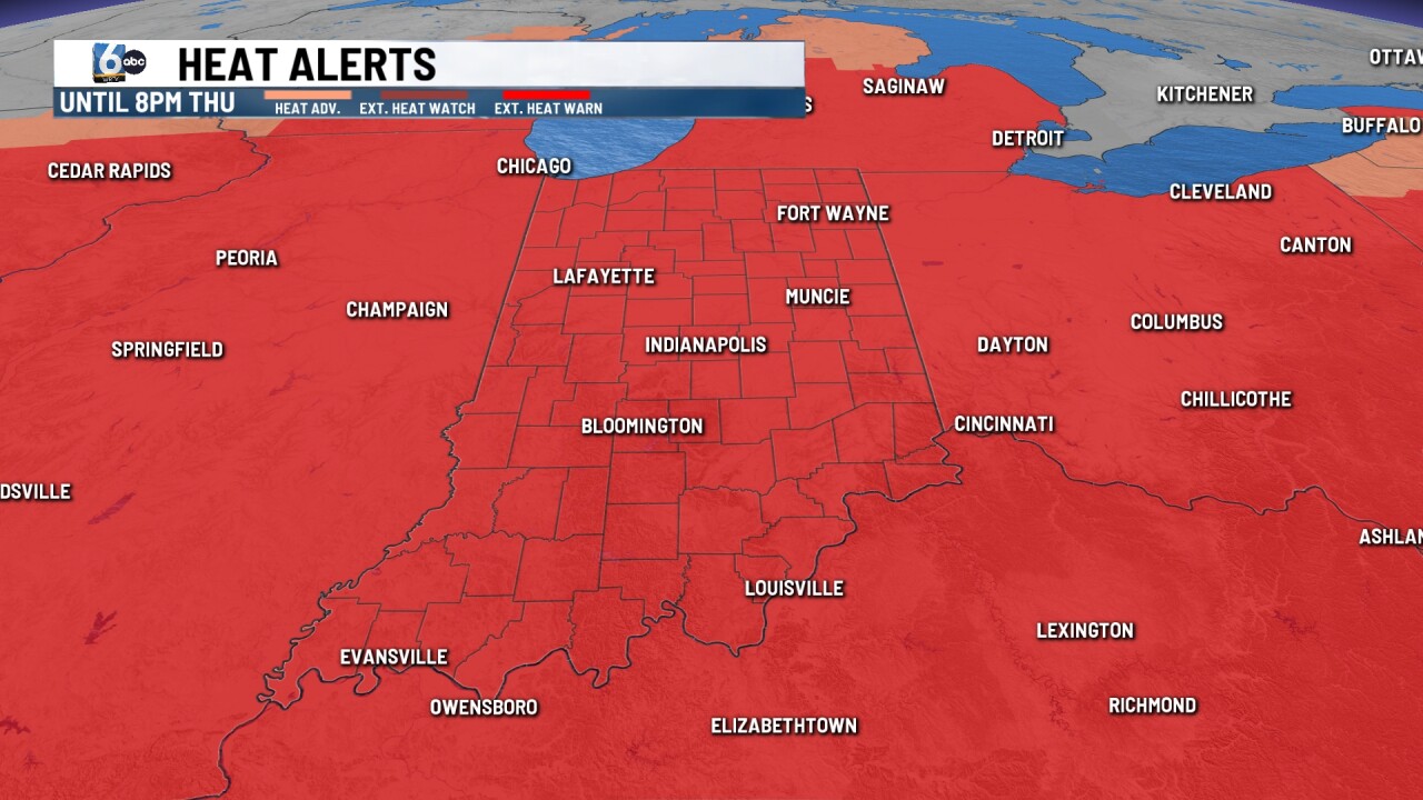
Extreme heat warning in place through Thursday at 8 p.m. Temperatures today will be climbing into the mid 90s. We will see heat indices or feels like temperatures between 105 and 110 degrees. Skies will be mostly sunny all day with no rain chances.
TONIGHT

No relief at night yet again with mostly clear conditions mild and muggy as temperatures stay into the low and middle of 70s.
TOMORROW

Much of the same conditions for your Thursday with high heat and humidity. Look for lots of sunshine with temperatures climbing into the mid 90s. Feels like temperatures will remain at 105 and higher. An extreme heat warning is still in place through 8 p.m.
7 DAY EXTENDED FORECAST

The ridge in the upper levels of the atmosphere begins to break down and move a little bit farther to the east. This will allow for the storm track to move as well and bring in a few spotty showers and thunderstorms. Scattered showers and storms are possible Friday afternoon and evening. There is a low and severe weather risk Friday with heavy rainfall and gusty winds. A level one or marginal risk is in place for much of central Indiana.
More showers and thunderstorms will be possible heading into the holiday weekend. It stays hot and humid with highs into the 90s.
