


INDIANAPOLIS (WRTV) — Calm week on tap for much of Central Indiana but the high heat returns especially for the middle of the week.
TODAY
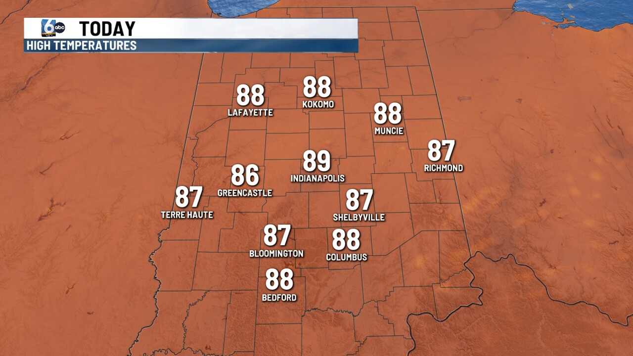
Beautiful day to start the new week under mainly clear skies. Temperatures however will climb back into the upper 80s with localized spots hitting 90. Heat index values will be in the upper 80s and low 90s.
TOMORROW

Sunshine continues for the day tomorrow under clear skies. Temperatures for most spots will break back into the low 90s. Heat index values will be in the mid 90s.
7-DAY FORECAST

Temperatures continue to climb through the middle of the week, however things will continue to look nice with plenty of sunshine even through Friday. Wednesday will likely be the hottest day this week with highs in the mid to low 90s. Heat index values will likely push the upper 90s even spots feeling as hot as 100. Rain chances will return to the state as early as Thursday. Most of the area will remain dry outside of a stray shower or two for the southern part of the state. A few isolated showers will be possible Friday as dew points begin to climb. Best chances for rain arrive this weekend, along with a cold front that will likely drop temperatures back to normal if not actually below normal by next weekend and to start next week.
