

INDIANAPOLIS (WRTV) — One more really extreme hot day today before we see a pattern change. Several shower and thunderstorm chances for the holiday weekend and while it still will be hot and humid, it will not be as intense.
TODAY
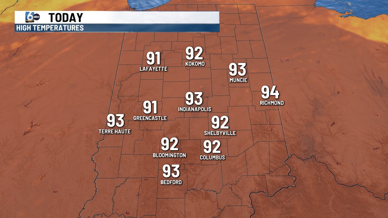
Sunny skies through much of the day today with high heat and humidity. An extreme heat warning finally expires around 8 PM. We will see indices or feels like temperatures at 105 to 110. High temperatures will climb into the 90s this afternoon.
There is a chance of a shower or thunderstorm possible later this afternoon and evening as our pattern begins to shift. Some of the thunderstorms could be on the stronger side with gusty winds and heavy rainfall. There is a marginal risk or a level one in place for much of central Indiana. A level two or slight risk in place for northern Indiana.
TONIGHT

Showers and thunderstorms come to an end later this evening. It still remains mild and muggy with temperatures into the 70s
TOMORROW

If you are heading to any Fourth of July parades early in the morning, it will be dry. Still uncomfortably hot and humid with temperatures into the 90s. We will look for high temperatures to climb into the 90s for the afternoon with heat index values around 100-105. Showers and thunderstorms will be possible into the afternoon and evening. Some of those could be on the stronger side with some gusty winds and heavy rainfall.
7 DAY EXTENDED FORECAST

The pattern continues to be active for the end of the holiday weekend and into next week. Spotty showers and thunderstorms will be possible on and off throughout the days. High temperatures will stay into the mid and upper 80s through much of next week.
