


INDIANAPOLIS (WRTV) — A stationary boundary produces the chance for more showers and storms today and tomorrow. Moderate to heavy rain could be possible. A large area of high pressure in the upper levels of the atmosphere takes hold of much of the country next week.
TODAY

We will see a mix of sun and clouds today. A spotty shower or thunderstorm can’t be ruled out but a better chance arrives later this evening. Warm and humid with highs in the middle to upper 80s. Higher humidity will make it feel more uncomfortable.
TONIGHT

Spotty showers and storms are possible. Some spots in southern Indiana are under a marginal risk or level 1 out of 5 for strong storms. Gusty winds and heavy rainfall are possible.
Lows fall into the upper 60s.
TOMORROW

Scattered showers and storms continue for the first part of the weekend. Moderate to heavy pockets of rain could be possible. Highs climb into the low and middle 80s.
7 DAY EXTENDED FORECAST
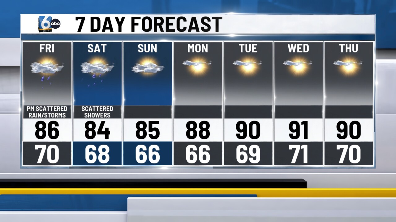
A big area of high pressure in the upper levels of the atmosphere takes hold across the central U.S. Dry for Sunday with highs climbing into the middle 80s.
Upper 80s and lower 90s will be likely across the state this week. Humidity will be high but not as oppressive as it was last week. Feels like temps will be into the low and middle 90s.
