

INDIANAPOLIS (WRTV) — It was a beautiful, sunny and warm start to the weekend. However, changes are on the way, with the potential for more strong-to-severe thunderstorms.
FLOOD WATCH:
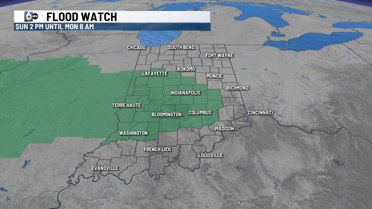
A Flood Watch will go into effect for Central Indiana at 2 PM Sunday and will last through 8 AM Monday, as a general 1-2" of rainfall is expected across the state. Localized spots could see 2"+.
TONIGHT:

Calm evening is on tap tonight with passing clouds and temperatures dropping into the upper 50s just before sunrise.
TOMORROW:

Yet again, changes will happen to end the weekend. A warm front will pass during the afternoon hours, bringing a few showers and thunderstorms. Once this round clears out, a second round will set up ahead of an advancing cold front. This second round will have the potential for severe storms.

Areas along and south of I-70 are in a 2 out of 5 for severe. All modes of severe will be in play. Gusty winds and heavy downpours will be the main risk. Small hail will be possible, with a few tornadoes possible, especially south and west along the Illinois border.
7-DAY FORECAST:

Following Sunday's cold front, temperatures will slightly cool into the mid to low 70s on Monday under clearing skies. Sunshine will return for the day on Tuesday, with more rain and storm chances returning for the day on Wednesday and Thursday. Temperatures will start to warm back up into the upper 70s and low 80s. The week will end calm, with even more thunderstorm chances returning for next weekend.
