

INDIANAPOLIS (WRTV) — Another round of strong, severe thunderstorms will be possible this afternoon and evening. Less humid and cooler conditions move in for the middle part of the work week. On and off rain chances continue into the holiday weekend.
TODAY

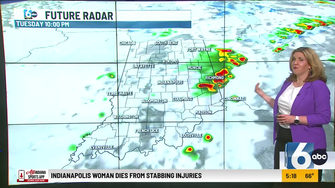
An isolated shower early on with more humid conditions today. Showers and thunderstorms develop later this afternoon and some of them could be on the stronger side. Gusty winds and heavy rainfall will be the main threats. Winds will be gusty out of the southwest today near 30 mph.
High temperatures will climb into the mid 80s with humid conditions.
TONIGHT

Showers and thunderstorms continue into the early evening hours with heavy rainfall. Low temperatures will fall near 60
TOMORROW
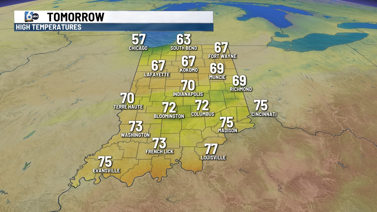
Morning showers are possible on your Wednesday. It’ll be cooler and less humid. High temperatures near 70. Skies become partly cloudy later in the afternoon with winds out of the north.
7 DAY EXTENDED FORECAST
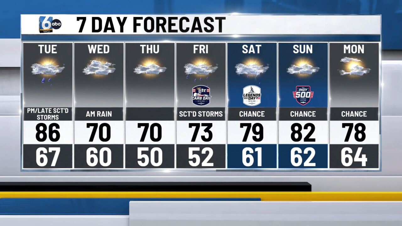
A beautiful day on Thursday with lots of sunshine and highs right around 70. Humidity values stay low.
Rain chances increase for your Friday with mostly cloudy skies. High temperatures will stay in the lower 70s.
Showers possible on Saturday under partly cloudy conditions with high knee upper 70s. Right now, it looks like we’ll see partly cloudy skies for Sunday with highs near 80. There is a slight chance for a few showers.
