
INDIANAPOLIS (WRTV) — Humid conditions all week long with several shower and thunderstorm chances. The humidity will make it feel much more uncomfortable through the middle part of the week. Spotty showers and thunderstorms could produce some very intense rainfall in parts of the metro area.
TODAY

A muggy Monday with very mild temperatures to start the day. Warm and humid for the afternoon with scattered showers and thunderstorms developing after the lunch hour. Some of these thunderstorms could bring some really intense rainfall in a short period of time. Localized flooding could be possible in some locations. High temperatures will climb into the lower 80s, but it will feel more like the middle 80s.

TONIGHT

Spotty showers and thunderstorms continue into the early evening hours with temperatures only falling near 70. High humidity values will continue to make it feel more uncomfortable
TOMORROW

Isolated showers and thunderstorms possible on your Tuesday. It will be warm and humid yet again with highs in the low 80s. Winds will be a bit breezy out of the south and may gust at times near 20 mph. Showers and thunderstorms developed late Tuesday night and very early on Wednesday morning.
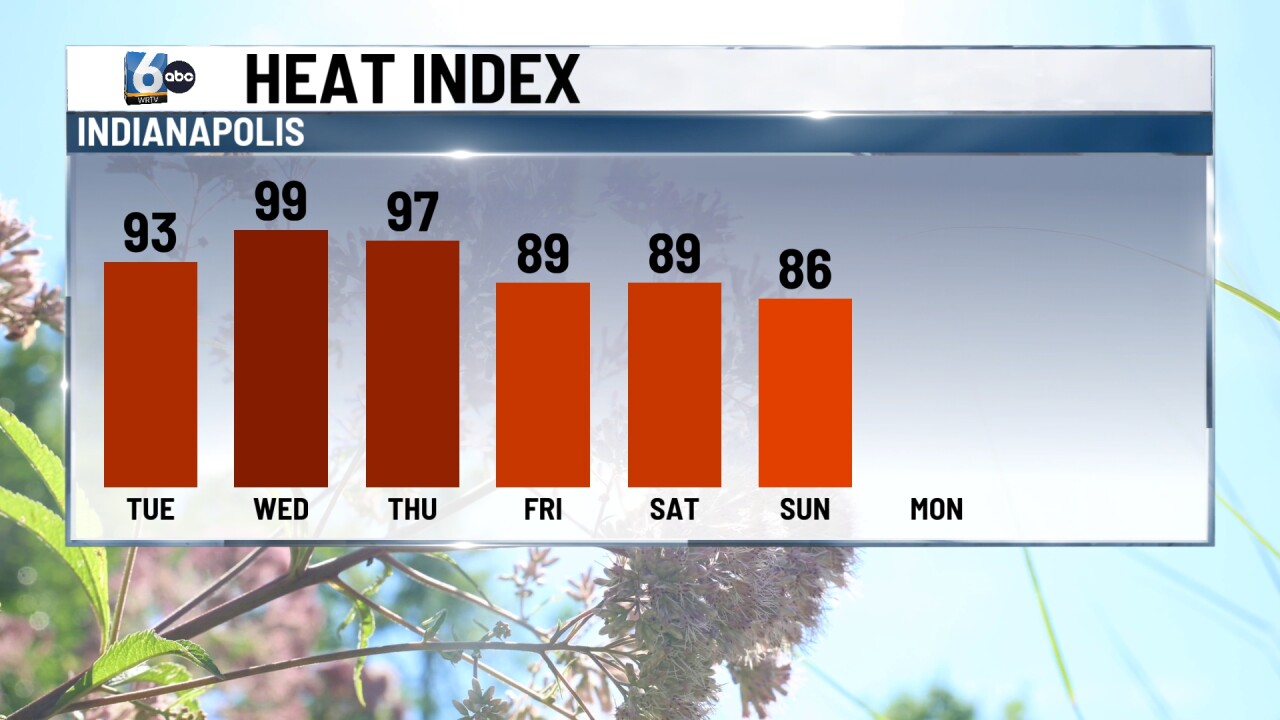
7 DAY EXTENDED FORECAST

A few showers and storms will be possible early Wednesday; otherwise, dry conditions for the rest of the afternoon. It will be hot and very humid with highs near 90 degrees. Heat indices or feels-like temperatures will likely be into the triple digits.
More spotty showers and thunderstorms are possible on Thursday and Friday with highs into the mid and upper 80s. Humidity values eventually drop late in the week and into the weekend. On Sunday, look for lower humidity values with highs in the lower 80s.
