
INDIANAPOLIS (WRTV) — Another round of storms is on the way tonight before we quiet down until Sunday.

TONIGHT:

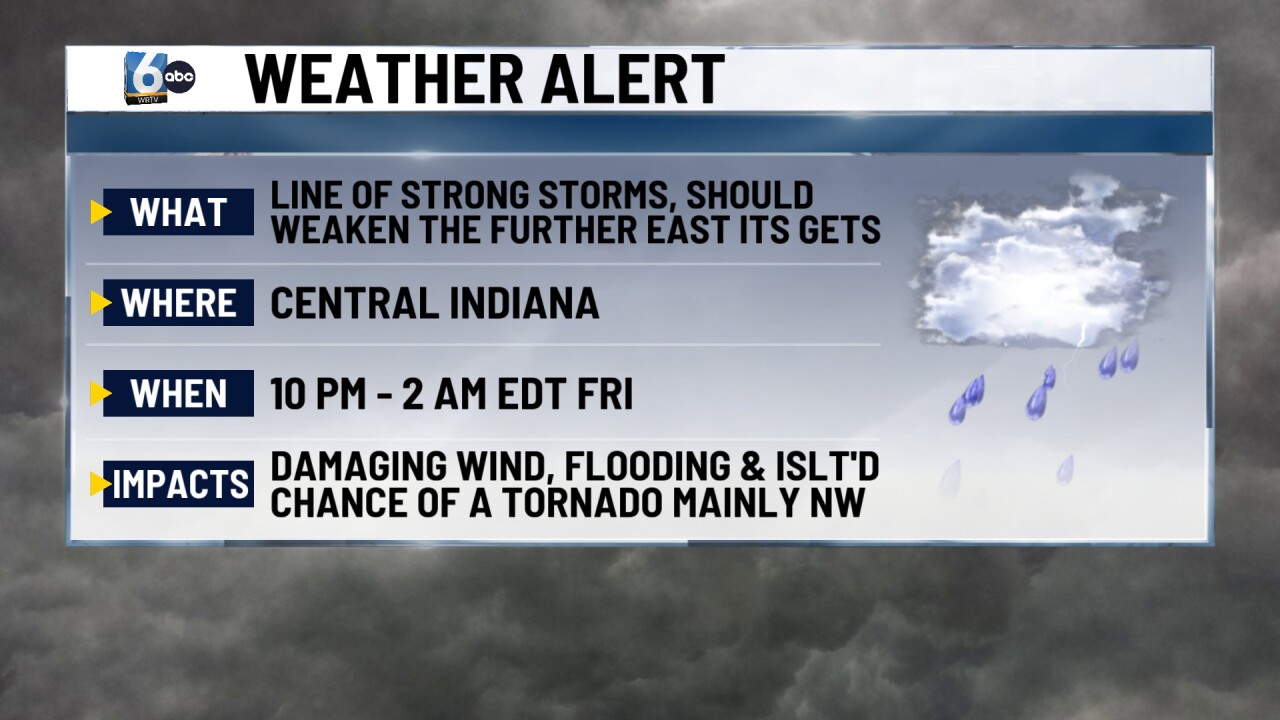
Parts of Illinois have been upgraded to a moderate (4/5) risk of severe storms this afternoon/evening. A nasty squall will likely move through this area. Most of central Indiana is in the slight (2/5) risk level, where we are expecting storms to arrive after sunset.

The timing of the severe threat for central Indiana will be from 10 PM to 2 AM EDT Friday. We will see how this line holds together in our area, as it is expected to weaken at some point. The damaging wind threat would be the highest, especially to the NW. Quick spin-up tornadoes can't be ruled out. Lingering showers and storms continue in southern Indiana into the early morning. Low temperatures in the mid-70s.
TOMORROW:

RELIEF is finally on the way. The cold front pushes through in the morning, ushering in less humid air. Clouds will decrease. High temperatures in the low to mid-80s.

SATURDAY:
Another nice day with the humidity held in check. High temperatures in the low to mid-80s.
7-DAY FORECAST:

A cold front moves into the area on Sunday, which brings the chance of showers and storms. Cooler-than-average conditions are expected next week, with multiple days in the 70s before rebounding into the 80s mid-week.
