
INDIANAPOLIS (WRTV) — Another round of showers and storms moves through this evening along a cold front.
TONIGHT:
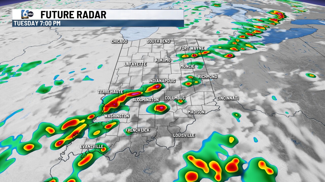
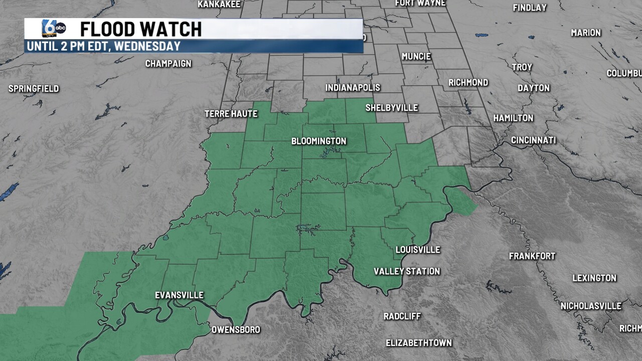
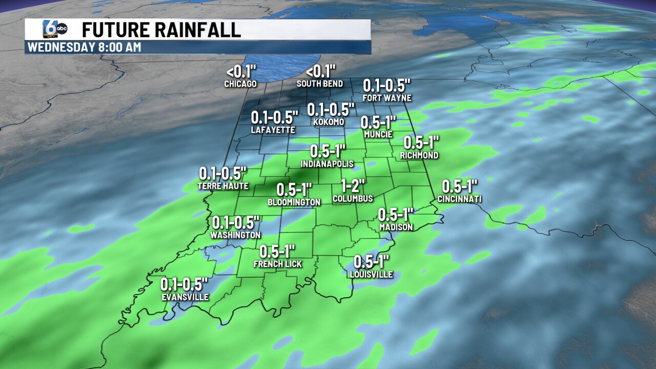
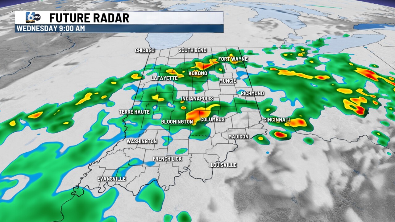
Showers and storms are likely. A few stronger storms are possible, with wind as the main concern. A Flood Watch is posted for many counties south of I-70 until Wednesday PM. The majority of these spots picked up 2-4" on Monday. An additional 0.5-1.5" of rain is possible in these locations. Low temperatures in the upper 50s.
TOMORROW:
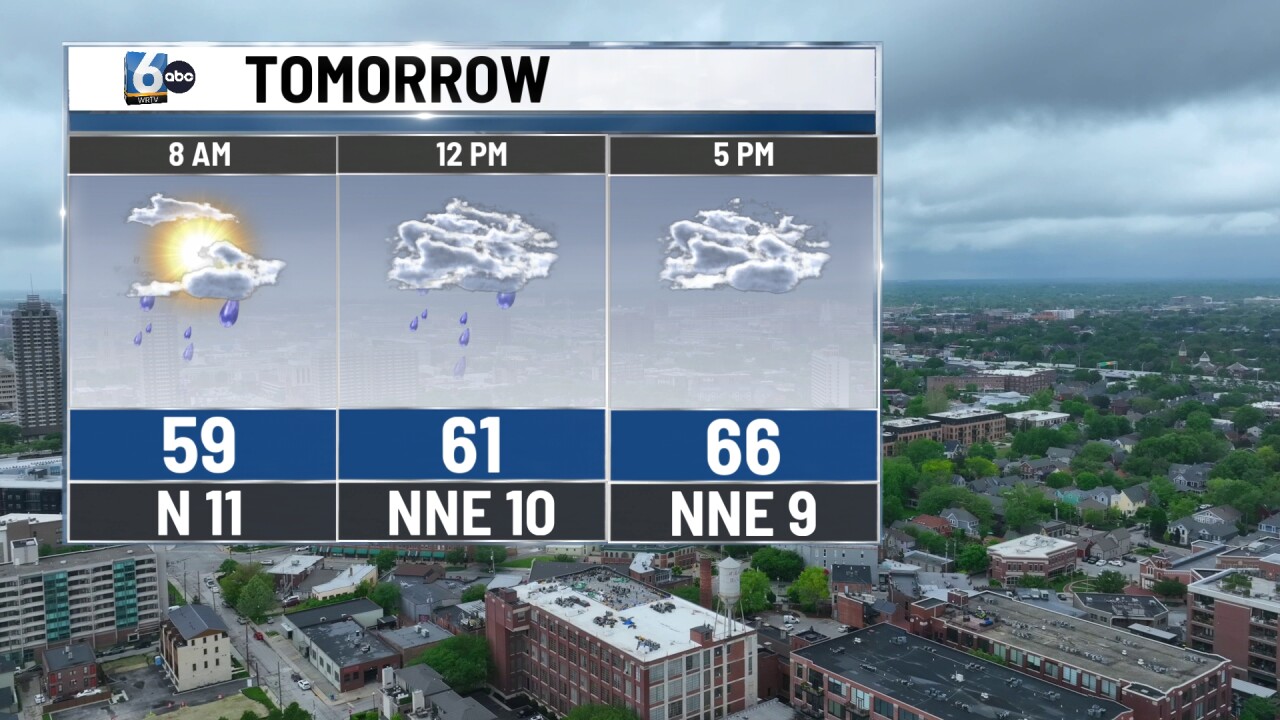
Scattered showers in the morning, turning spotty by the afternoon. Mostly cloudy skies remain for the PM hours. High temperatures in the upper 60s. Less humid air will move in as well.
THURSDAY:
Partly cloudy. High temperature near 70 degrees.
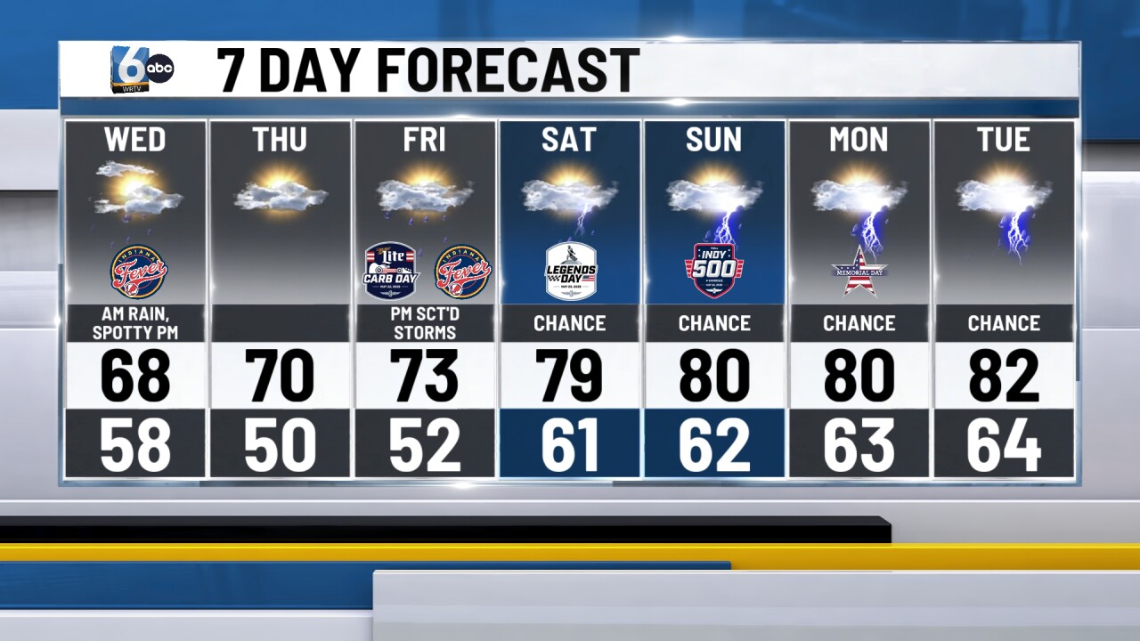
7-DAY FORECAST:
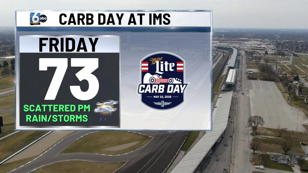
A warm front arrives in Indiana Friday PM, which brings in scattered showers and storms for Carb Day. Slightly humid air returns this weekend, which gives us a smaller chance of rain for both Saturday and Sunday. We will monitor the forecast very closely on Sunday for the Indy 500, but it does not look like a complete washout this far out.