

INDIANAPOLIS (WRTV) — Beautiful weather started the day, but conditions are quickly changing. Rain and storm chances return for the middle of the week.
SEVERE THUNDERSTORM WATCH:

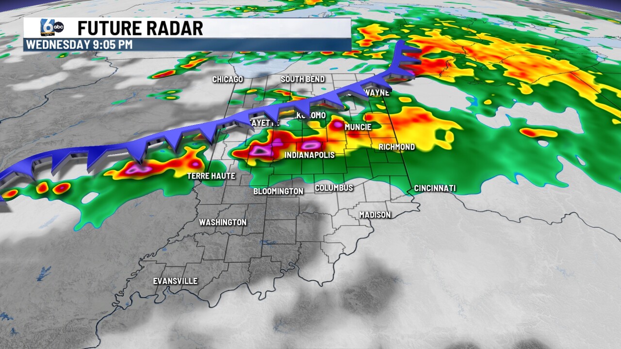
A severe thunderstorm watch remains for counties along and north of I-70 until 11 p.m. EDT. These counties lie within a 2 / 5 on the severe weather scale, while counties south of I-70 lie in a 1 / 5 on the severe weather scale.
Main threats will be gusty winds and localized heavy downpours. Small hail up to the size of a pea will be possible, with a low-end risk for a brief spin-up tornado further north.
TONIGHT:
Few showers and storms will work through the area this evening. Any storm can bring gusty winds and small hail. Storms will exit the area by 11 p.m.
TOMORROW:


Rain and storm chances will continue for the day tomorrow. A warm front will pass during the early afternoon hours and could bring a few strong to low-end severe storms. The main wave of activity will be during the evening hours with all modes of severe weather in play.

7-DAY FORECAST:

A cold front passes Thursday morning, allowing temperatures to drop back into the mid to low 70s, with sunshine around for the afternoon. Sunshine will hang around for the day on Friday with temperatures warming back into the upper 70s and low 80s. More sunshine and temperatures for the day on Saturday, before showers and storms return to end the weekend. Sunday will see the return of a few showers and thunderstorms, with the best chance to see activity in the afternoon and evening hours. Activity will exit Monday morning, leaving the beginning of the week with sunshine and temperatures in the upper 70s/low 80s.
