

INDIANAPOLIS (WRTV) — A terrific Tuesday with sunny skies expected today. Rain chances will arrive but not until later this evening. We have a couple of rain chances throughout the week. Temperatures begin to really ramp up for the weekend.
TODAY

A cool start with temps in the 40s this morning. Lots of sunshine for the afternoon with temperatures climbing into the upper 70s. Winds will be breezy out of the southwest and may gust at times near 20 to 25 mph.
TONIGHT

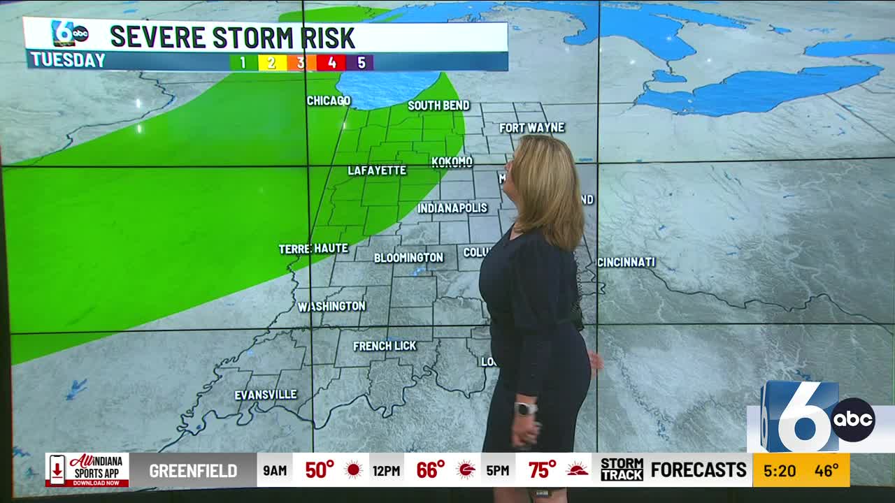
A cold front swings through Indiana later this evening, bringing showers and thunderstorms across the state. There is a marginal risk of level one out of a level five that some of the thunderstorms may reach severe criteria. Main threats in Northwestern sections of Indiana will be gusty winds and moderate to heavy rainfall at times. Rain chances begin after the evening commute in Northwest Indiana. That line will shift further southward and continue during the overnight hours in the metro area.
TOMORROW
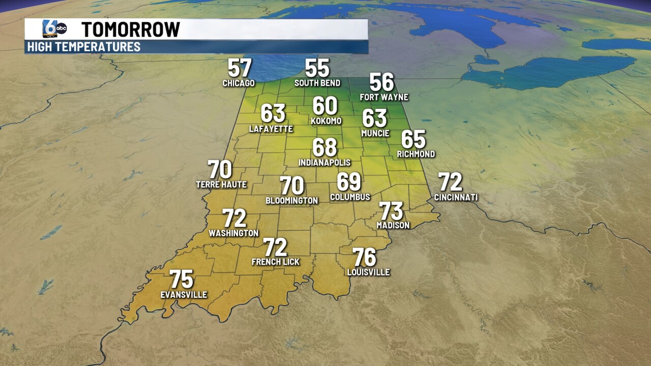
A few spots early Wednesday morning may see a few lingering showers. Otherwise partly cloudy skies for the afternoon, but it will be breezy and cooler. Winds will switch to the northwest and may gust at times near 30 mph. Temperatures will be into the lower 60s in the northern part of the state and bid an upper 60s farther south. It will feel much cooler thanks to the winds.
7 DAY EXTENDED FORECAST

Sunny skies continue for Thursday with dry conditions. Temperatures will be below normal into the upper 60s.
Lots of dry conditions on Friday. Another system moves in and brings us a chance for some showers and even a few thunderstorms late Friday. High temperatures will climb into the lower 70s.
We will see summer light conditions for the weekend. If you are heading to Indianapolis Motor Speedway, it will be warm with temperatures into the low 80s. There is a slight chance for an isolated shower or thunderstorm Saturday and Sunday. However, we will see lots of dry time.
