

INDIANAPOLIS (WRTV) — An Extreme Heat Warning is now in place for all of Indiana through Thursday evening. Heat indices will be approaching dangerous levels at 105 and higher. The hot and humid weather will continue all week long as high temperatures stay into the 90s.
TODAY
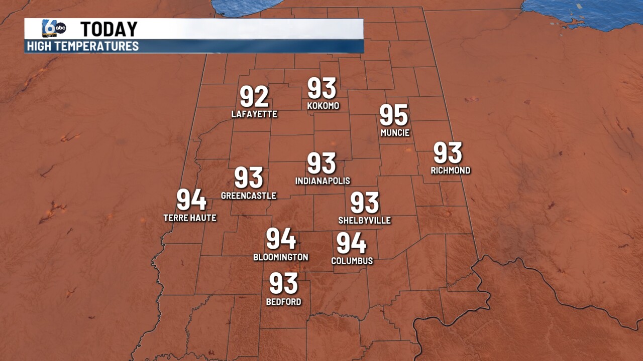
Very mild and muggy to start off your Tuesday morning. Sunshine all day long will bring our temperatures up a couple of degrees warmer than yesterday. Hot and humid with highs reaching 93 degrees. Heat index values will climb and exceed 105 at times across parts of the state.
TONIGHT
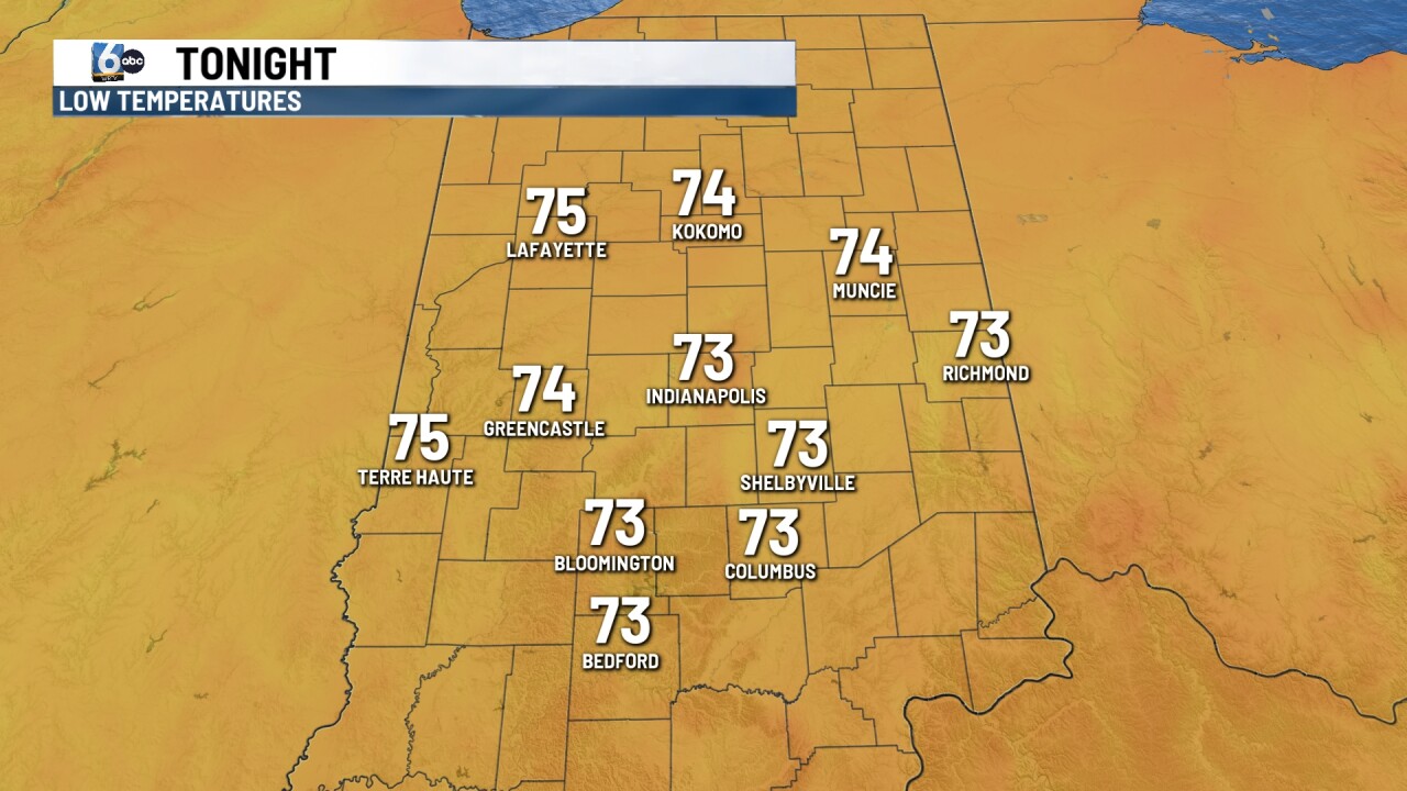
No relief at night expected under clear skies tonight. Look for mild and muggy conditions with lows staying low in the middle 70s.
TOMORROW
Another sunny, hot and humid day on Wednesday. High temperatures climb, even a few degrees hotter than the last couple of days. Look for highs right around 95 with again heat index climbing at 105 or higher.
7 DAY EXTENDED FORECAST
Lots of sunshine again on Thursday with just a very slight chance of a spotty shower storm late Thursday. High temperatures climbing again into the mid 90s.
Low 90s expected on Friday and Saturday with a slight chance of a spotty shower or thunderstorm. It will continue to be hot and humid for the holiday weekend. Scattered showers or thunderstorms will be possible for the Fourth of July and an isolated shower or storm impossible on Sunday. Temperatures drop into the 80s for Sunday and Monday.
