


INDIANAPOLIS (WRTV) — Warmer conditions for the end of the work week, but also several rain chances as well. Another heat dome moves in across parts of the central US heading into next week.
TODAY

High pressure overhead for today, bringing us lots of sunshine and light winds. A few clouds will develop into the afternoon with dry conditions across Central Indiana and into parts of southern Indiana we could see a few isolated showers, popping up across parts of the state. High temperatures will climb into the upper 80s with slightly humid conditions.
TONIGHT
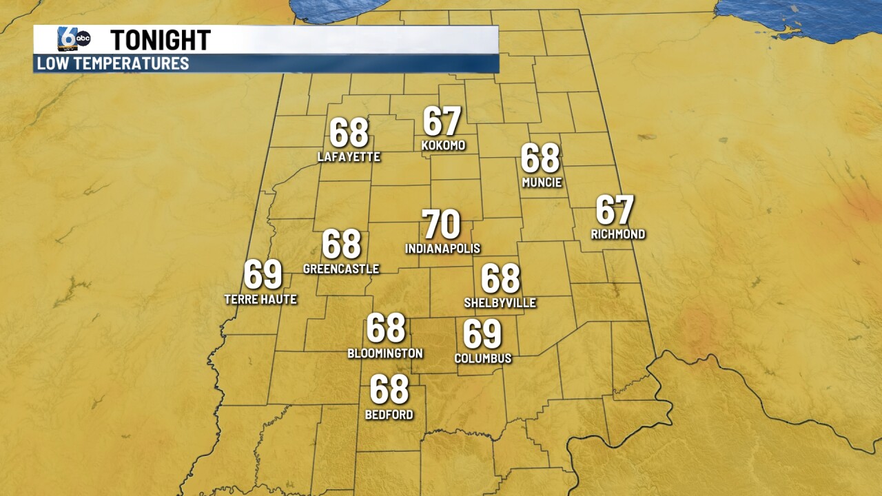
A few clouds overnight tonight it will continue to be mild and slightly humid. Low temperatures will fall into the mid and upper 60s.
TOMORROW

Hot and humid for your Thursday with lots of sunshine. High temperatures climbing into the upper 80s right around that 90-degree mark. Showers and thunderstorms develop late Thursday night and some of those could be on the stronger side. A level one out of a level five is in place on our severe weather risk scale. A level two is across parts of southwestern Indiana. Heavy rain is possible with some of the thunderstorms along with some gusty winds too.
7 DAY EXTENDED FORECAST

Showers and thunderstorms will linger into early Friday with high temperatures climbing into the mid 80s. Partly cloudy conditions for your Saturday with a chance for a few showers and temperatures around normal into the mid 80s. Another heat dome moves in across parts of the central US. This could bring us hot and humid conditions into early next week with highs close to 90.
