
INDIANAPOLIS (WRTV) — A wonderful Wednesday with sunny skies and low humidity. Rain chances return later this week with high heat and oppressive humidity.
TODAY
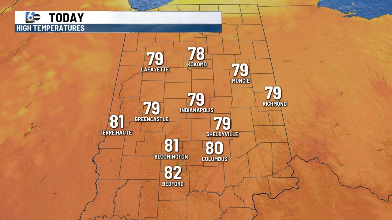
Sunny skies for the first part of the day. Skies become partly cloudy later this afternoon with temperatures rising into the upper 70s and lower 80s. Humidity values stay low for today.
TONIGHT

An isolated shower or thunderstorm will be possible in the northern parts of the state for the early evening. During the overnight hours, we see a chance for some scattered showers and thunderstorms. Humidity values begin to climb slightly, and with the cloud cover temperatures will only drop into the mid 60s.
TOMORROW

Partly to mostly cloudy skies at times on Thursday. A spotty shower or thunderstorm could be possible on and off throughout the day. It will be more humid with temperatures climbing into the lower 80s. More significant rain moves through Thursday evening and overnight. Some spots could pick up some heavier pockets of rain
7 DAY EXTENDED FORECAST

Partly to mostly cloudy on Friday with some spotty showers and thunderstorms that could be possible. More heavy rain is possible across parts of Indiana.
A scattered shower or thunderstorm is possible on Saturday in the southern part of the state. More rain is possible on Sunday with the chance for some scattered showers and storms. Humidity values really rise and become oppressive Sunday and into early next week. Highs on Sunday will be in the upper 80s and 90s on Monday and Tuesday. Heat index values or feels like temperatures will be approaching the triple digits.
