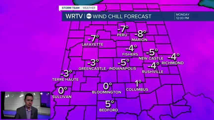


A Cold Weather Advisory continues until 10am Monday. Wind chills start the day from -15° in the north to near 0° in southern areas. We already have some school delays posted on WRTV.com. Wind chills only ease into the teens during the afternoon.

We see quite a bit of sunshine with some passing clouds Monday. A SW breeze helps to "warm" afternoon temperatures into the lower and middle 20s. However, that breeze is also responsible for the colder feels like temperatures.

Temperatures are looking up for much of the week! We'll begin to melt some of the snow Tuesday with highs in the middle 30s. We even get temperatures into the 50s Thursday! The warmer weather comes with our next chance for rain.

Indianapolis Weather Forecast:
Monday: Partly sunny. High: 24°
Tuesday: Sun and clouds. High: 36°
Wednesday: Partly sunny. High: 41°
Indianapolis 7-Day Weather Forecast

