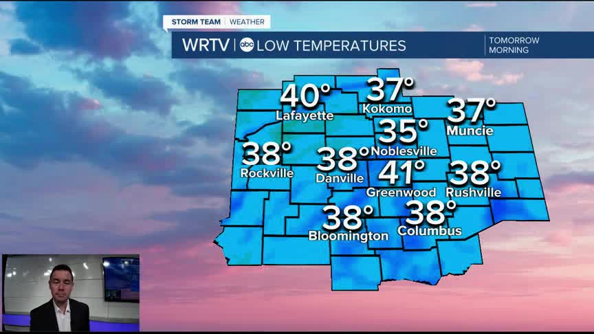


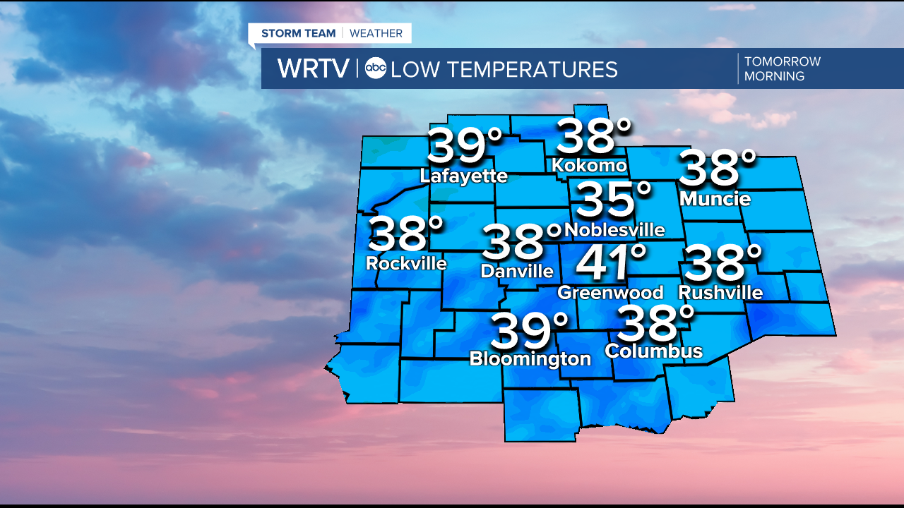
Clear skies and a light wind spell a recipe for chilly temperatures overnight. There is a Frost Advisory until 9AM Friday from Terre Haute to Indy to Brookville and areas to the north. The city will likely stay closer to 40° overnight. However, other areas like Noblesville and Anderson will drop into the middle and upper 30s.
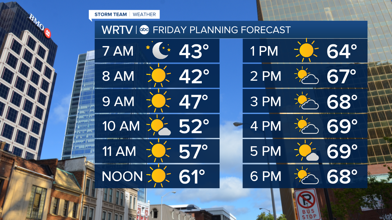
After the chilly start, we begin a warming trend by Friday afternoon. High temperatures right around 70° are pretty close to average. We go from a sunny start to more clouds by the afternoon. We do have a front approaching the area, but with such dry air in place we're unlikely to see much more than a sprinkle.
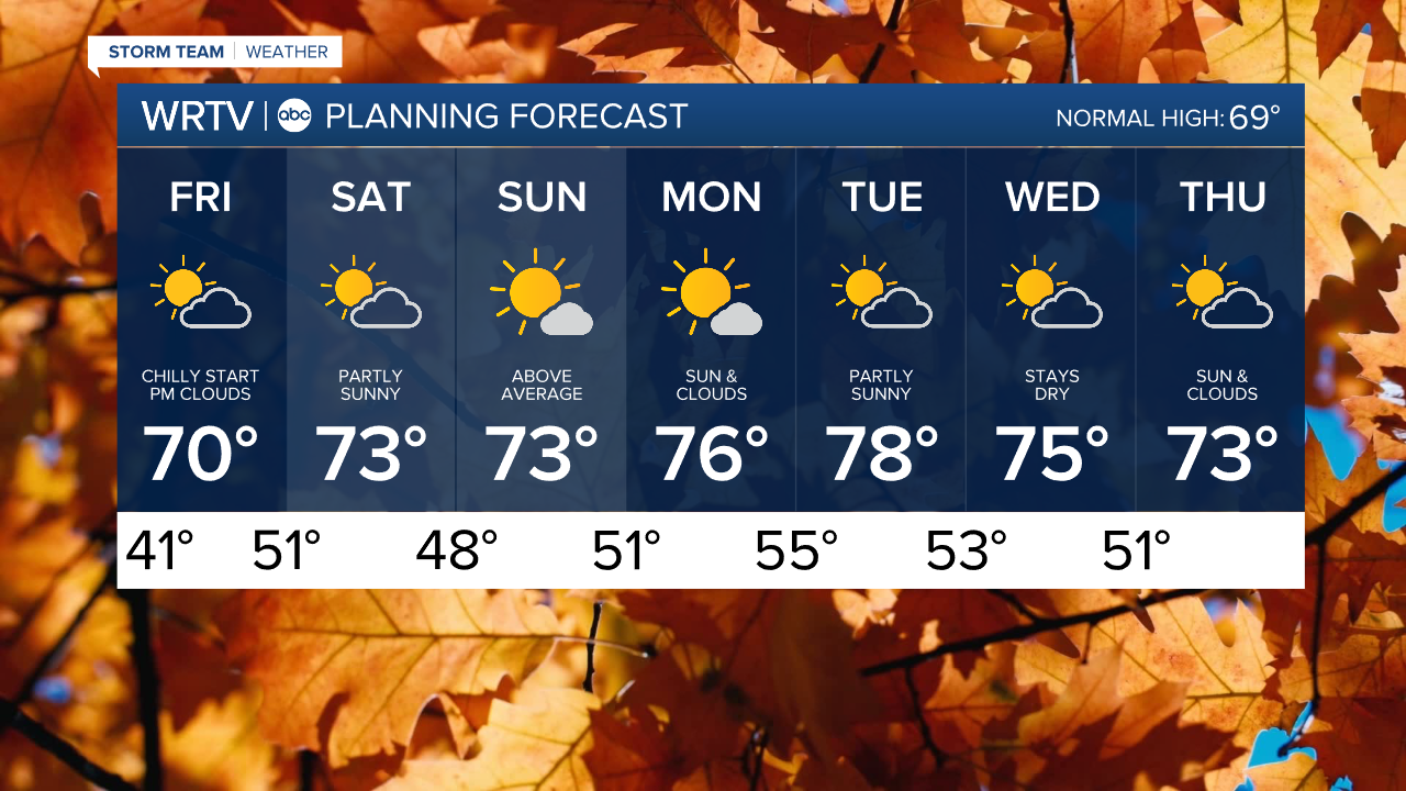
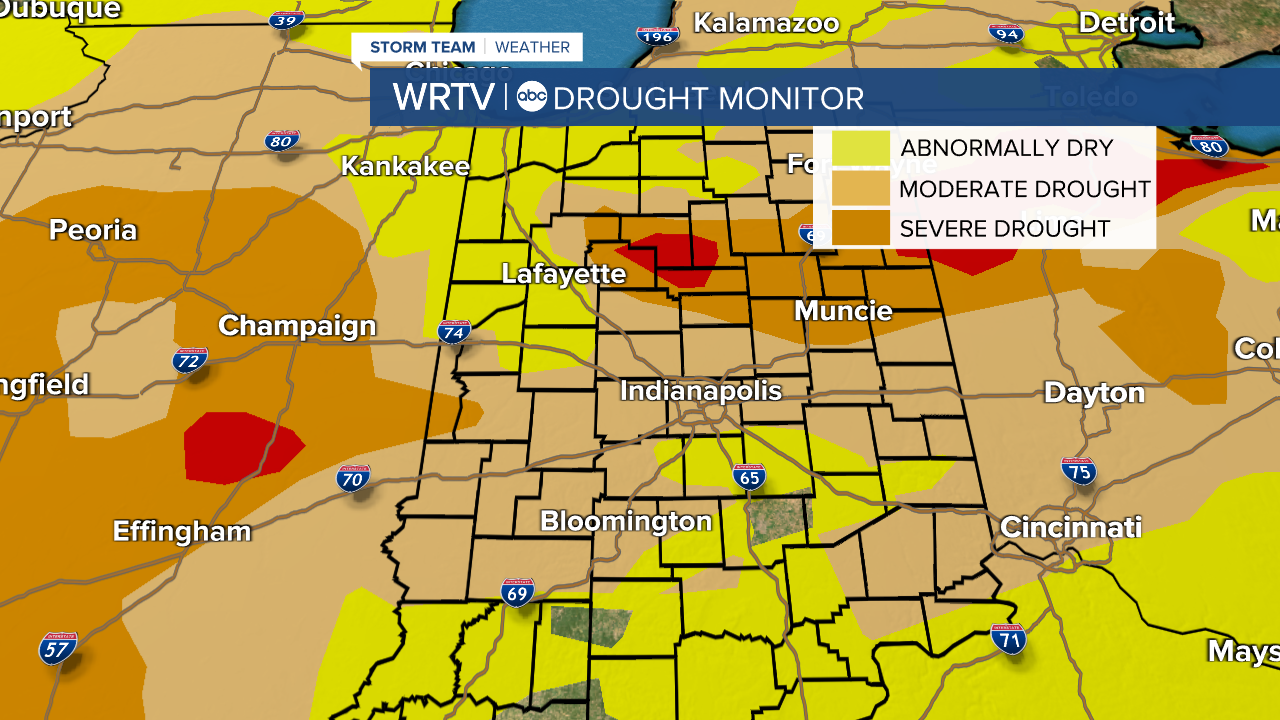
The 7-day forecast contains more mild and dry weather. The dry part of the forecast isn't great for ongoing drought conditions. We even have extreme drought showing up in Kokomo and Logansport. Only areas SE of Indy have seen enough rain lately to ease the dry conditions.
Indianapolis Weather Forecast:
Friday: Morning sun and afternoon clouds. High: 70°
Saturday: Partly sunny. High: 73°
Sunday: Mostly sunny. High: 73°
Indianapolis 7-Day Weather Forecast