
INDIANAPOLIS (WRTV) — Showers and storms will exit the area as high pressure begins to build in. However, high humidity and high heat will kick in, leading to the holiday weekend.

TONIGHT:
A few showers and storms will linger across the southern part of the state early tonight. As the showers wrap up, fog will begin to develop mainly south of I-70, in the area where today's rain showers remained. Fog at times through 9 am can reduce visibility to less than a mile, near 0 at times.

TOMORROW:
Fog will lift by 10pm and we will see clouds generally decrease through the day. A stray shower or two cannot be ruled out. However, most areas will remain dry as sunshine returns during the afternoon hours. Temperatures will max out in the mid 80s.

7-DAY FORECAST:
High heat returns to the region to start the week, and honestly doesn’t look to go anywhere anytime soon. Plenty of sunshine is expected Monday through Thursday, through much of the week, as high temperatures climb into the mid and low 90s. At times, heat index values will push the triple digits. Even feeling as hot as 100 at times.
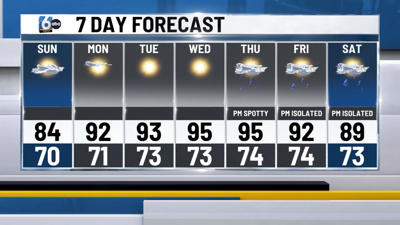
Rain chances may return by next weekend. Thursday afternoon and evening could feature a spotty shower or storm. Friday and Saturday, isolated thunderstorms will be possible as well.
