


Headlines
- AM RAIN CHANGING TO A WINTRY MIX TODAY
- END OF THE WEEK SNOW CHANCE
- BIG TEMPERATURE DROP THIS WEEKEND
We started Wednesday off with temperatures in the 40s. That will be the high for the day as we get colder into the afternoon. Strong north winds will drive temperatures down. That will change over our rain to more of a wintry mix and even light scattered snow showers for the second half of the day. Temperatures get cold again overnight.

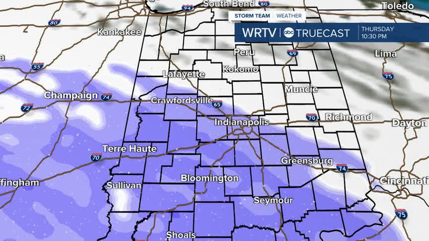
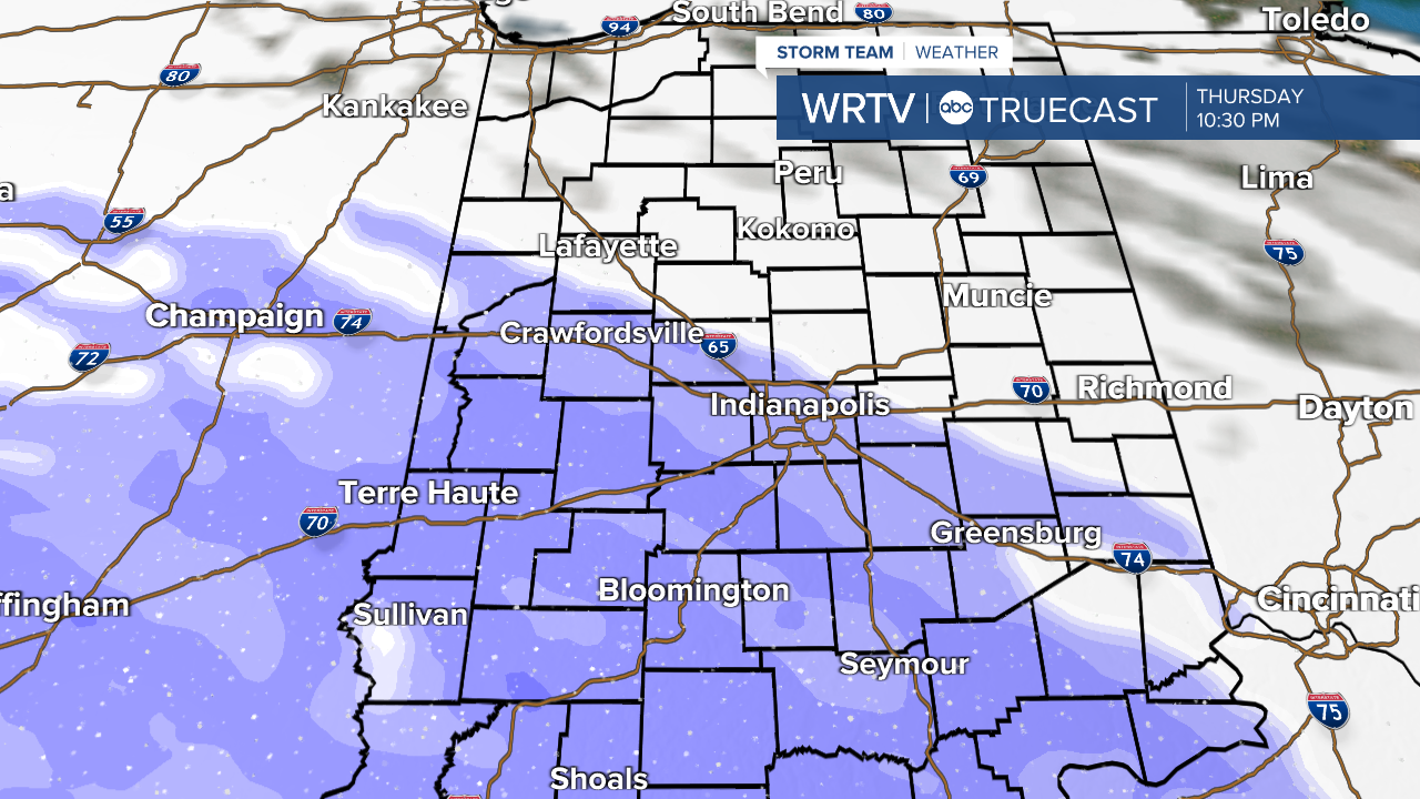
Thursday looks mostly dry, but the evening and overnight hours brings a renewed chance for snow. This is shaping up to be a narrow band of snow that will work across central Indiana overnight Thursday and into Friday morning. Some will see higher totals near 3 to 4 inches this that tapering off as you head north and south. As of Wednesday morning the heaviest snow is targeting south of the Indy metro. Know that this band is expected to slide a bit north or south so the bulls eye for this winter weather maker will need to be refined as we get closer to Friday morning.
After that snow clears, it will be very very cold. We are talking overnight lows in the single digit range and highs in the teens or colder!
Indianapolis Weather Forecast:
Today: AM rain to PM wintry mix. High: 34°
Overnight: Scattered light snow. Low: 23°
Tomorrow: Cloudy. High: 30°
Indianapolis 7-Day Weather Forecast

