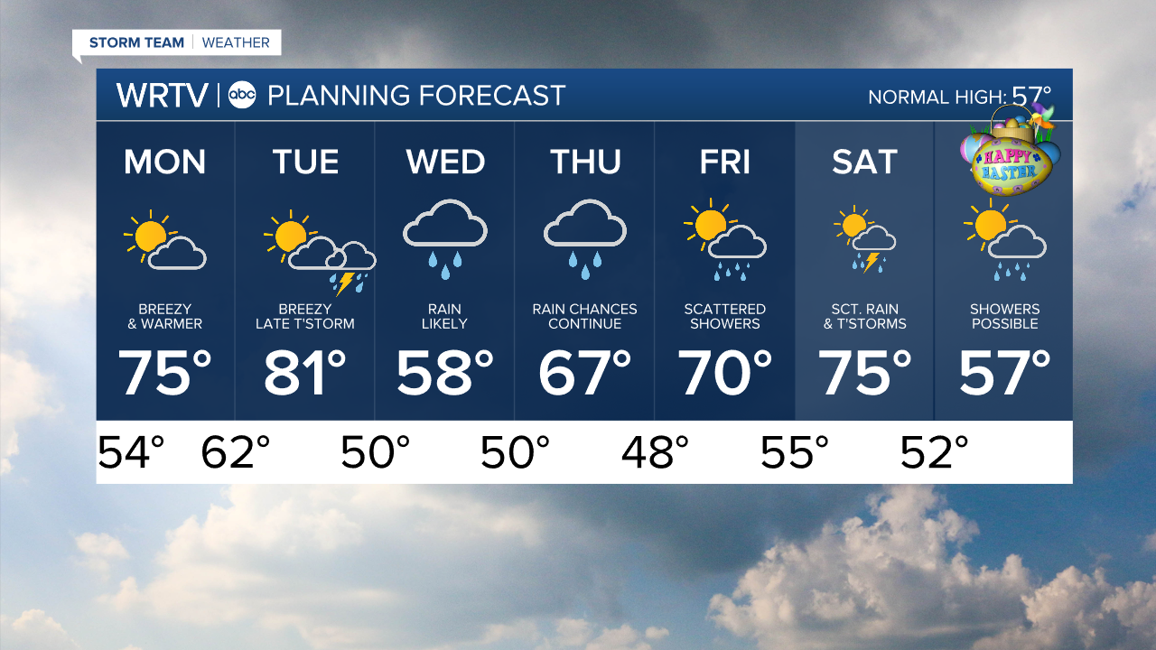


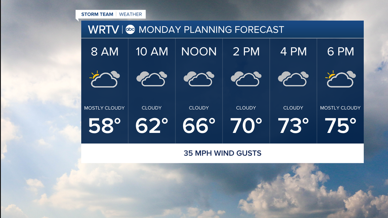
Temperatures are making their way back into a warmer phase as we look to the new week. Although we will have clouds around Monday, I do think we will work in some sunshine. SW winds of 10-20 mph could gust over 30 mph at times. That gives our temperatures yet another boost. We'll enjoy afternoon highs in the middle 70s.
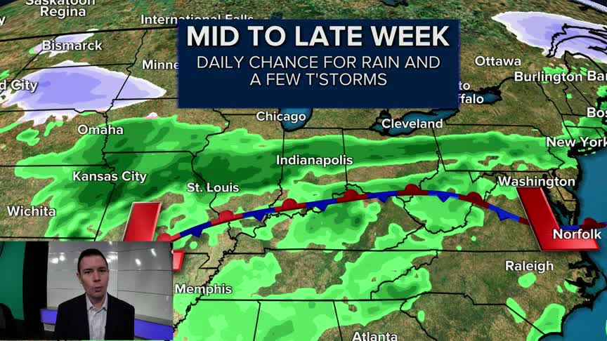
Warm and quiet weather lasts through much of our Tuesday. There is the chance for a few storms late Tuesday. This kicks off what is likely to be a pretty wet stretch of weather for the rest of the week. While it won't rain all day, we will have periods of rain. You'll want to keep the umbrella handy.
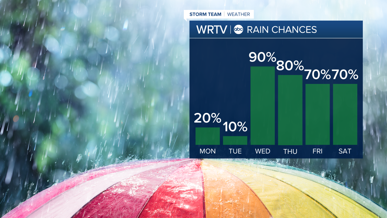
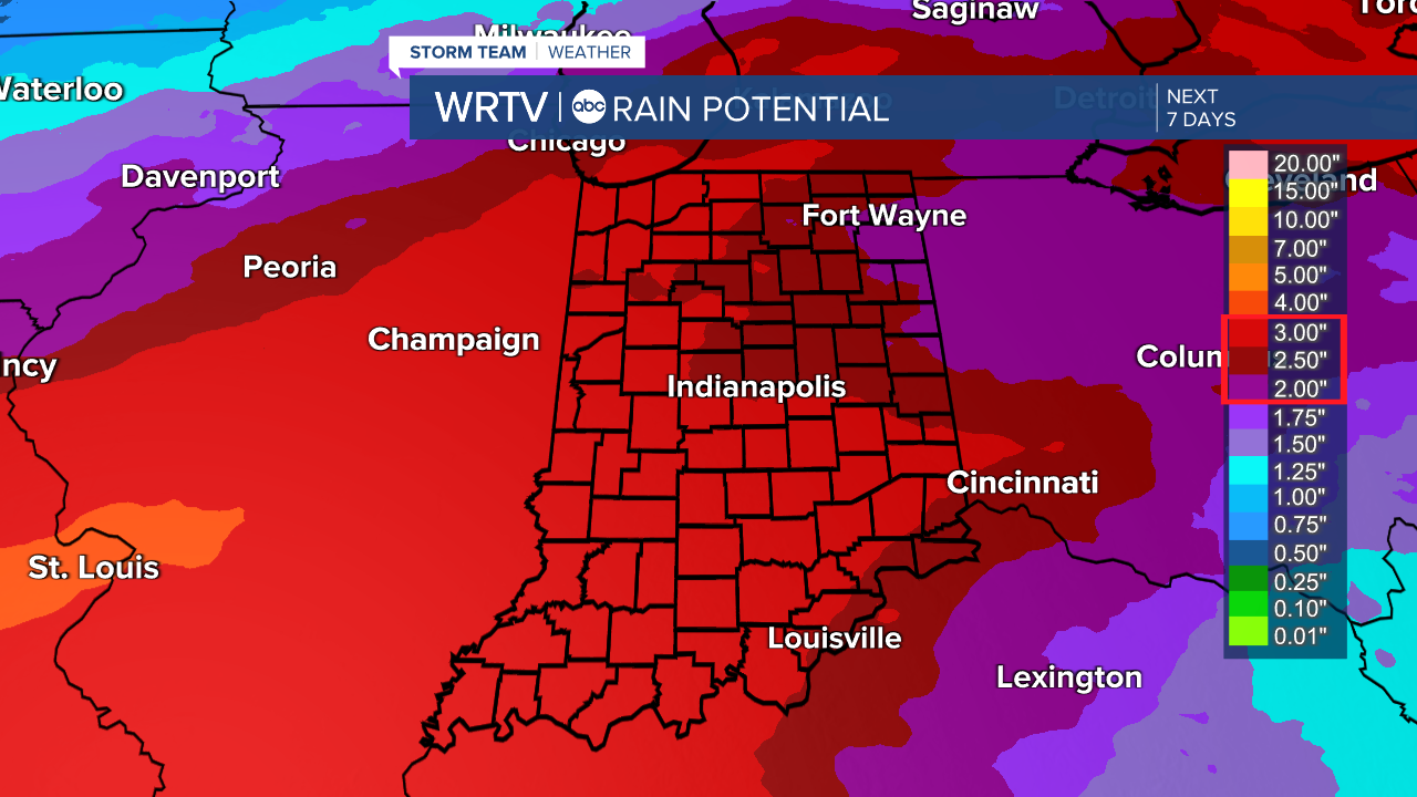
Rainfall could add up to between 2" and 4" by next weekend. The stretched out duration of the rain should help minimize urban flooding issues. However, river flooding is something we'll watch closely through the week.
Indianapolis Weather Forecast:
Monday: Mostly cloudy and breezy. High: 75°
Tuesday: Partly sunny and breezy. Late storm possible. High: 81°
Wednesday: Rain likely. High: 58°
Indianapolis 7-Day Weather Forecast