


Headlines
- POTENTIAL RECORD HIGH TEMPERATURES
- SEVERE STORM RISK TUESDAY INTO WEDNESDAY
- COOLING OFF LATE WEEK
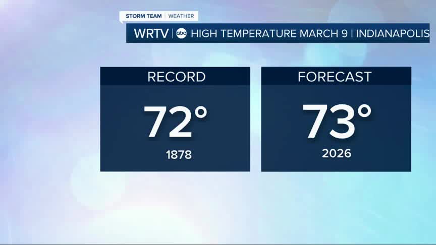
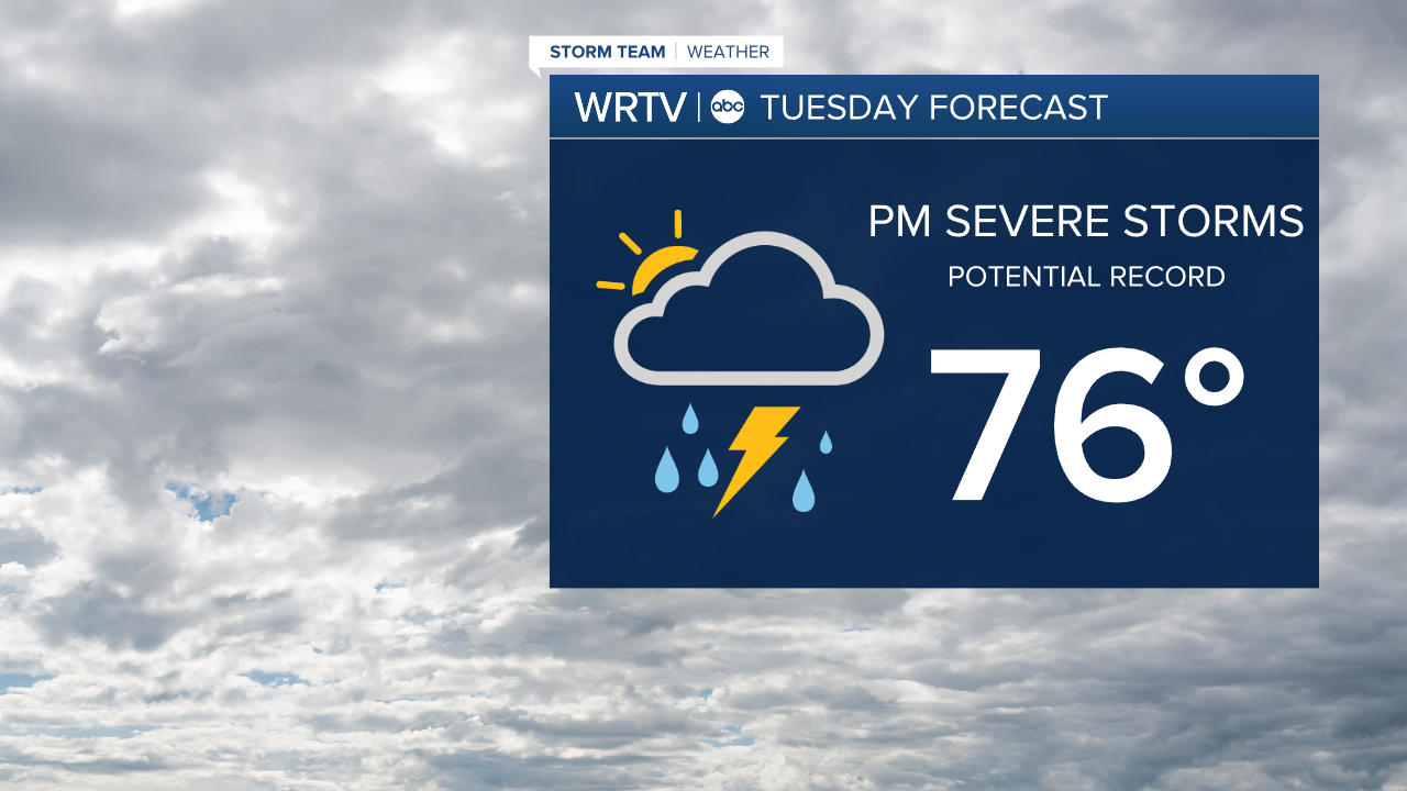
We will start the week with warmer weather! Temperatures will climb into the 70s. If we can hit 73° today, we will break a record high. It is a long standing record set back in 1878. The heat is here to stay into Tuesday. Out forecast high of 76° would break the record high of 74° set in 2009. Most of Tuesday looks dry and cloudy, but storms will be top of mind Tuesday evening into Wednesday morning.
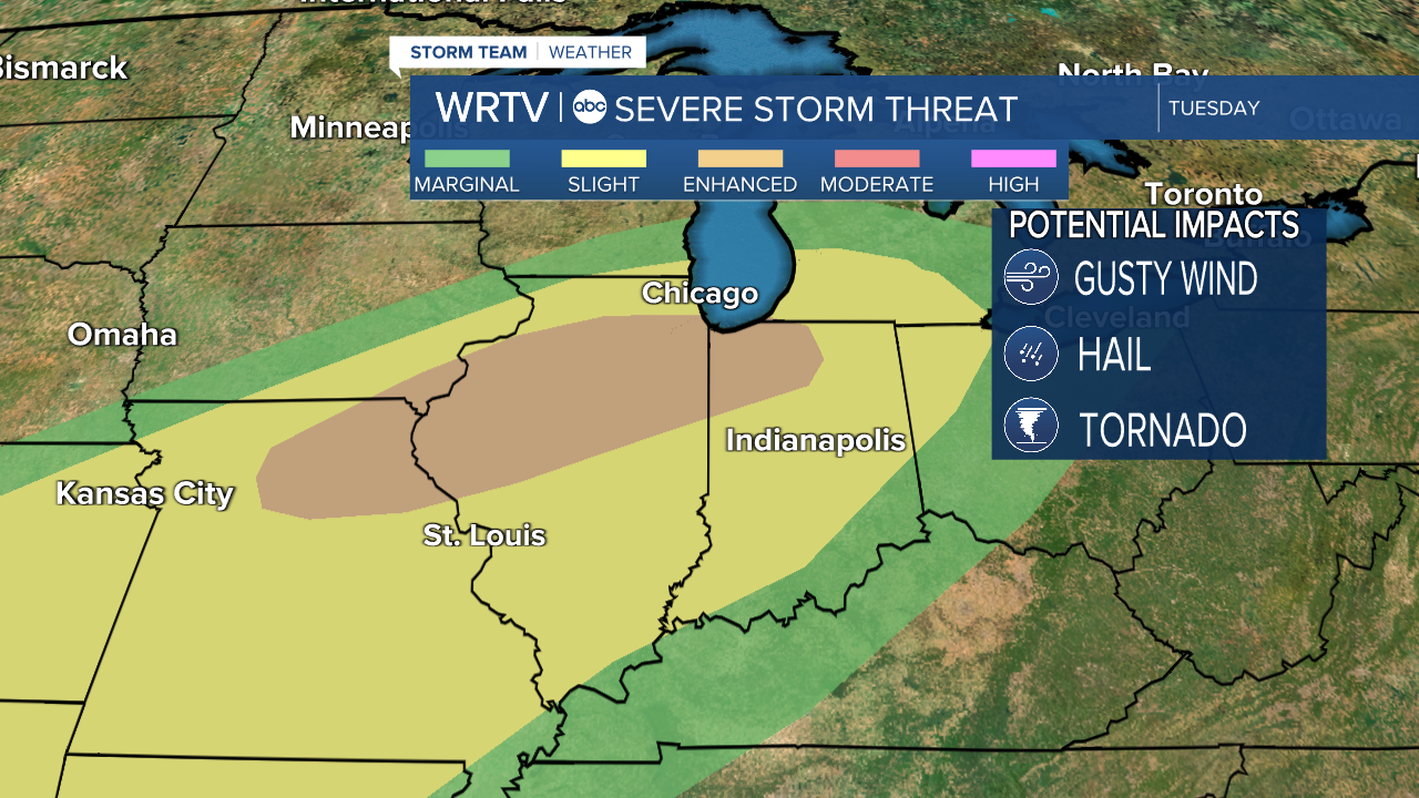
Most of the state is under a "slight" risk for severe weather. That is a level 2 out of 5. The northwest corner is under a level 3 out of 5 or an "enhanced" risk. All modes of severe weather are possible with wind, hail, and even a tornado are on the table. Have a way to get alerts, something that can wake you up, as these storms move in early Wednesday. We will be watching this closely.
This heat can't last forever. Temperatures will drop back into the 50s and even 40s by the end of the week.
Indianapolis Weather Forecast:
Today: Mostly sunny. High: 73°
Overnight: Mostly cloudy. Low: 60°
Tomorrow: Cloudy with PM storms. High: 76°
Indianapolis 7-Day Weather Forecast

