


It's going to be a frigid Monday. A Cold Weather Advisory runs from early Monday morning all the way to Tuesday morning. Even if you aren't in the advisory, it will still be cold. Monday is a great day to minimize your time outdoors. Be sure to layer up, if you do have to venture out.
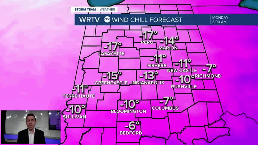
Wind chills will be at their coldest Monday morning. Feels like temperatures will range from about -10° to -20°. Thankfully, most kids won't have to brave the cold because of the holiday.

It doesn't feel much better by the afternoon. Wind chills are likely to stay below zero across most of Central Indiana.

Of course, actual temperatures remain very cold Monday. It's the wind that makes it feel even worse. West winds will gust between 25 and 35 mph. One bright spot is a little more sunshine as clouds decrease through the day.

Temperatures recover from the frigid feel by Wednesday. However, that "warm-up" is brief. More cold temperatures take aim on us by next weekend.
Indianapolis Weather Forecast:
Monday: Decreasing clouds. Very cold & breezy. High: 13°
Tuesday: Partly sunny. High: 26°
Wednesday: Mostly cloudy. Isolated snow shower. High: 40°
Indianapolis 7-Day Weather Forecast

