

INDIANAPOLIS (WRTV) — Following a few showers and storms Sunday afternoon, a brief period of quiet and sunny weather will return to start the new week.
Tonight:
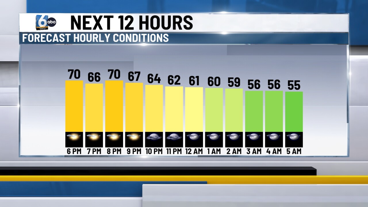
Calm and a bit cooler weather is expected tonight. Clouds will continue to clear out overnight, leading to mainly clear skies by sunrise. This will allow temperatures to dip into the 50s early tomorrow morning.
TOMORROW:
Beautiful start to the week tomorrow, and honestly, the best-looking day this week. Temperatures will max out in the mid 70s, remaining below normal, under mainly clear skies.

STRONG TO SEVERE STORMS:
A few rounds of strong to severe storms will be possible Tuesday and Wednesday. Tuesday will feature a 1 out of 5 risk for strong storms. Small hail and gusty winds will be possible.

Wednesday is being kept under close eye on with a 2 out of 5 risk, with all modes of severe weather in play.

7-DAY FORECAST:
A weak disturbance will pass on Tuesday. A weak warm front will push temperatures back into the upper 70s with a few isolated evening T-storms possible. A stronger system will work through Wednesday. Much of the day will be calm followed by storms during the late evening hours.
The risk is being monitored for strong to severe storms late Wednesday evening and overnight. The cold front passes Thursday morning allowing temperatures to drop back into the mid to low 70s, with sunshine around for the afternoon.
Sunshine will hang around for the rest of the week with temperatures warming back into the upper 70s and low 80s.
