INDIANAPOLIS (WRTV) — Showers and slow-moving storms continue across central and southern Indiana to kick off the weekend
TODAY:
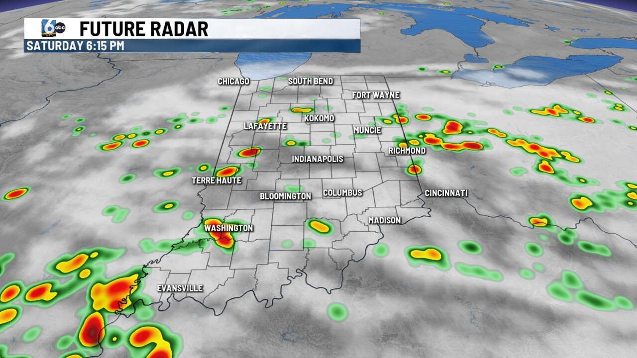
Clouds remain for much of the day; however, most spots will be dry through the day. A few localized to spotty showers and storms will be possible for those along and south of I-70. Temperatures will max out in the mid to low 80s.
TOMORROW:
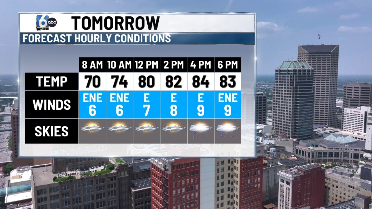
Fairly calm weather returns for the day Sunday. A spotty shower and storm or two will be possible for spots south of I-70; however, most areas will remain dry. Temperatures will max out in the mid 80s under clearing skies.
7-DAY FORECAST:
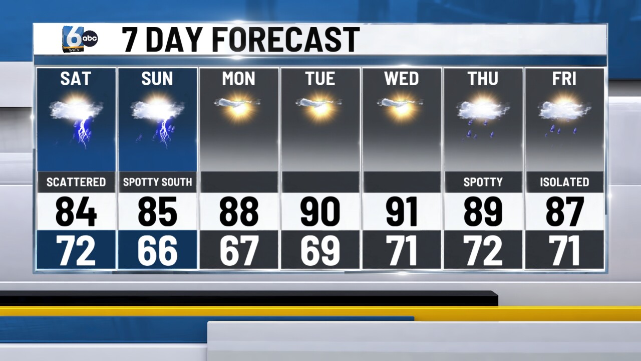
A new ridge of high pressure will settle in across the western and central US to end the weekend. High pressure will spread east through the day Monday and Tuesday. This will allow for mainly clear skies through the first half of the week, with temperatures that could get back into the 90s. A stray pop-up shower or storm will be possible during the week, especially for those further south of I-70. A few spotty Isolated showers and storms will be possible along a cold front off to the east. Most spots will not see much relief in the way of humidity and temperature-wise from the front.