


Our weather is going through a big transformation this weekend.
Much colder air rushes across Central Indiana Sunday. Temperatures spend much of the day in the 30s, but it will feel more like the 20s. That's because NW wind gusts around 30 mph will bring in the frigid feel. The quick arrival of the winter chill will likely have you reaching for the heavier coat. Skies stay mostly cloudy with the chance for some scattered rain and snow showers.

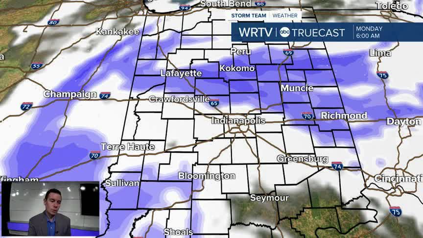
Sunday night into Monday morning brings the chance for a band of light snow to sweep across the area. This could lead to some slick spots early Monday with temperatures dropping into the 20s.

Our first accumulating snow of the season is likely for many of us by Monday morning. Some north and eastern locations could see 1"-2" of snowfall. Central areas could see a light coating to 1" of snow. Southern areas have a lower chance of snow sticking. Greatest accumulations will be on grassy and elevated surfaces.

Indianapolis Weather Forecast:
Sunday: Mostly cloudy with scattered rain and snow showers. Windy. Temperatures fall.
Monday: Partly sunny with scattered snow showers. Breezy. High: 36°
Tuesday: Partly sunny. High: 43°
Indianapolis 7-Day Weather Forecast

