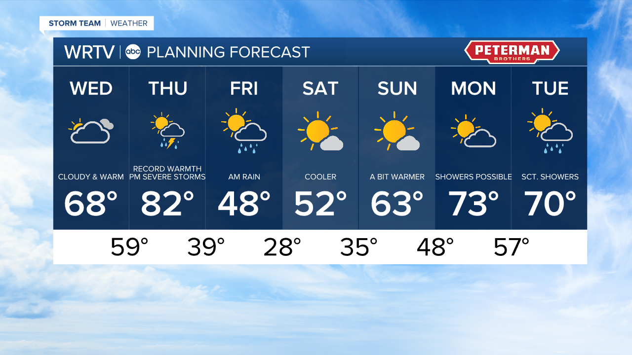


Headlines
- RECORD BREAKING HEAT
- SEVERE STORM CHANCE
- COLD AT TIMES INTO THE WEEKEND
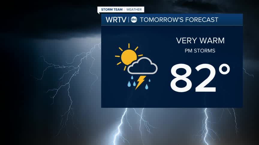
Warmer weather is on the way into Thursday. We are set to land near 70° Wednesday afternoon then 80° plus on Thursday. Our forecast high of 82° would break the current record of 80° set in 1907. That heat and humidity will fuel storms and showers Thursday night into Friday morning. There is an "enhanced" risk or a level 3 out of 5 for severe weather in place. We could see all modes of severe weather including hail, wind, and even an isolated tornado.

Storms hold off until late Thursday. Here is a snapshot at 11pm Thursday night. Have a way to get alerts overnight just in case a severe storm finds you.

It will be a lot colder in the wake of those storms. Temperatures tank into the 20s and 30s for overnight lows. Warmer weather fills back in fairly quickly with highs back in the 50s, 60s, and 70s quickly.
Indianapolis Weather Forecast:
Today: Cloudy. High: 68°
Overnight: Overnight showers. Low: 59°
Tomorrow: Evening storms. High: 82°
Indianapolis 7-Day Weather Forecast