


Headlines
- RECORD BREAKING WARMTH
- LOW-END SEVERE WEATHER CHANCE
- SUNSHINE RETURNS
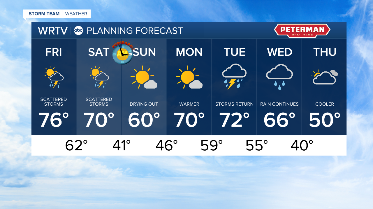
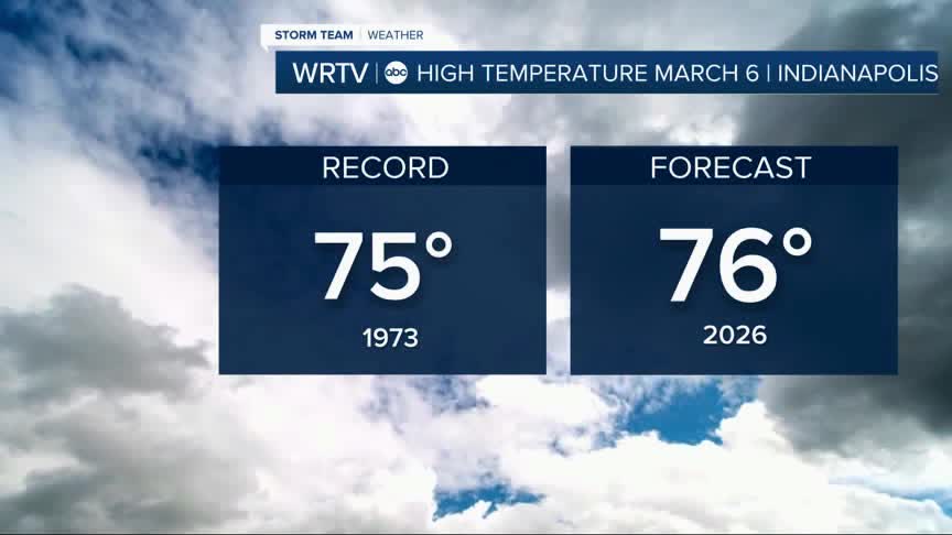
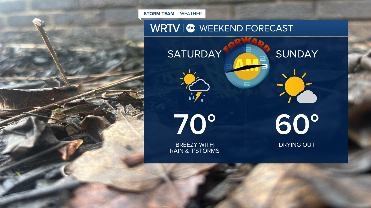
We are on record watch with temperatures expected to get back into the mid 70s Friday afternoon. If we can get to 76°, the old record of 75° will fall. That was set in 1973! All that energy will fuel storm chances Friday evening into Saturday morning. There is a low-end severe weather risk Friday for some isolated storms.

That threat will carry over into Saturday morning. We will likely start the day off with scattered storms and showers, but dry out for the afternoon.

I know many of us are looking forward to some sunshine! That is Sunday here in central Indiana. A reminder, we "spring forward" Saturday into Sunday. That means we lose an hour of sleep. Our sunrise and sunset will be an hour later.
Rain returns by midweek. Temperatures surge back into the low 70s, cooling into the 50s by Thursday.
Indianapolis Weather Forecast:
Today: Scattered PM storms. High: 76°
Overnight: Overnight storms. Low: 62°
Tomorrow: AM storms then clearing. High: 70°
Indianapolis 7-Day Weather Forecast