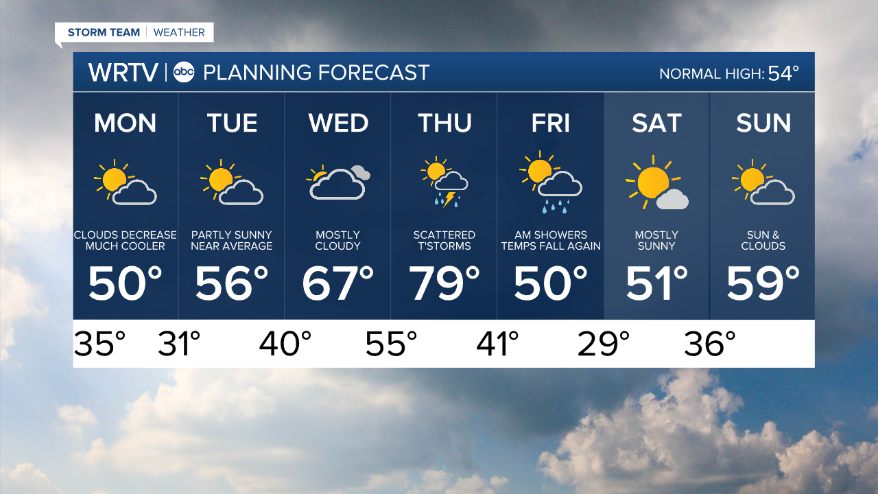
INDIANAPOLIS — Sunday brought the warmest March temperature on record for Indy with a high of 88°. Temperatures take a big hit Monday. We start the day in the mid 30s with highs struggling to hit 50°. A north breeze adds an extra chill to the air. Skies become mostly sunny, after clearing out some morning clouds.

Be sure to protect any early spring plants Monday night. Temperatures are likely to dip below the freezing mark by Tuesday morning. Cold temperatures could become an issue again over the upcoming weekend.

High temperatures manage to rebound back into the 50s and eventually the 60s and 70s as the week goes along.
Indianapolis Weather Forecast:
Monday: Becoming mostly sunny. High: 50°
Tuesday: Partly cloudy. High: 56°
Wednesday: Mostly cloudy. High: 67°
Indianapolis 7-Day Weather Forecast