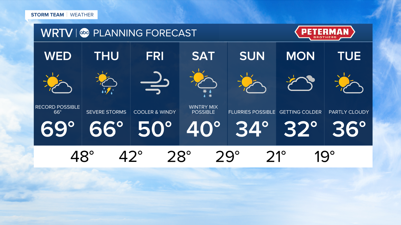


Headlines
- RECORD WARMTH
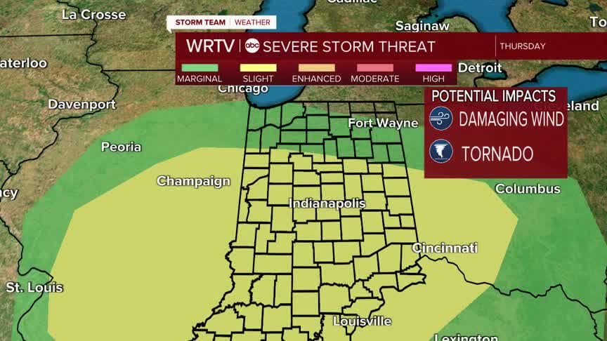
- SEVERE STORM POTENTIAL
- COLDER THIS WEEKEND
We will warm-up in a big way. Temperatures are expected to surge into the upper 60s and even low 70s today! Anything above 66° will break the record high for Indianapolis set back in 2017. A few other cities that are on record watch are Lafayette at 66° (2017), Terre Haute at 70° (2017), and Vincennes at 71° (2017). Wednesday afternoon dries out with a storm chance expect Thursday. There is enough energy for severe storms to form. Our area is under a level 2 out of 5 or a "slight" risk.
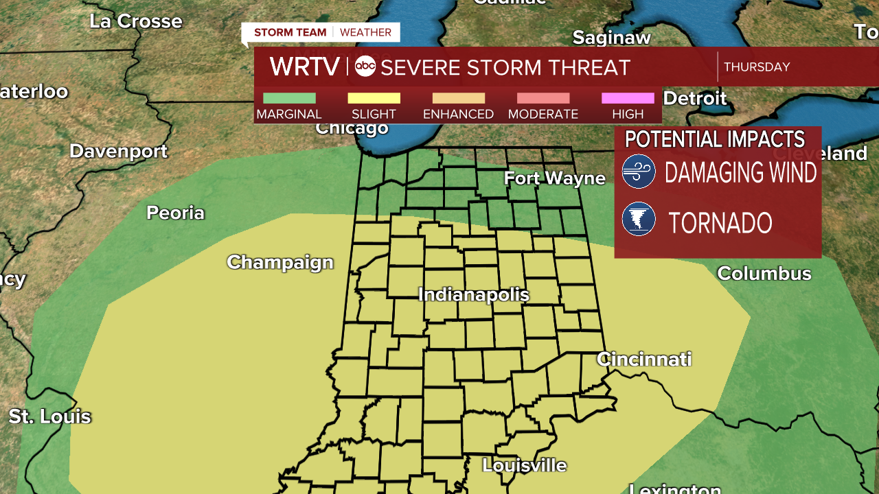
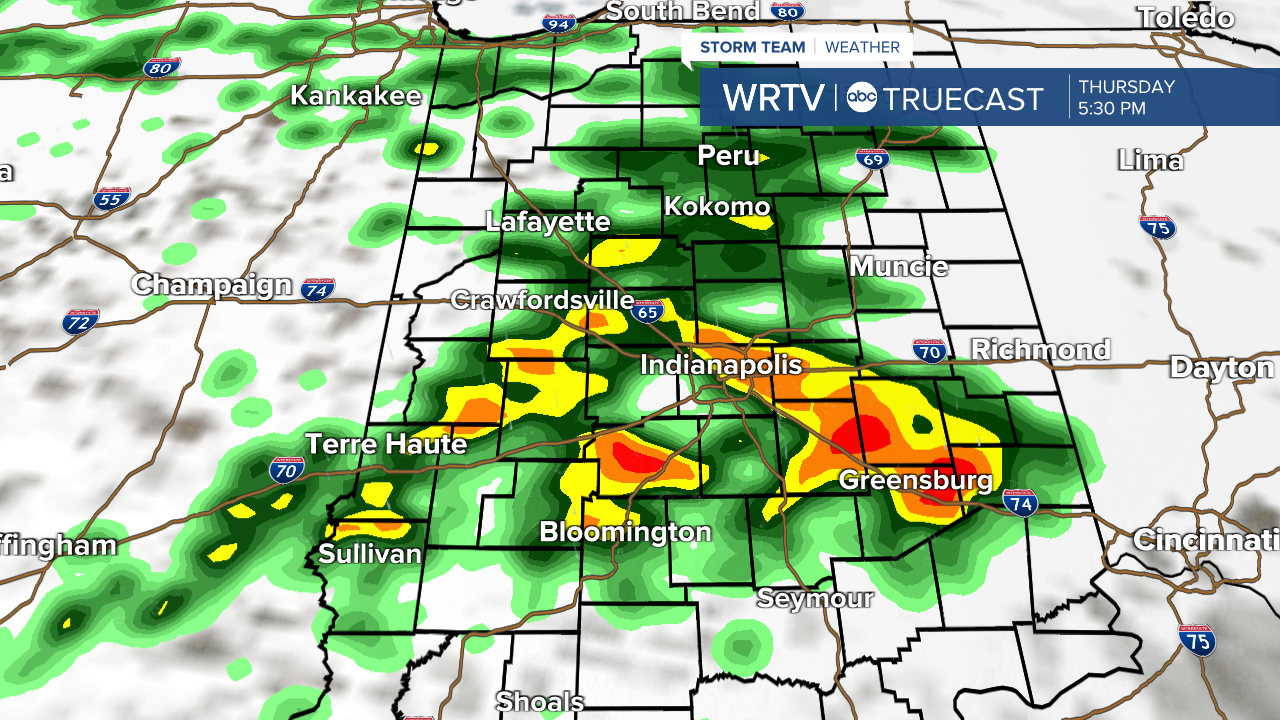
Storms and showers are expected by later afternoon and into the evening hours. Below is a snapshot form our forecast model at 5:30 pm. The main threat with this system will be damaging wind. There is also and isolated tornado threat. Have a way to get alerts and have your severe weather safety plan ready to go. It is a good idea early to find the safest place in your house. That is, an interior room with no windows and as many walls between you and the outside as possible.
Colder air will eventually replace this unseasonably warm air mass. Temperatures drop by the weekend and into next week with highs falling into the 30s.
Indianapolis Weather Forecast:
Today: Partly cloudy. High: 69°
Overnight: Mostly cloudy. Low: 48°
Tomorrow: Strong to severe storms. High: 66°
Indianapolis 7-Day Weather Forecast