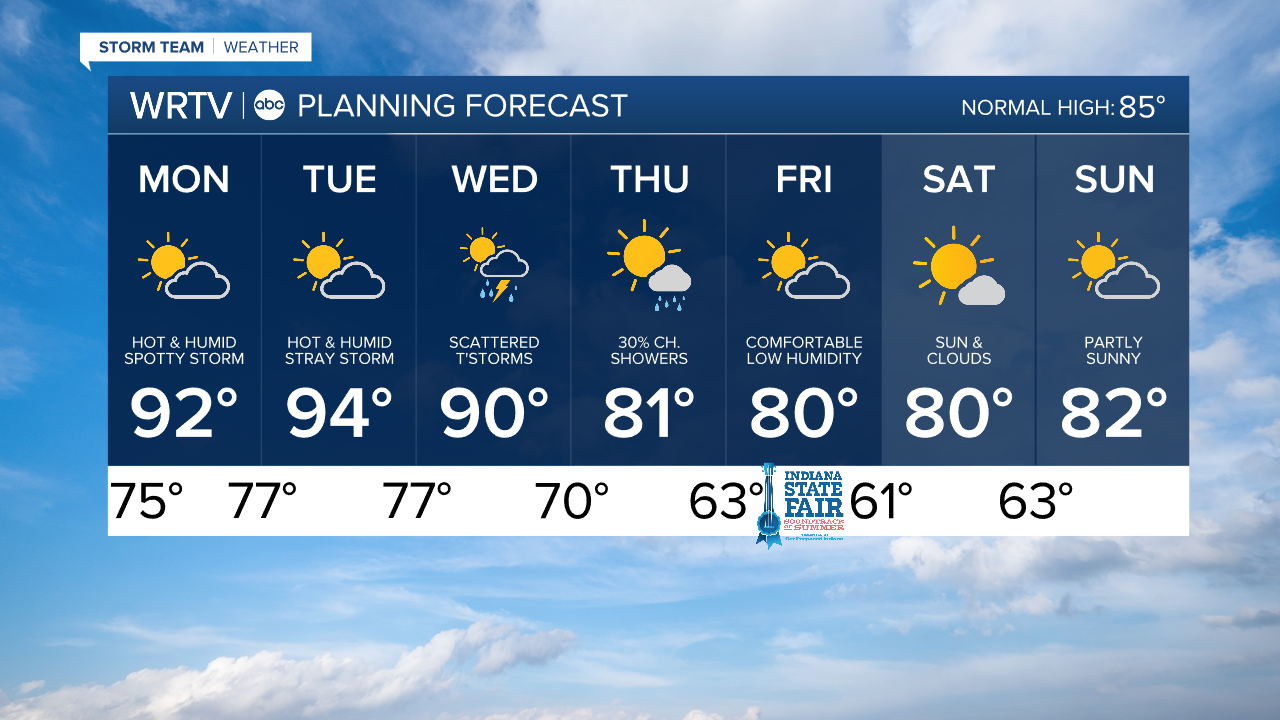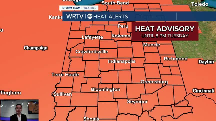


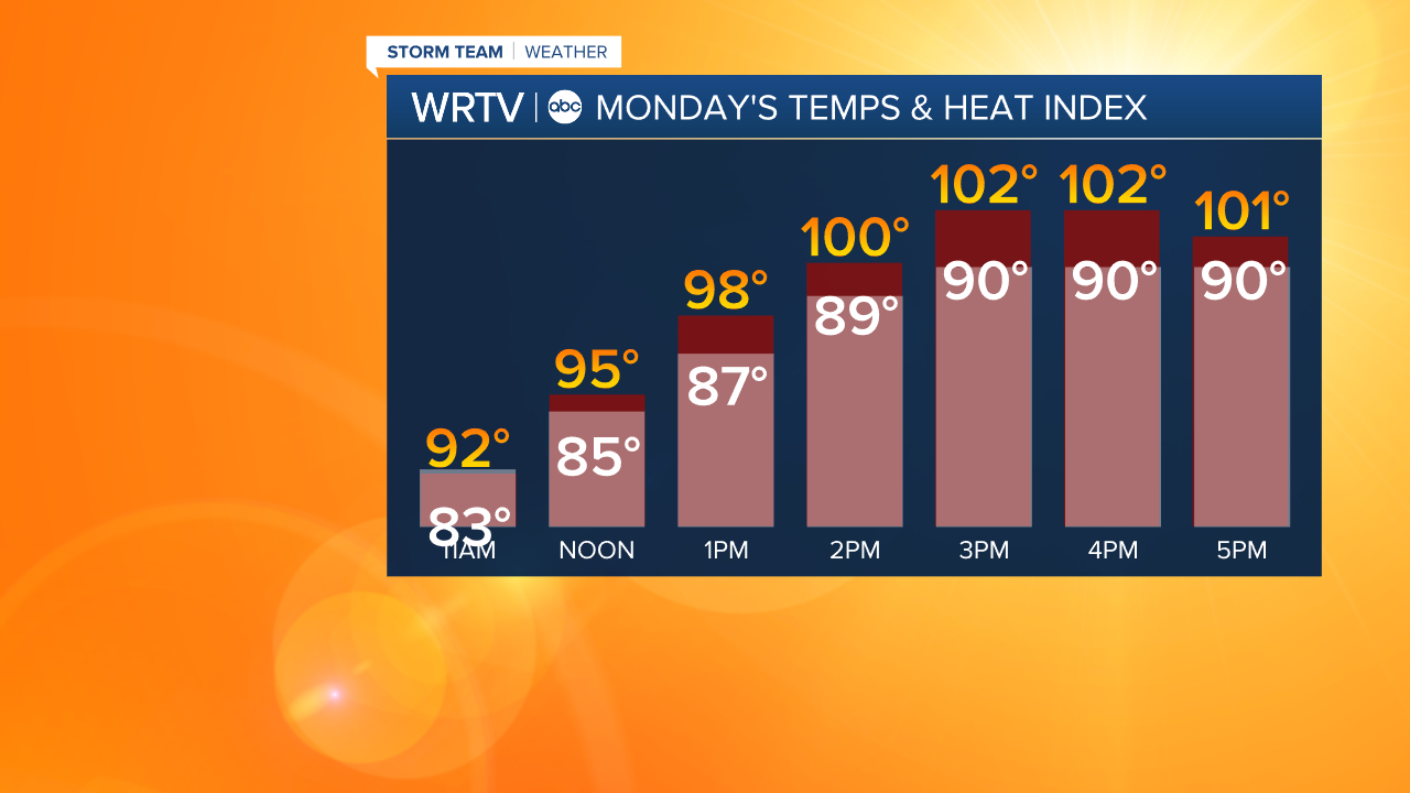
Rain chances become much more limited to start the week. That means temperatures climb even higher. Afternoon highs reach into the lower 90s Monday. The very high humidity adds to the uncomfortable feel. Heat index values reach into the triple digits during the afternoon. The Heat Advisory has been extended until 8pm Tuesday. If you can, limit your time outdoors Monday to the morning and late evening. Skies stay partly sunny with just a spotty storm chance.
Tuesday could bring the hottest temperatures so far this year. We're forecasting a high of 94° with heat index values around 105°. Scattered storms and a cold front Wednesday will lead to a much more comfortable end to the week. Highs will be around 80° Thursday and Friday.
Indianapolis Weather Forecast:
Monday: Partly sunny. Spotty storm possible. High: 92°
Tuesday: Partly sunny. Stray storm possible. High: 94°
Wednesday: Scattered storms. High: 90°
Indianapolis 7-Day Weather Forecast