

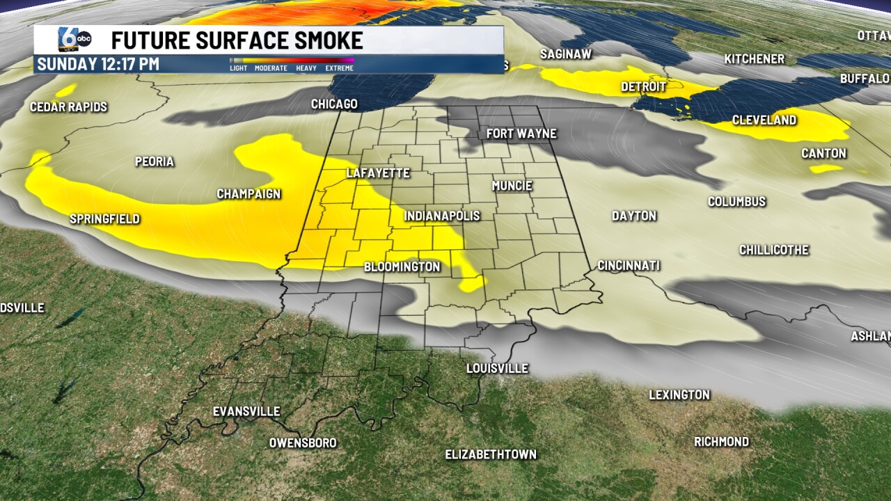

INDIANAPOLIS (WRTV) — Calm weather settles in to end the weekend across Central Indiana, with relief from the high heat arriving next week.
TONIGHT:
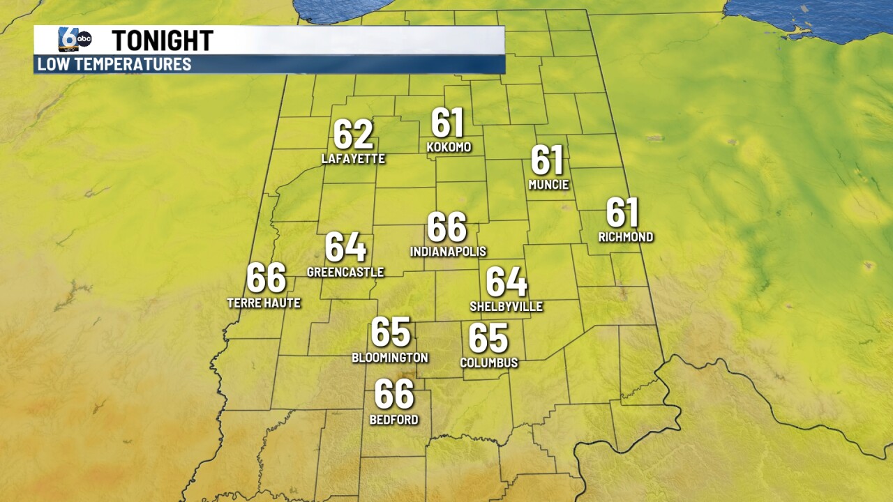
Beautiful weather for our Sunday night. Wildfire smoke lightens once the sunset sets, leaving mainly clear skies through the overnight. Temperatures will drop into the mid to low 60s, a localized spot or two may reach as cool as the upper 50s.
TOMORROW:
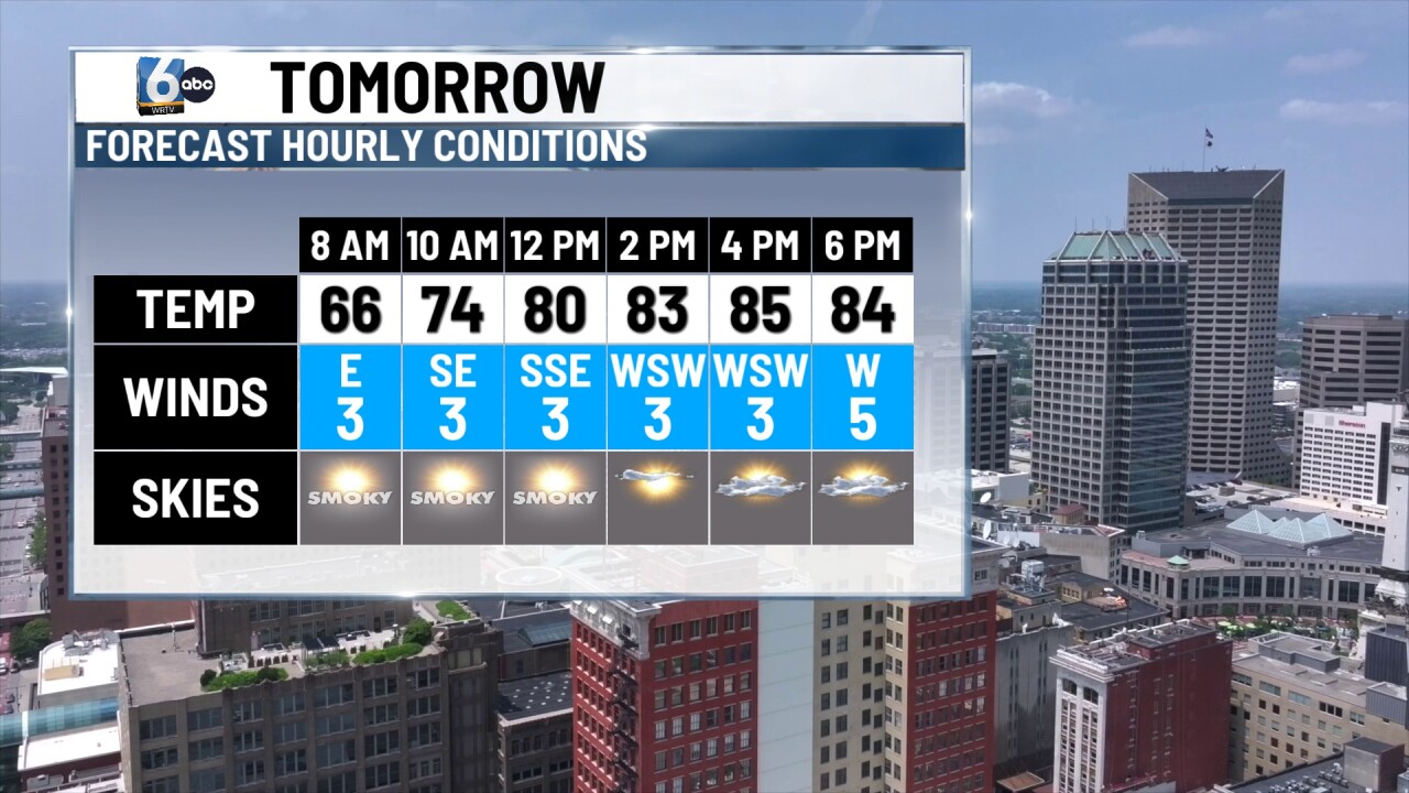
Sunshine kicks off our new week. Temperatures will warm a few degrees into the mid to upper 80s under mainly clear.
7-DAY FORECAST:
High temperatures will remain in the upper 80s to low 90s through Tuesday out ahead of another cold. This cold front will return the storm chances late Monday evening and overnight. Storms will likely exit before lunch time on Tuesday.
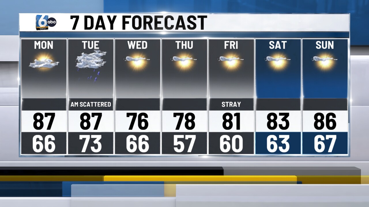
Cooler temperatures will linger through the rest of the week. High temperatures could remain in the 70s Wednesdays through Friday.
Rain chances will likely remain suppressed with the return of high pressure. However a stray pop up shower or storm will be possible any day through the rest of the week.
