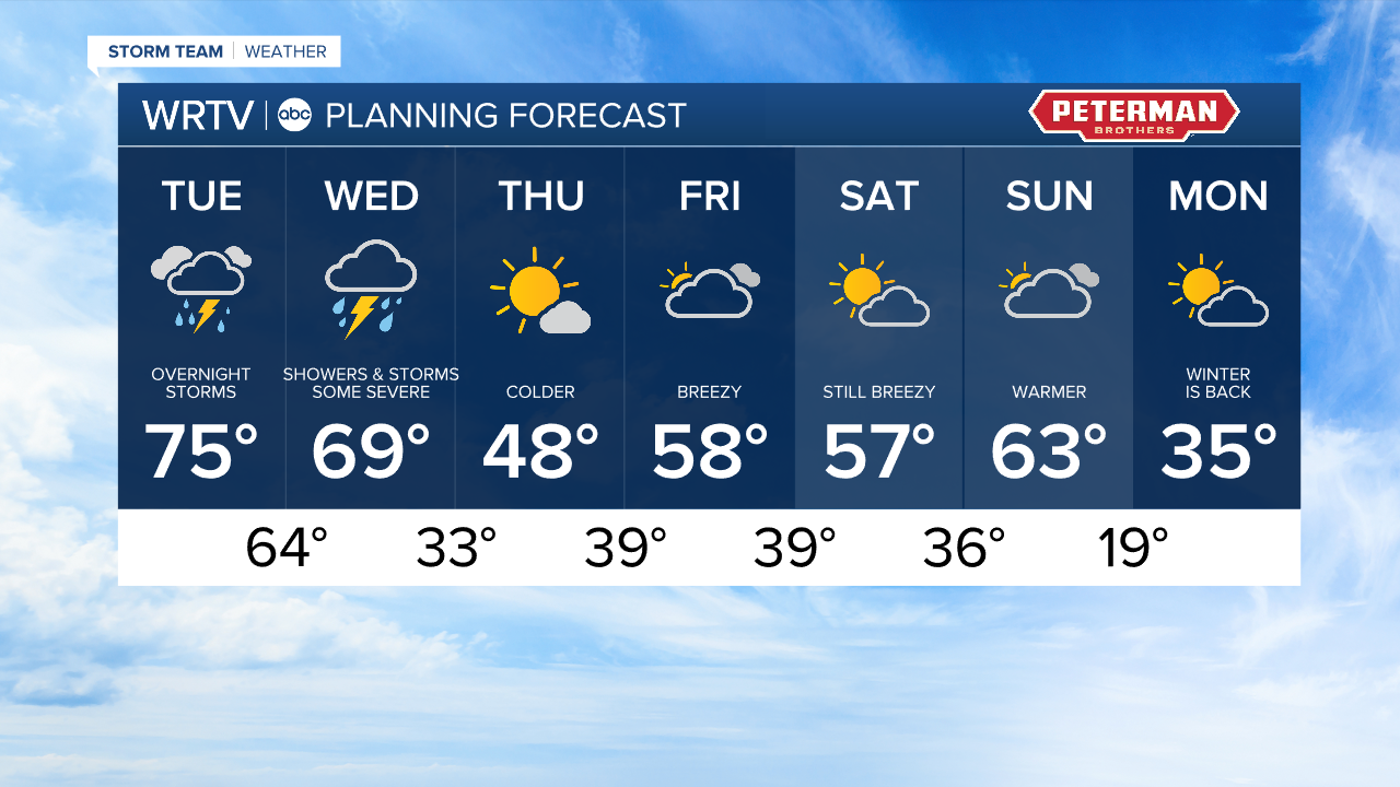


Headlines
- POTENTIAL RECORD HIGH TEMPERATURE
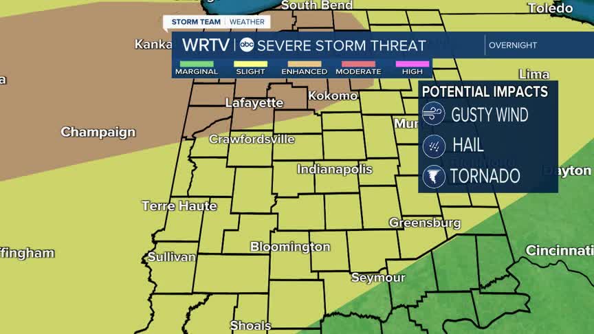
- OVERNIGHT SEVERE STORMS
- MUCH COLDER NEXT WEEK
It will be a hot and humid day by mid March standards! Highs are forecast to climb into the mid 70s. If we can hit 75° we will break the current record high of 74° set in 2009. That heat and humidity will get storms and showers going overnight and into Wednesday morning. That is the severe weather risk shown in the image above and below. Because this system splits days, there is a risk map for Tuesday and Wednesday. Our time frame for storms is starts around midnight and will peak just before daybreak Wednesday.

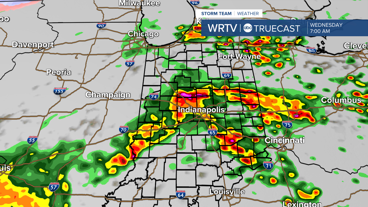
All modes of severe weather are possible including strong winds, hail, heavy rain, and even tornadoes. Have a plan and don't panic. Because this system arrives when many of us will be asleep, have a way to get alerts that can wake you up. A weather radio is a great option. We will be with you through this system and bring you updates as soon as they develop. Here is a 4 AM snapshot of the scattered storms.
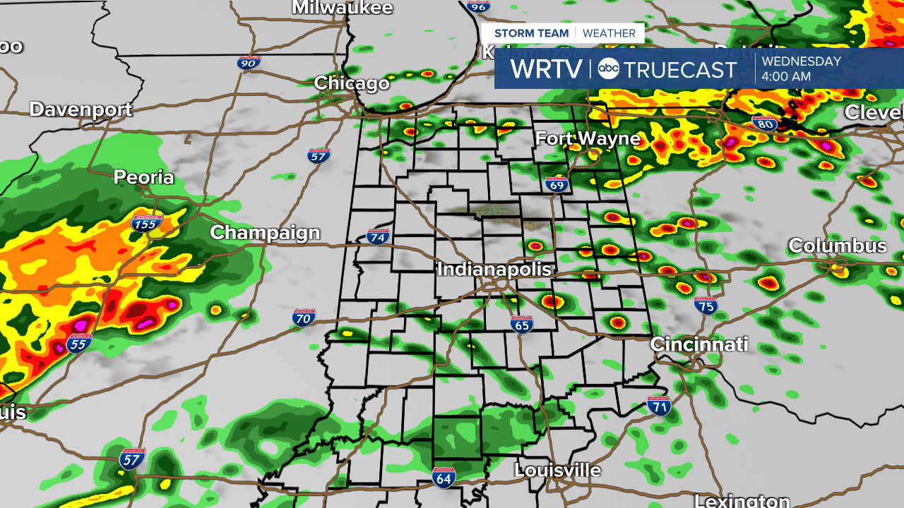
Coverage will expand early Wednesday morning. The morning commute will likely be a lot slower with the storms and showers.
Then or focus shifts to some big temperature swings. While we are talking warmth in the short term. Take a look at next week with highs tanking back into the 30s! That will be some weather whiplash.
Indianapolis Weather Forecast:
Today: Mostly sunny. High: 75°
Overnight: Mostly sunny. Low: 64°
Tomorrow: Mostly sunny. High: 69°
Indianapolis 7-Day Weather Forecast