


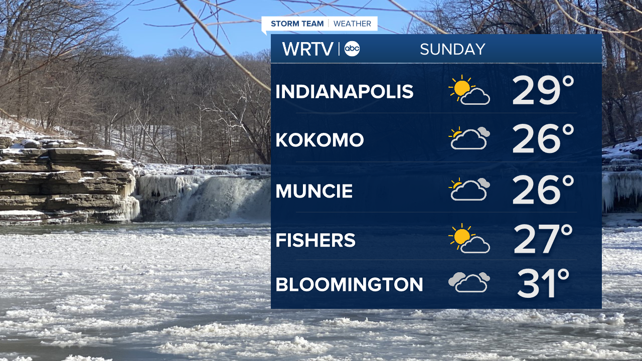
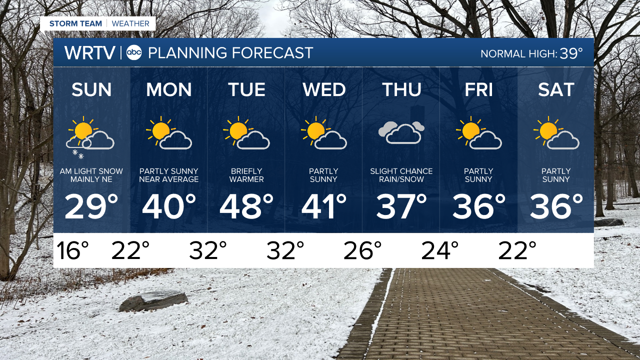
We will have quite a few clouds, but still try to work in some sunshine here and there Sunday. Temperatures remain on the cold side with highs only in the 20s and wind chills in the teens.
wrtv
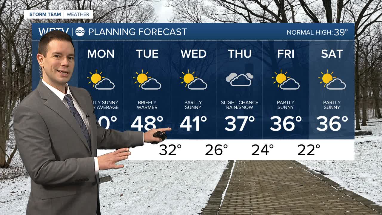
The week ahead does bring us some warmer temperatures. Highs around 40° Monday and near 50° Tuesday will help in melting the snow we've had on the ground for the last two weeks.

wrtv
Some questions remain on whether we will see much active weather this week. Models have been trending quieter for us, but we could still see some rain or a wintry mix mid to late in the week.
Indianapolis Weather Forecast:
Sunday: AM snow chance NE. Partly sunny. High: 29°
Monday: Partly sunny. High: 40°
Tuesday: Partly sunny. High: 48°
Indianapolis 7-Day Weather Forecast
wrtv
