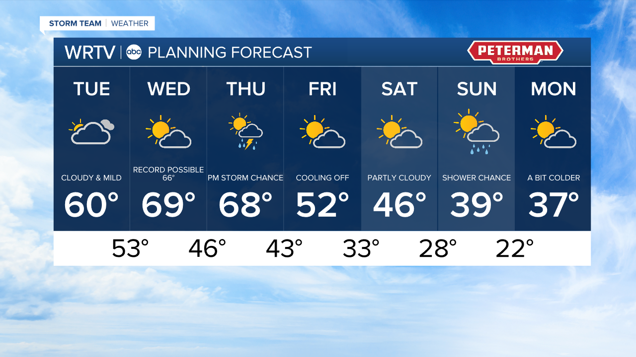


Headlines
- RECORD WARMTH POSSIBLE
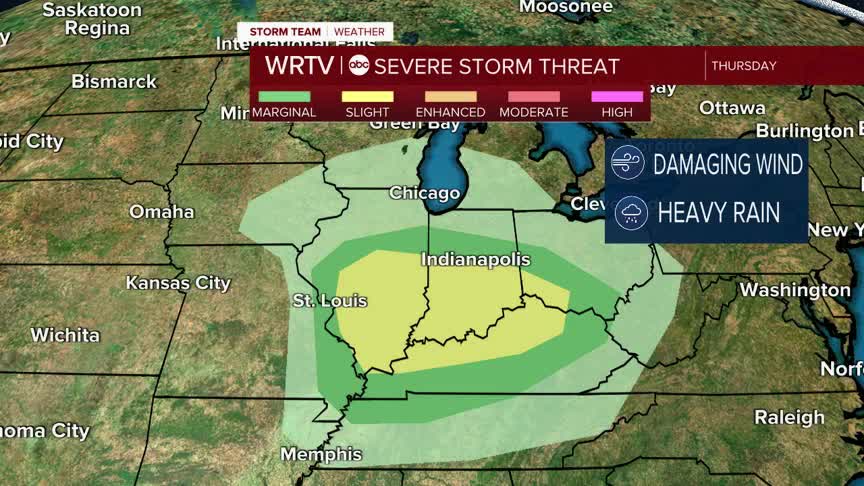
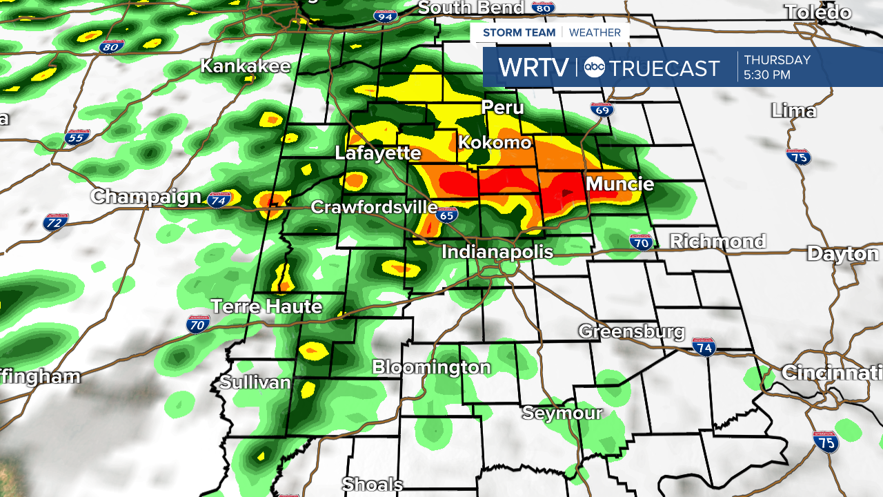
- SEVERE STORMS POTENTIAL THURSDAY
- COOLING OFF THIS WEEKEND
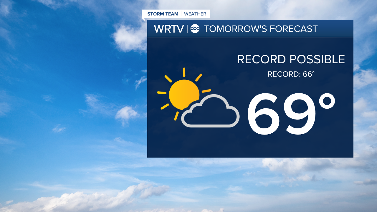
Our spring-like stretch continues through midweek. That will surge temperatures into the 60s and even near 70°! All that energy will fuel strong to even severe storms Thursday evening. A slight risk or a level 2 out of 5 is in place Thursday evening. Starting with the warmth - we look to start Wednesday with temperatures in the mid 50s. That could break the record for the warmest start to February 18th, ever. With that warm start, it is no surprise highs climb to near 70°. Anything over 66° will break the record high temperature.
That is where our storm chance comes in. All that energy could translate to strong/severe storms Thursday evening. There is a lot of spin in the atmosphere, so, strong winds, heavy rain, and even an isolated tornado are all possible. There is a good deal of uncertainty with how much lift we will have (key for storm development). If the lift and spin don't line up, that could limit storm growth. Either way, it is a good time to review your severe weather plan as we get closer to spring.
Cooler temperatures are back just in time for the weekend. Highs drop back into the 40s and even 30s by Saturday and Sunday.
Indianapolis Weather Forecast:
Today: Mostly cloudy. High: 60°
Overnight: Scattered showers. Low: 53°
Tomorrow: Partly cloudy. High: 69°
Indianapolis 7-Day Weather Forecast