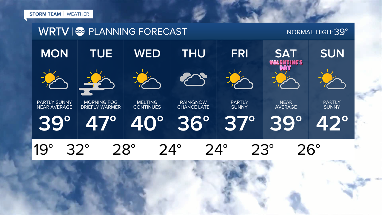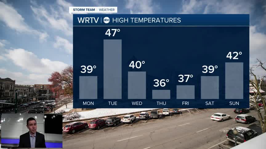


The new week finally brings a new weather pattern. After the cold start, Monday afternoon temperatures reach into the upper 30s to lower 40s. This will help melt more of the snow that's been on the ground for more than two weeks. We'll have a mix of sun and clouds with clouds taking over later in the day.
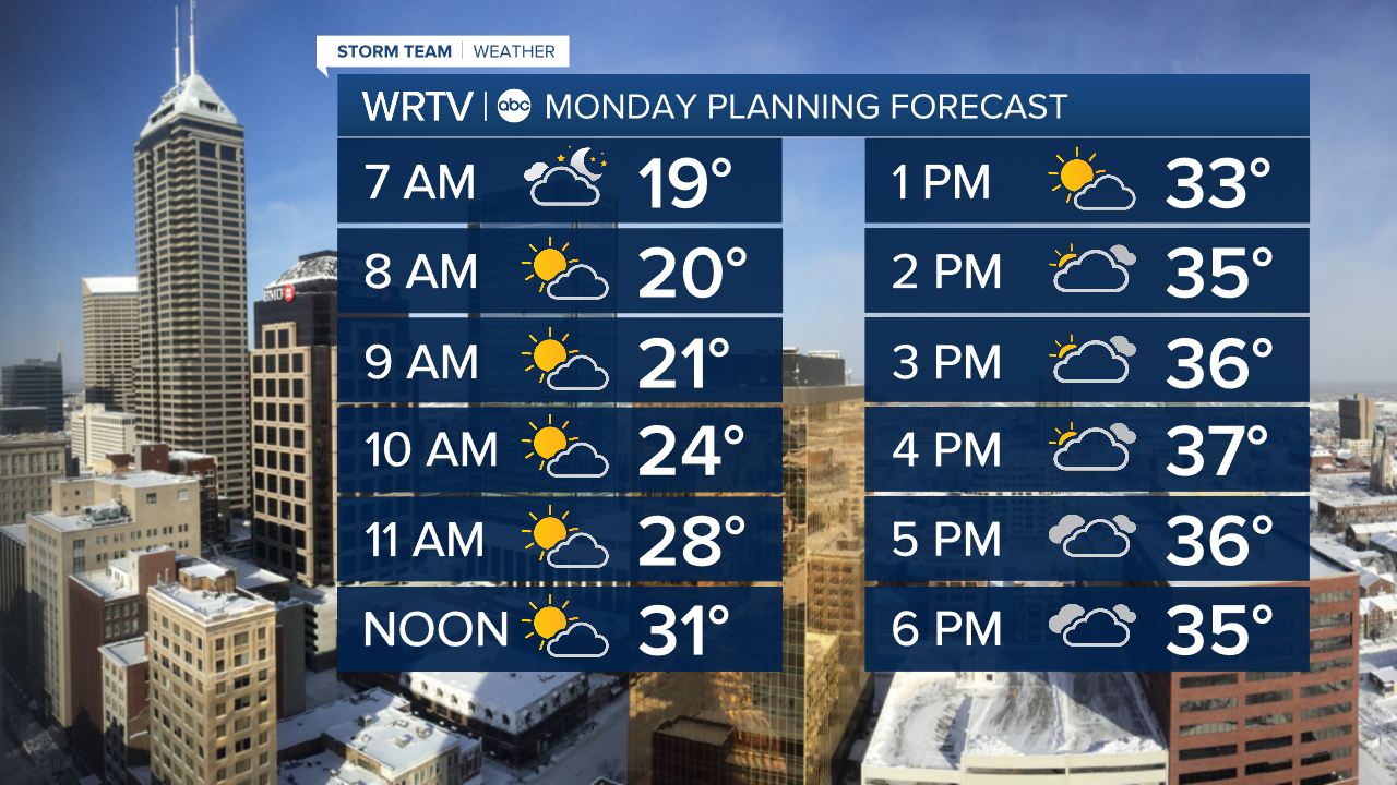
The gradual melting of snow continues much of Monday night with lows only around 32°. The result is likely to create some fog going into Tuesday morning. A bit of a southerly breeze may help some, but be prepared for some limited visibility especially early in the day.

Temperatures top out well into the 40s Tuesday, before cooling a bit. Still, we're looking at our first string of 32°+ days since January 21st/22nd.

Indianapolis Weather Forecast:
Monday: Partly sunny. High: 39°
Tuesday: AM fog. Partly sunny. High: 47°
Wednesday: Partly sunny. High: 40°
Indianapolis 7-Day Weather Forecast