

INDIANAPOLIS (WRTV) — Another round of strong to severe storms will return to finish out the weekend.
SEVERE STORMS:
Much of Central and Southern Indiana lie within a 2 out of 5 for severe storms. All modes of severe weather will be in play. Highest threats are for damaging winds and localized flooding. Small hail cannot be ruled out, with another non zero risk for tornadoes.
The best tornado potential will be south of I-70, for spots such as Columbus, Bloomington and along the Indiana and Illinois border. Storms will work into the Indy Metro area by 7pm. Storm chances will linger through midnight. Any storm will have the potential to be strong to low end severe.
FLOOD WATCH:
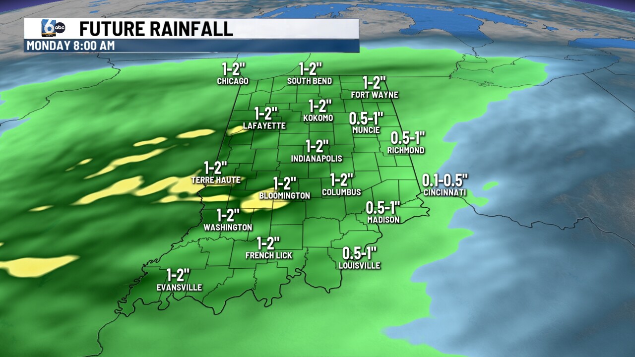
A Flood Watch has been issued for Central Indiana and will run until 8 AM Monday morning. 1-2” of rain is expected for the majority of the area, with localized pockets of 2”+.

TOMORROW:
Storms will clear out first thing in the morning. Skies will stay mostly cloudy through much of the day. A stray shower will be possible, but much of the day will be dry. The temperature will remain cooler in the mid to low 70s.

7-DAY FORECAST:
Following Sundays cold front temperatures will slightly cool into the mid to low 70s on Monday under clearing skies.
Sunshine will return for the day on Tuesday with more rain and storm chances returning for the day on Wednesday and Thursday. Temperatures will start to warm back up into the upper 70s and low 80s.

The week will end calmly with even more thunderstorm chances returning for next weekend.
