
INDIANAPOLIS (WRTV) — Calm and very warm end to the weekend. However even warmer temperatures and the return of storms kicks off the new work week.
Tonight:
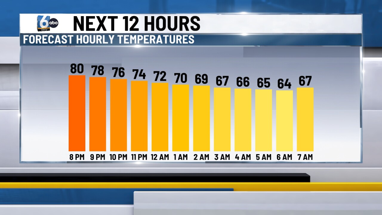
Mainly clear skies are expected through the overnight hours. This will allow temperatures to drop out of the 80s, down through the 70s before they bottom out in the mid 60s around sunrise tomorrow morning.
TOMORROW:
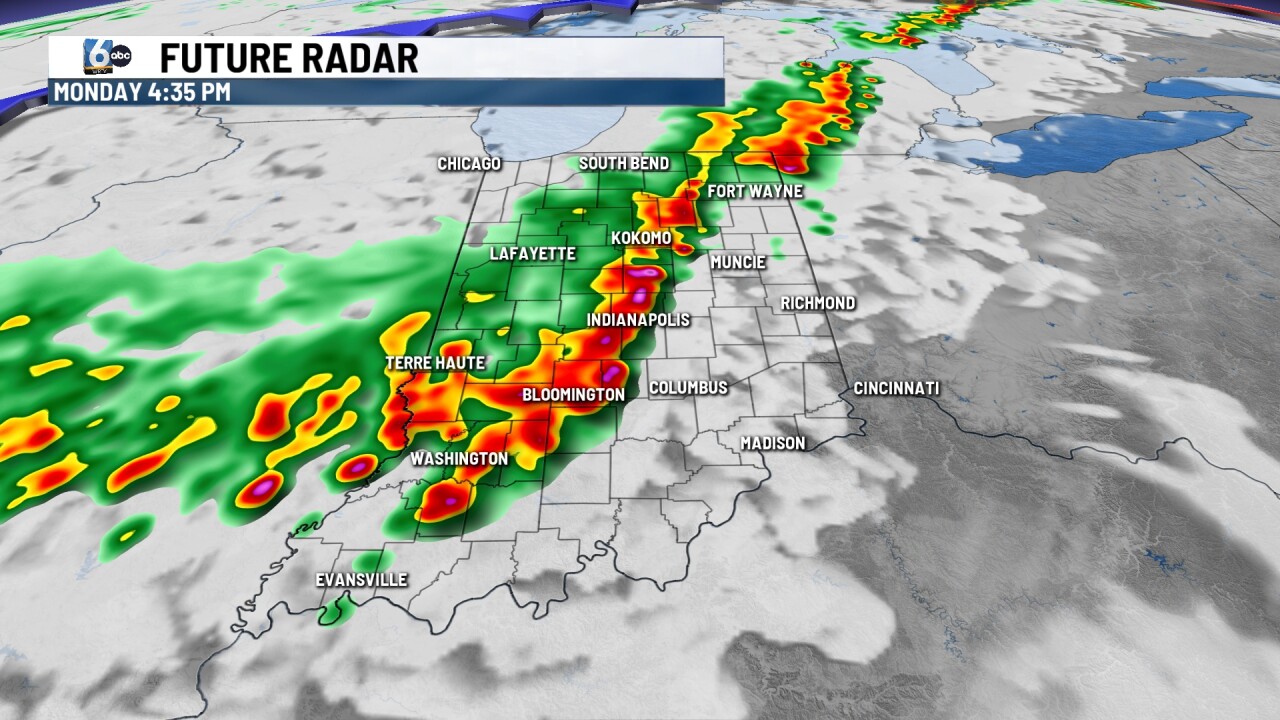
A calm start to the day is expected. But activity will quickly ramp up. Clouds will build back in through the morning hours with showers and storms arriving in the afternoon.
Storms could reach western Indiana as early as 2-3 p.m., with storms likely impacting the Indy metro area for the evening commute and dinner time. Any storms will have the potential to bring gusty winds and small hail.
TUESDAY:
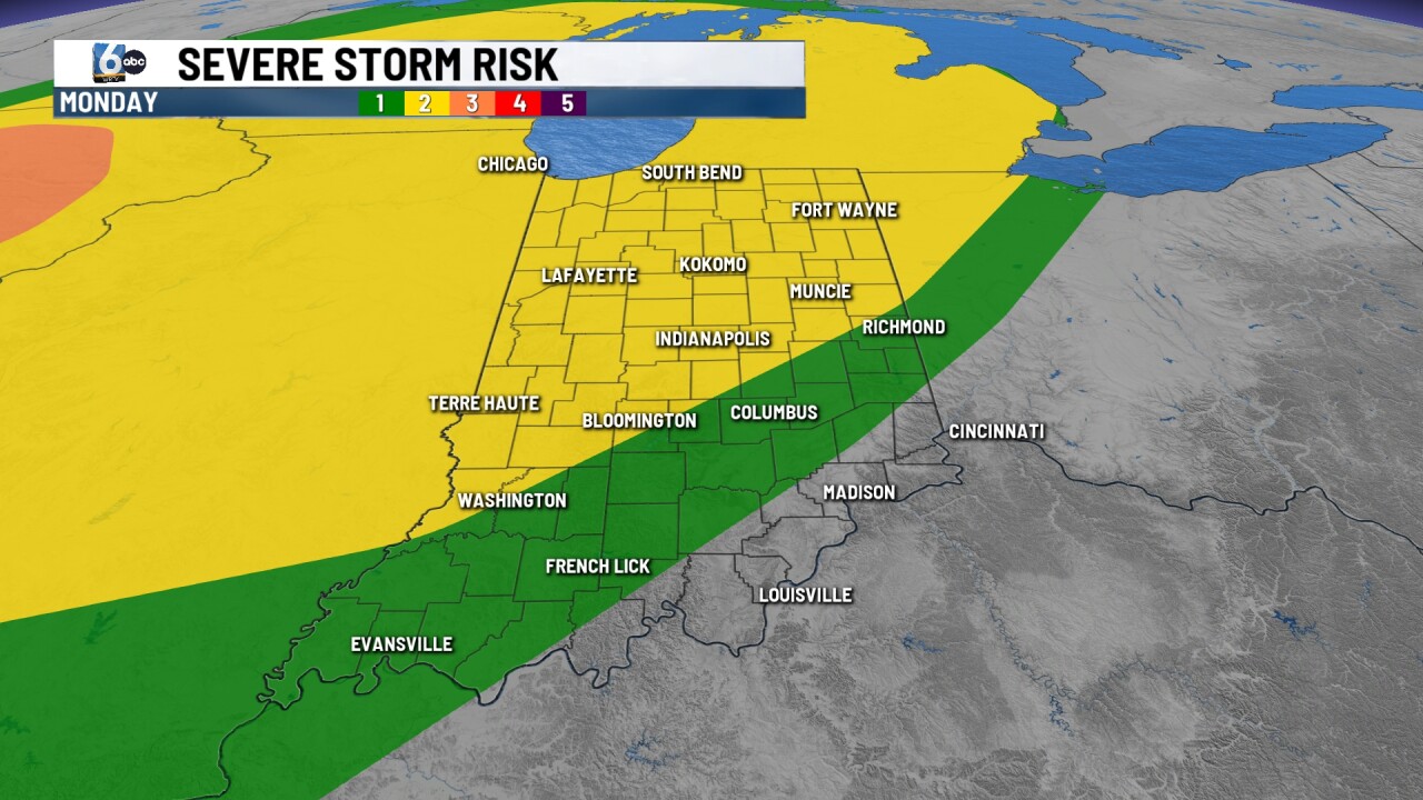
Storm chances continue for the day on Tuesday with temperatures remaining in the upper 80s. Any storms can bring gusty winds and small hail.
7-DAY FORECAST:
A cold front passes through overnight into Wednesday morning, cooling temperatures back to normal in the low 70s. Plenty of sunshine is expected as well.
The second half of the week features near-normal temperatures with a mix of clouds and sunshine. A few isolated showers and storms will be possible during the afternoon hours Friday and Saturday.
We will have to monitor a low-end risk for afternoon pop-up showers and storms for Race Day.
