INDIANAPOLIS (WRTV) — Warmer temperatures are on the way for the second half of the weekend, with rain and storm chances returning to start the new week.

TONIGHT:
Rain chances continue this evening and overnight, with a few storms possible, especially south of I-70. Any storms could bring gusty winds.

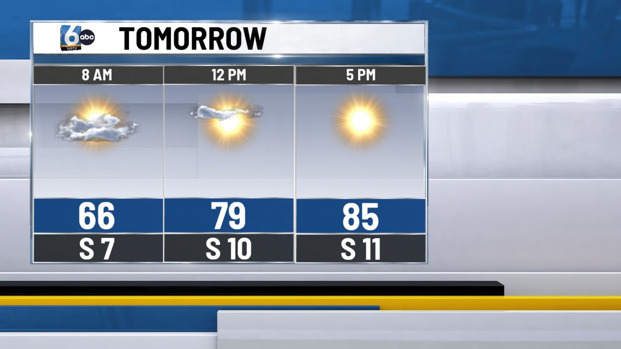
TOMORROW:
Warmer temperatures arrive to end the weekend, with a brief moment of dry weather. Sunshine returns for the day under mainly clear skies. High temperatures will rise into the mid to upper 80s.
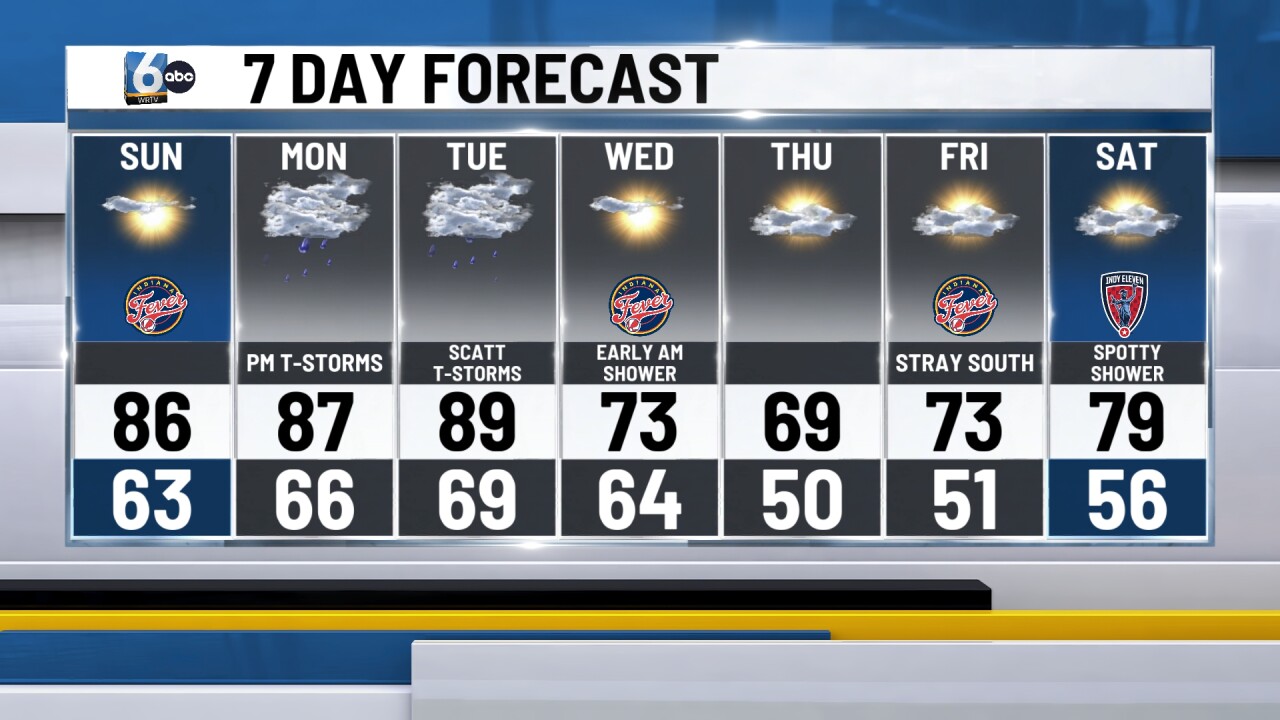
7-DAY FORECAST:
Rain and storm chances return to start the new week on Monday and Tuesday. Much of the day Monday will remain dry as temperatures remain in the 80s.
Best storm coverage will be in the late afternoon and evening hours. A few storms could contain gusty winds and small hail. Storm chances continue for the day on Tuesday with temperatures remaining in the upper 80s. Any storms can bring gusty winds and small hail.
A cold front passes through overnight into Wednesday morning cooling temperatures back to normal in the low 70s. Plenty of sunshine is expected as well.
The second half of the week features near normal temperatures with a mix of clouds and sunshine before rain and storm chances could return next weekend.