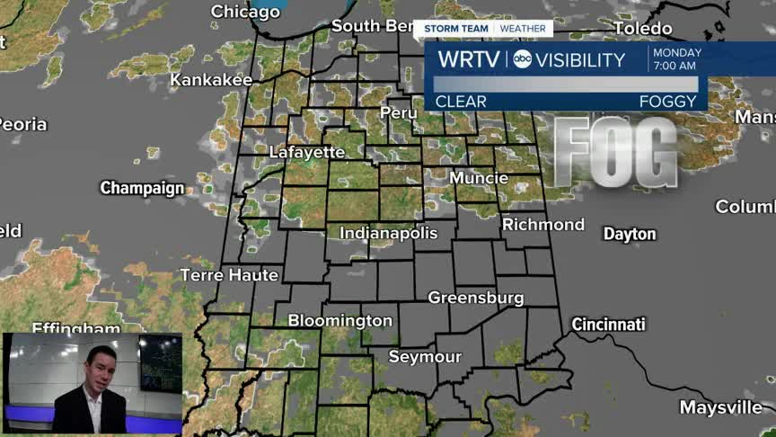


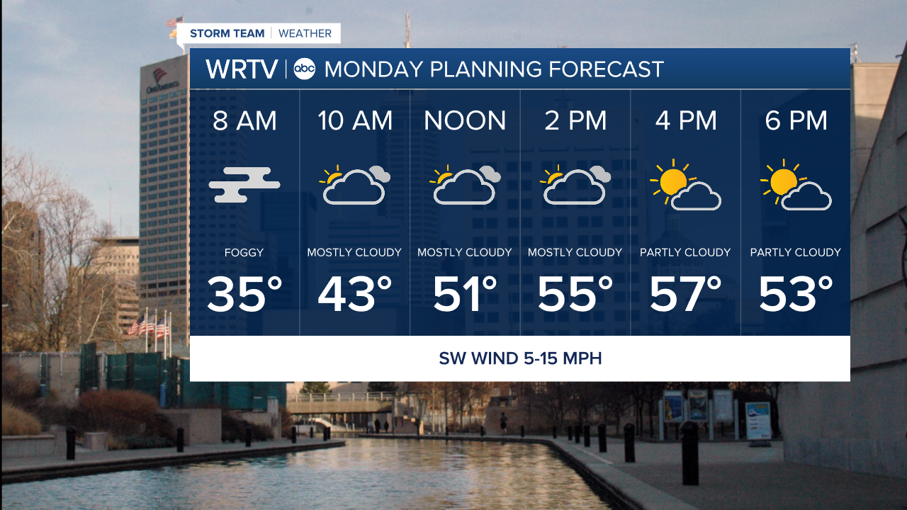
Fog continues to develop through Monday morning. The lowest visibility will be over areas that saw rain over the weekend. Some outlying spots could dip into the lower 30s. That means we can't rule out isolated slick spots. There is a Dense Fog Advisory for areas south of Indy through 10AM Monday.

Once the fog lifts, we're in store for more nice weather Monday afternoon. The return of some sunshine and a SW breeze get our highs into the middle and upper 50s.
Much of the week brings mild to warm temperatures. We could break the record high of 66° Wednesday. We're currently forecasting temperatures to reach near 70° during the afternoon. Our next chance for showers arrives early Wednesday. A few more showers or storms are possible late Thursday.
Indianapolis Weather Forecast:
Monday: Morning fog, then partly sunny. High: 58°
Tuesday: Mostly cloudy. High: 59°
Wednesday: AM showers possible. Partly sunny. High: 69°
Indianapolis 7-Day Weather Forecast

