

INDIANAPOLIS (WRTV) — Above-average temperatures will continue to be theme of the forecast over the next 7 days. There will be a few rain opportunities.
TONIGHT
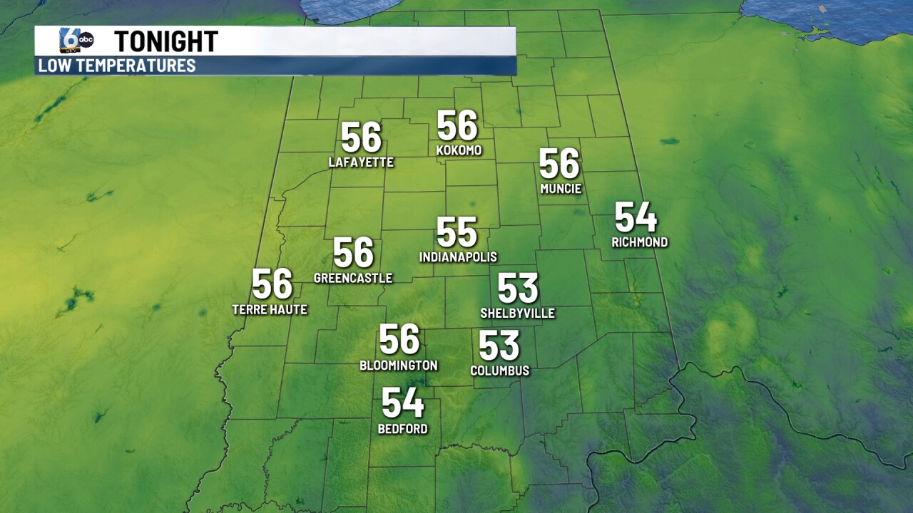
After a breezy afternoon, winds will decrease for the overnight hours. Low temperatures in the mid-50s.
TOMORROW
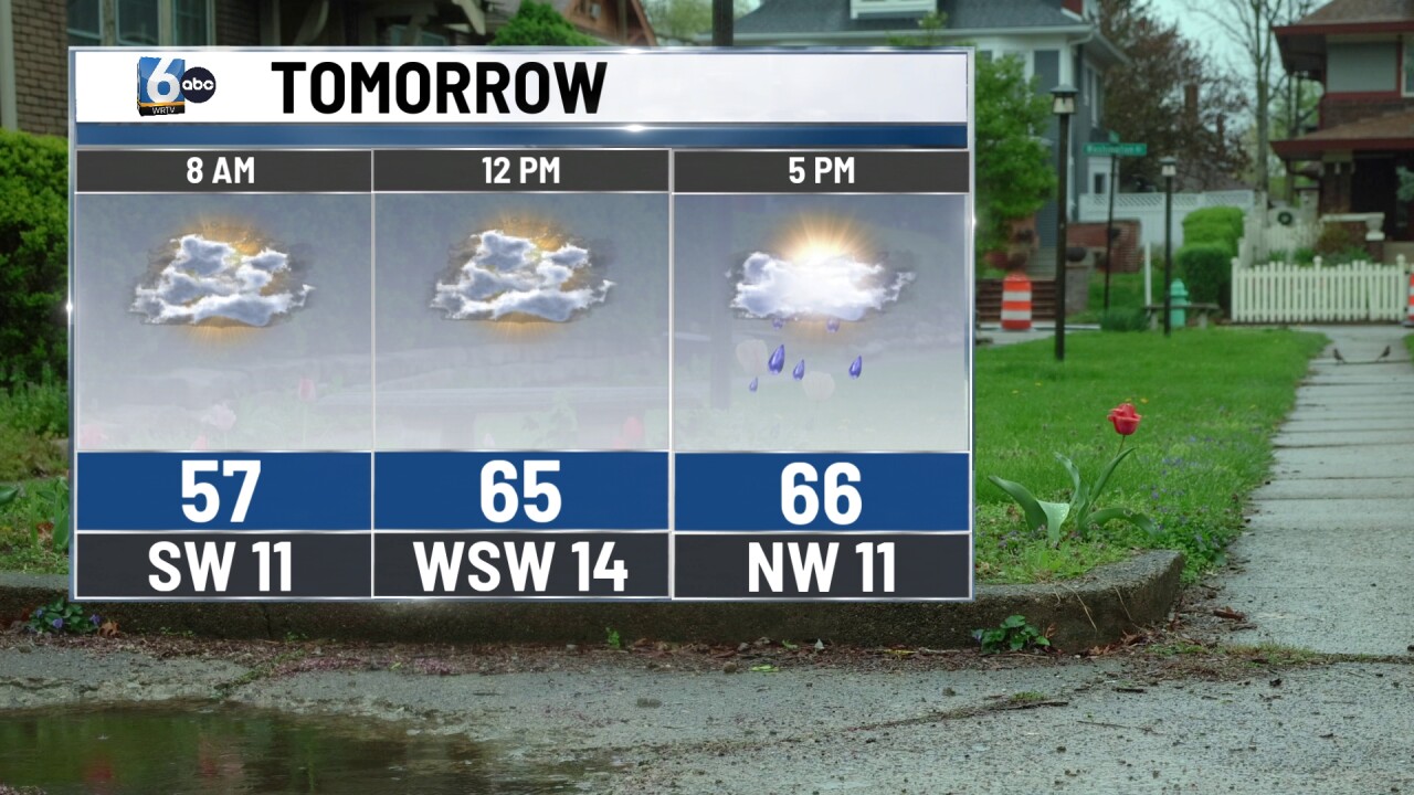
Rain is on the way along a cold front, but it won't be a washout. Scattered light showers move in from midday into the late afternoon. Central Indiana is not in a severe weather risk, but I wouldn't rule out some isolated rumbles of thunder. Rainfall amounts will generally be under 0.1". High temperatures near 70 degrees.
WEEKEND
Even behind the cold front, temperatures will still be slightly above average on Saturday. Much warmer air works back into the area by Sunday. Dry conditions are expected both days.
7-DAY FORECAST
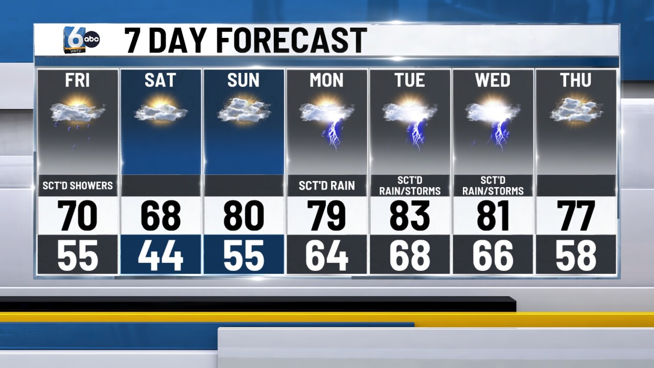
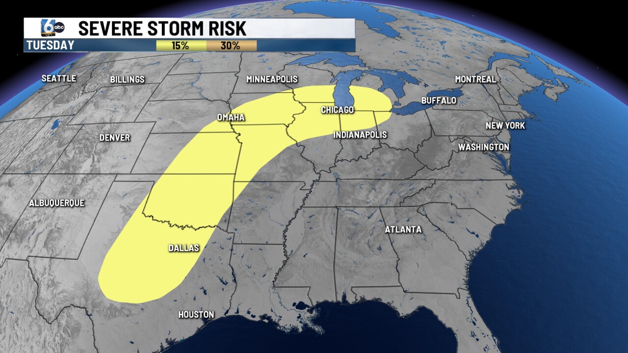
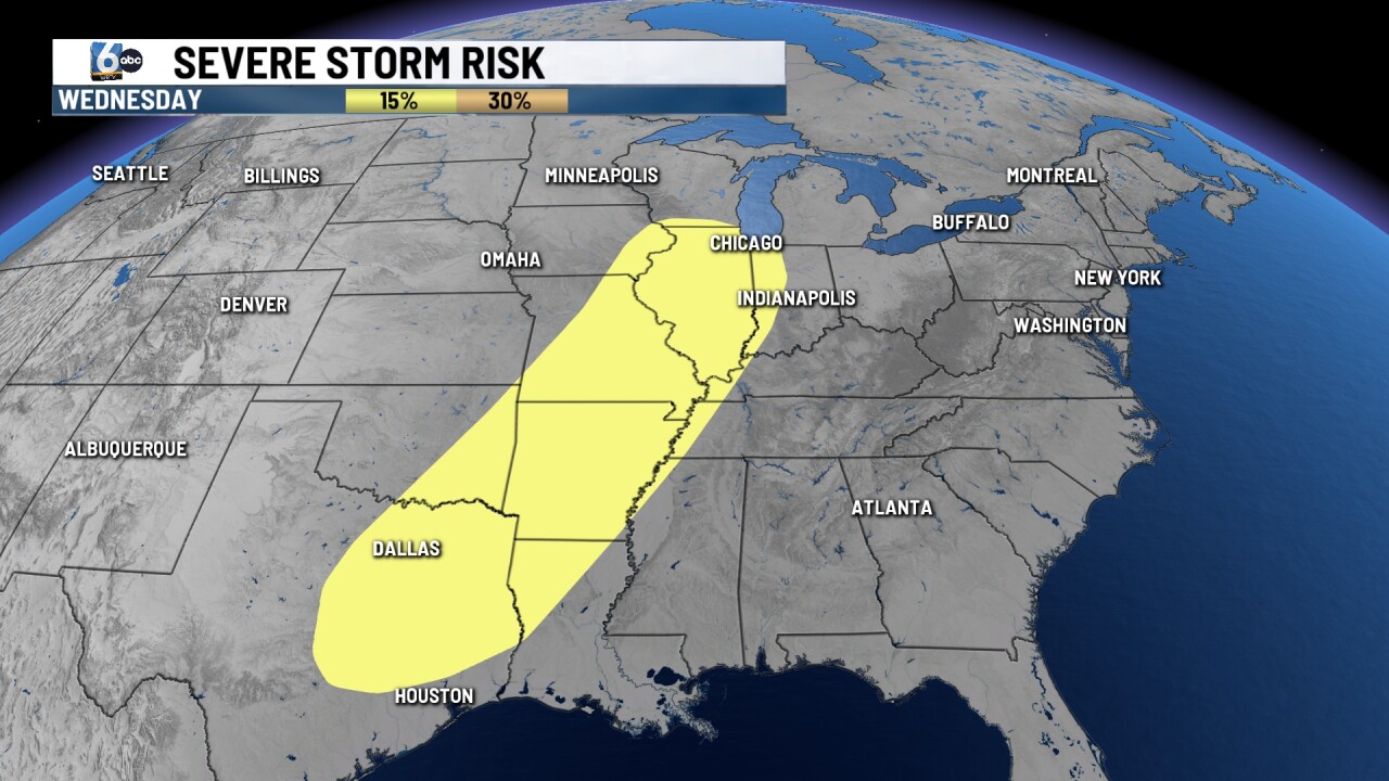
Our pattern turns unsettled again next week. Scattered rain is anticipated on Monday. High temperatures will be in the 80s for both Tuesday and Wednesday. Northern Indiana is in the slight risk of severe storms on Tuesday. The western half of Indiana is in the slight risk of severe storms on Wednesday. We will monitor as we get closer.
__
