


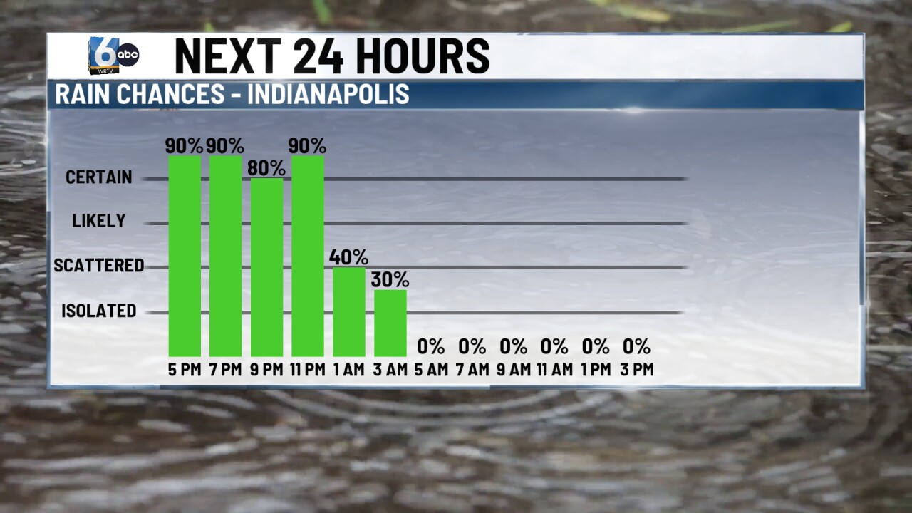
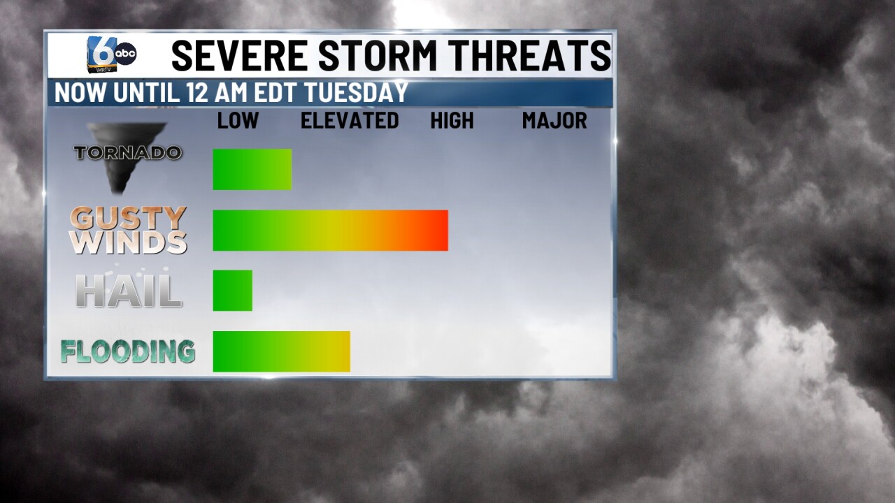
INDIANAPOLIS — A severe thunderstorm watch is in place for parts of central Indiana until 7 PM EDT. We will monitor for additional watches and warnings as the evening goes on. A Flood Watch is also in place until 2 AM EDT Tuesday for multiple counties in central Indiana.

TONIGHT

Widespread showers and storms. Another line of storms could contain damaging wind and isolated tornadoes mainly south of I-70 after 7 PM and before midnight. Multiple inches of rain could also be on the table south of I-70. Mostly cloudy skies remain in the early morning hours. Low temperatures near 60 degrees.

TOMORROW
Mostly cloudy. Scattered showers arrive later on Tuesday night. High temperatures in the low 60s.
WEDNESDAY
A few showers in the early morning before clouds decrease to partly cloudy skies. High temperatures in the mid-60s.
7-DAY FORECAST
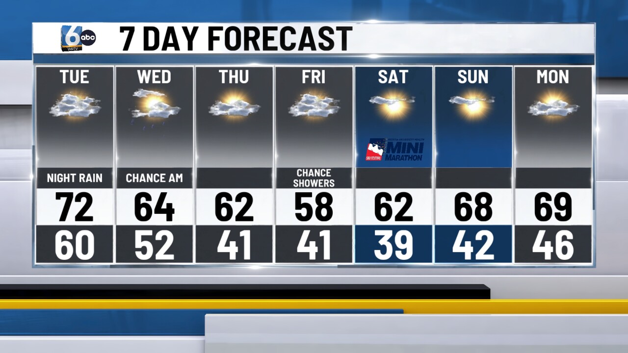
Temperatures for the rest of the week into the start of the weekend will run below average in the 60s and upper 50s. Dry conditions are expected to persist after Wednesday morning's rain chance.
__
