

INDIANAPOLIS (WRTV) — A cold front is crossing central Indiana this evening. Our broad pattern still keeps much of Indiana warm over the next 7 days.
TONIGHT
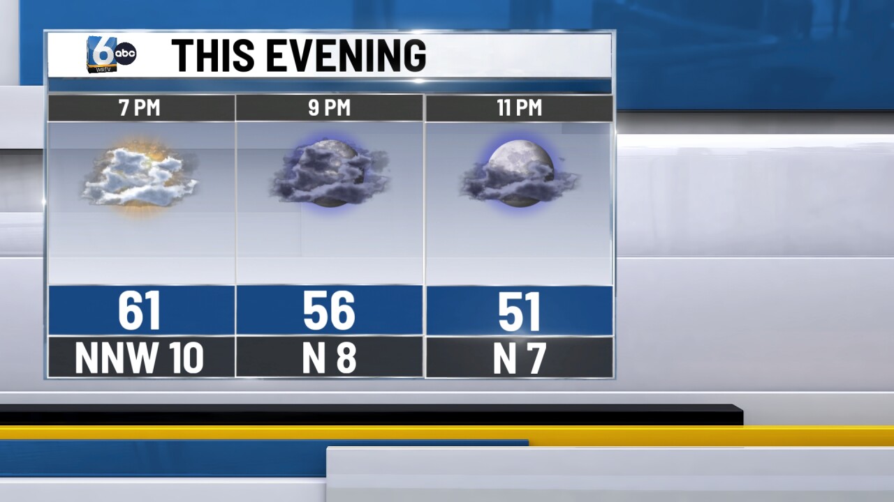
Spotty showers from the late afternoon exit to the south. Clouds will decrease as the night goes on. Low temperatures in the low 40s.
TOMORROW
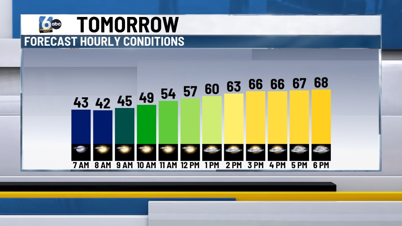
Mostly sunny skies to start. Clouds increase through the afternoon. High temperatures in the upper 60s.
SUNDAY
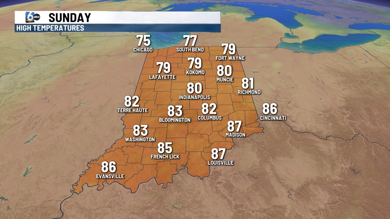
Temperatures warm up underneath a warm front. Mostly cloudy skies are anticipated. High temperatures near 80 degrees with winds gusting to around 30 mph.
7-DAY FORECAST
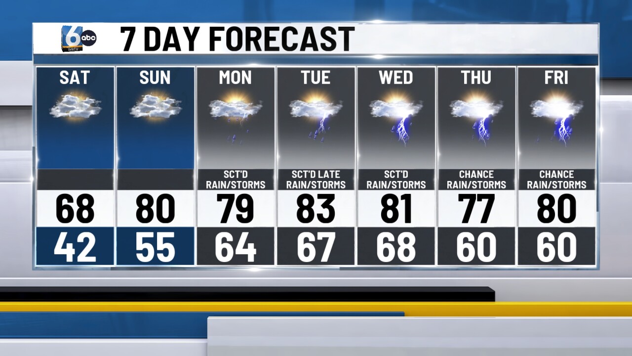
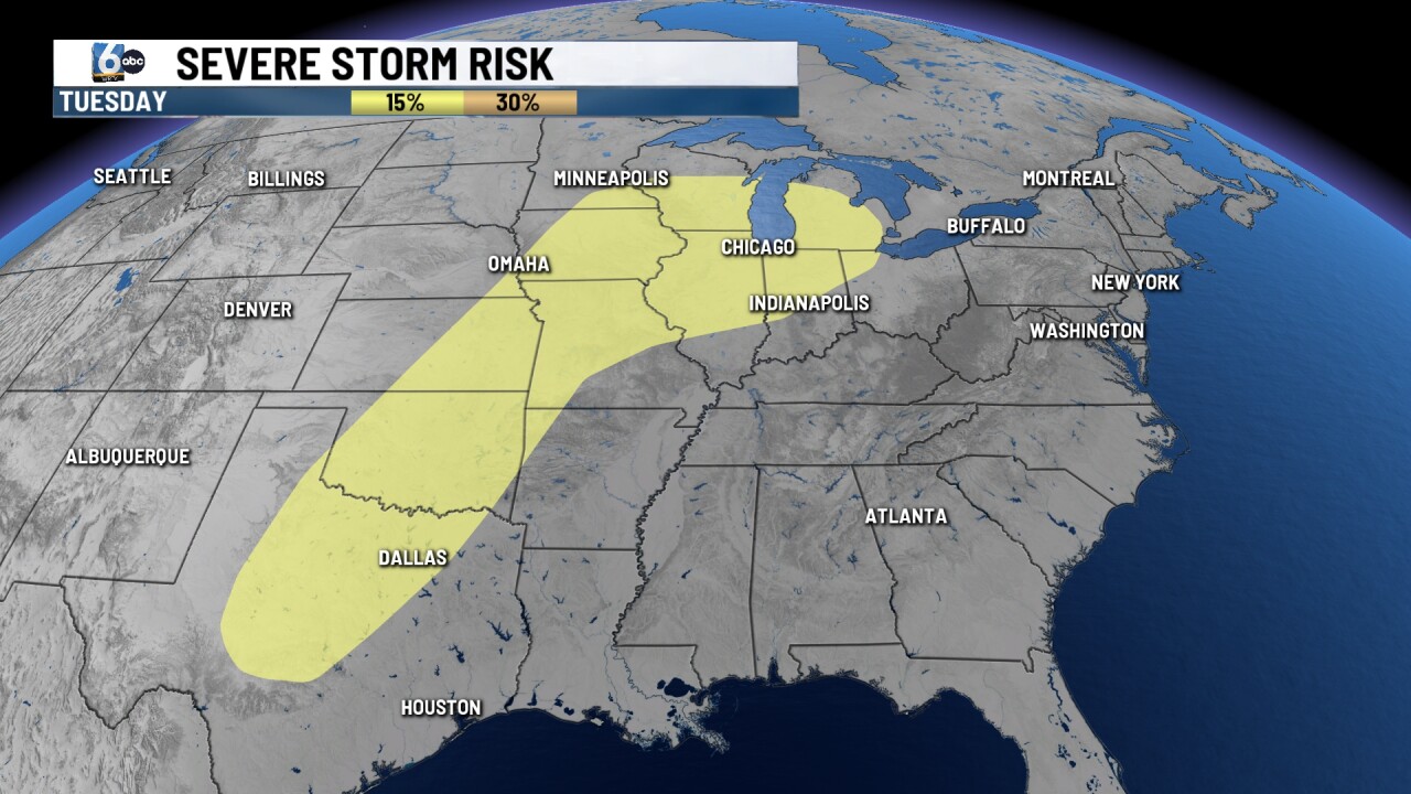
Central Indiana will be in the warm sector much of next week. This will bring in almost daily rain/storm chances. Most of these chances at rain don't appear to be all-day soakers. The northern half of Indiana is in a slight risk of severe storms on late Tuesday. Indianapolis could be close to the record high on Tuesday, 85 degrees set back in 1883.
__
