


INDIANAPOLIS — Another round of showers and storms on the way later tonight, however, severe storms aren't expected.
TONIGHT
Clouds increase to mostly cloudy. Numerous showers and a few storms arrive mainly after midnight and last through the early morning. Small hail is possible, but the severe risk is very low. Considering all the rainfall we had on Monday, it won't take much for flooding to occur. An additional 0.5-1" of total rainfall is expected. Low temperatures in the low 50s.
TOMORROW

Scattered rain waking up exits by midday. Partly cloudy skies with the lingering chance of a spotty sprinkle through the late afternoon. High temperatures in the low 60s.

THURSDAY
Partly cloudy. High temperatures in the low 60s.
7-DAY FORECAST
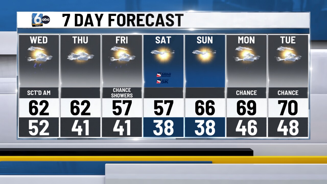
A cooler and drier pattern sets up. Over the weekend, we could have overnight lows in the 30s. Smaller chances of rain re-enter the forecast next week.

__
