


INDIANAPOLIS — Summer-like showers and storms continue over the next few hours. The weekend is shaping up to be a good one before a strong system late Monday.
TONIGHT
On/off showers and storms continue through the evening. Overall, the severe risk is low, but there may be an isolated gusty storm, though in eastern Indiana. Mostly cloudy skies remain for the rest of the night with low temperatures in the mid to upper 50s.
TOMORROW
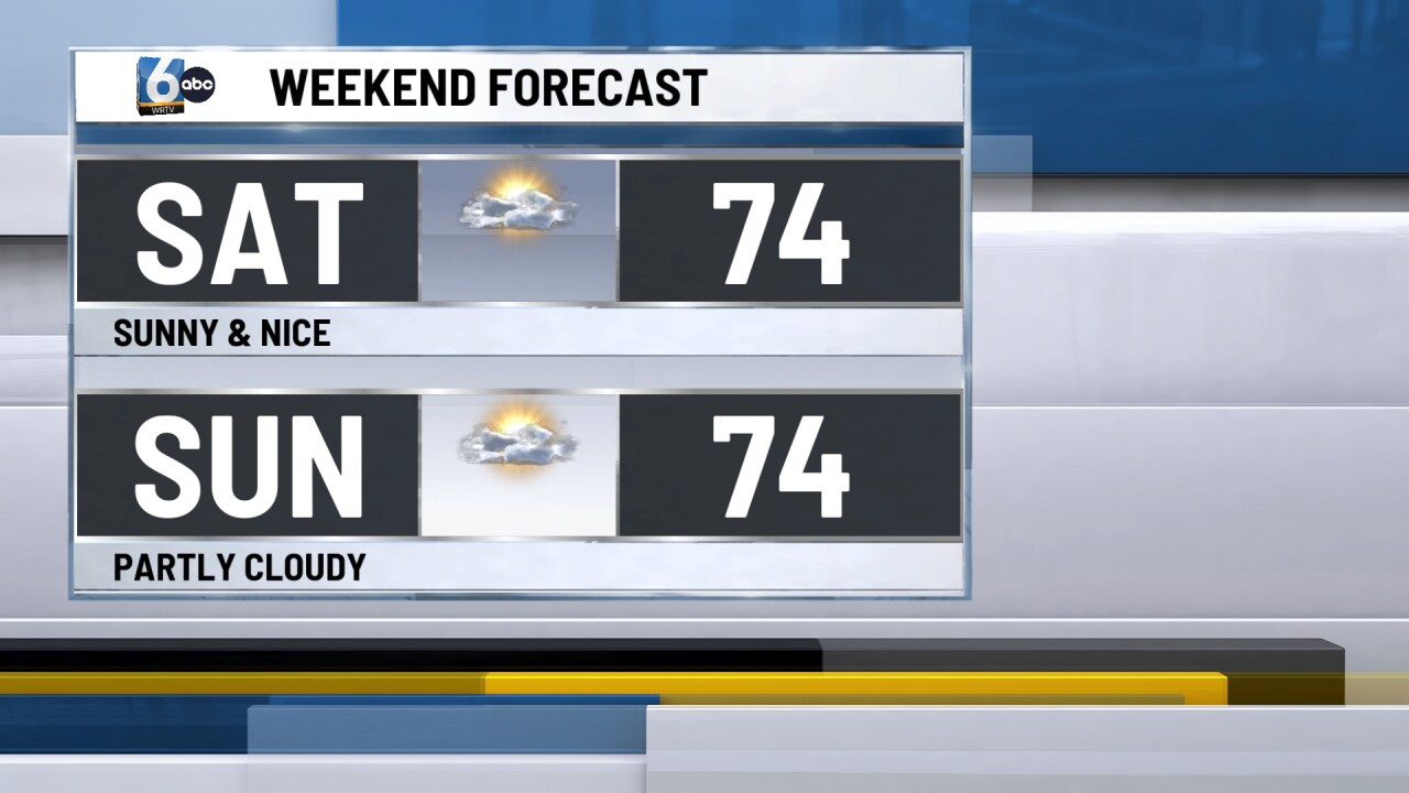
Partly cloudy to mostly sunny skies. A beautiful way to start the weekend with high temperatures in the mid-70s.
SUNDAY
Partly cloudy skies. High temperatures are once again above average and in the mid-70s.
7-DAY FORECAST

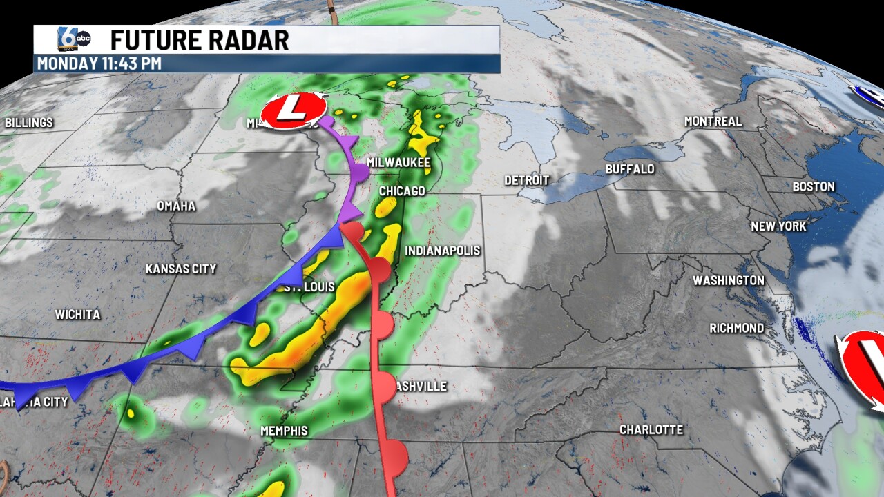
Late Monday, central Indiana will have to monitor the for the chance of severe storms. The risk is currently higher in Illinois, but most of Indiana is at a slight risk. The timing is looking more likely at this point, Monday night for our area, with all modes of severe weather on the table. Temperatures take a dip after Monday with multiple days in the 60s and even the upper 50s to close out next week.
__
