
INDIANAPOLIS (WRTV) — We continue to track the potential for record temperatures, rain/storm chances, and breezy winds the next few days.
TODAY

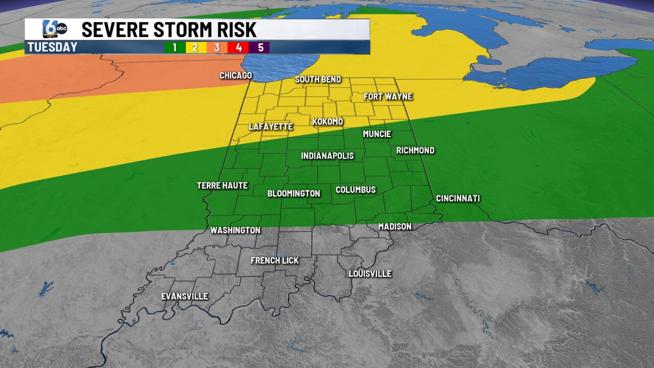
Scattered showers and storms possible into this afternoon and tonight. A level 1/5 severe risk is in place across much of central Indiana with a level 2/5 risk along and north of a Lafayette-Gas City line. Wind and hail are the main threats. Highs in the low to md 80s, and Indy's record high for today is 85 from 1883.
TONIGHT
We'll keep the chance around for spotty to scattered showers and storms with a low-end severe risk. Lows once again could be on the record warm side with numbers in the low to mid 60s. Indy's record warm low tonight is 62 from 2002.
WEDNESDAY
Showers and storms are likely at times. There is a level 1/5 severe risk across northern and central Indiana for wind and hail. Highs in the low to mid 80s. Indy's record high for Wednesday is 84 from 2002.
7-DAY FORECAST

Another level 1/5 severe risk is ahead for Thursday with wind and hail once again the primary threat. Friday looks mainly dry, warm, and windy with numbers in the mid 80s. Friday's record high is 87 from 1896. Saturday is another day to monitor for stronger storm potential before we cool down a bit Sunday.
