


INDIANAPOLIS (WRTV) — Poor air quality again today with high heat, humidity and smoke from Canadian wildfires. Spotty showers and thunderstorms into the afternoon hours as well.

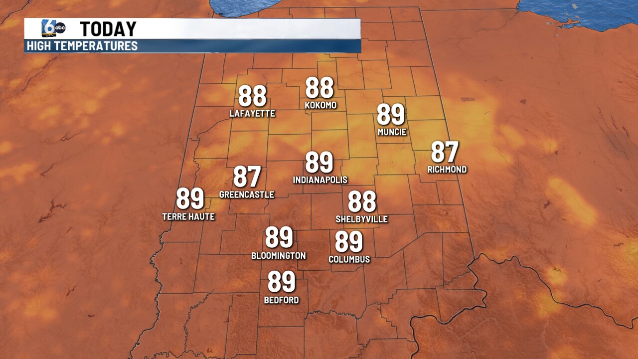
TODAY: Air Quality Alert in place across much of Indiana thanks to smoke from wildfires across parts of Canada. High heat and humidity will continue today. High temperatures will climb close to 90 degrees this afternoon with heat index values into the mid 90s. Scattered showers and thunderstorms will be possible into the afternoon and evening hours. Some of those thunderstorms may reach severe criteria with gusty winds and heavy rainfall. There is a level one in out of level five of some of those thunderstorms will reach severe criteria.
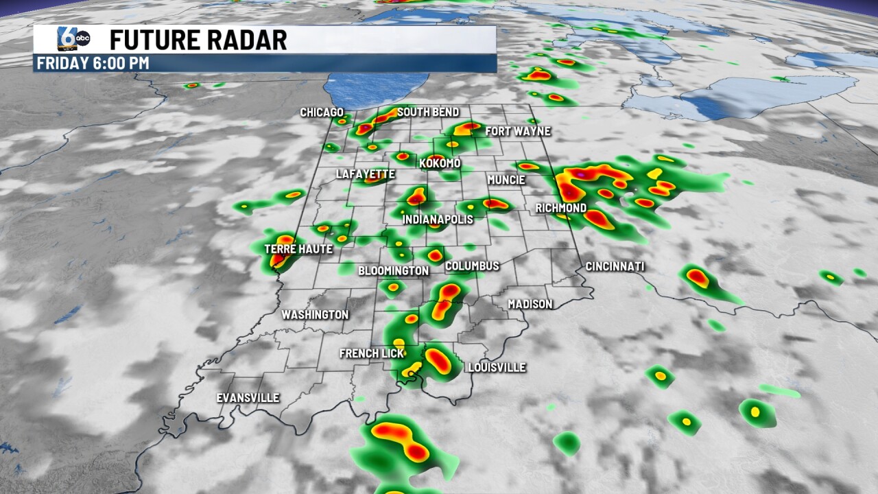
TONIGHT: Mild and muggy this evening with temperatures falling into the 70s.
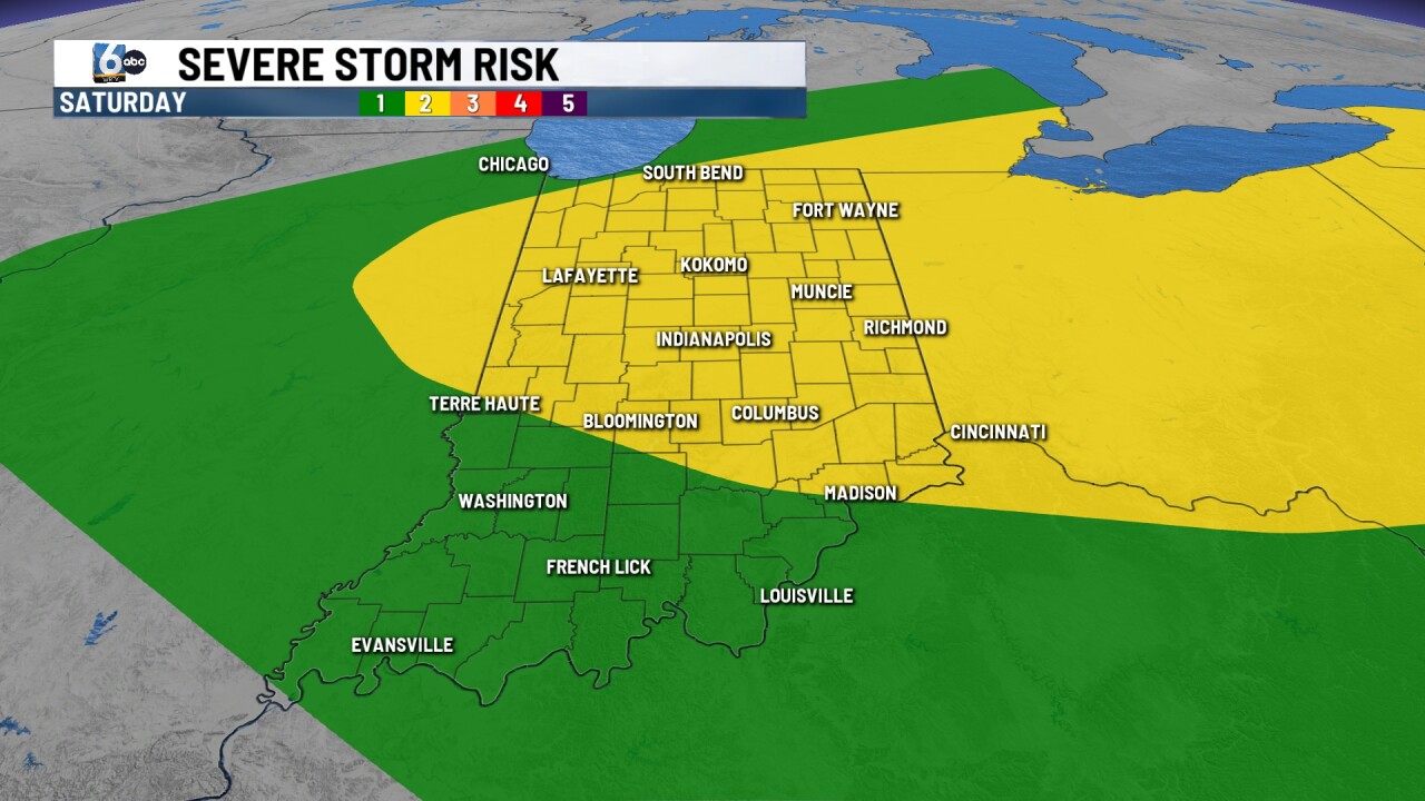
TOMORROW: Dry for the first part of the weekend, otherwise sunny, hot and humid again. Highs will reach 90. Showers and thunderstorms develop later Saturday evening. Some of those could be on the stronger side with gusty winds and heavy rainfall. A level two out of five for severe weather risk is in play.

7 DAY EXTENDED FORECAST: The end of the weekend looks dry sunny skies with highs into the mid 80s. Still on the warm side for the beginning of next week with temps in the mid upper 80s. Rain chances possible on Tuesday. Pattern shift brings temperatures down below normal for Wednesday and Thursday with high near 80.


