

INDIANAPOLIS (WRTV) — Temperatures are making a run at record highs this afternoon. Our attention now turns to storm chances this evening into tonight.
TONIGHT
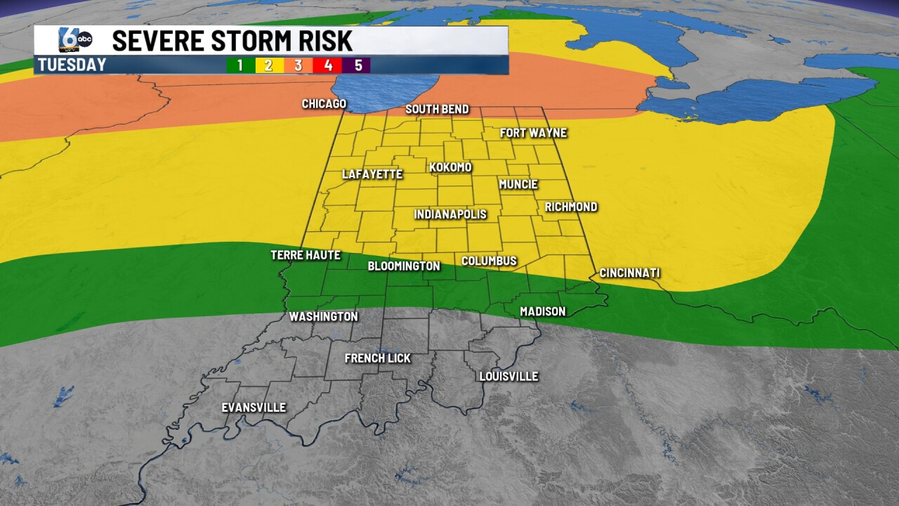
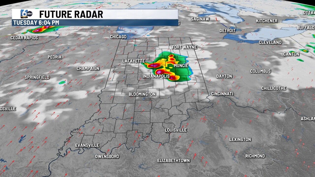
The Storm Prediction Center has expanded the slight (2/5) risk into central Indiana. Cells could fire in the next few hours along a boundary left over from this morning. This is separate from the severe storm risk along the stalled front in Wisconsin & Illinois.
Large hail & isolated tornadoes are possible within these first cells, if they fire. As the line merges, wind becomes the concern. Further into the evening, there is a separate cluster from Illinois worth watching. Our severe storm window will run until 11 PM. Low temperatures in the mid to upper 60s.
TOMORROW

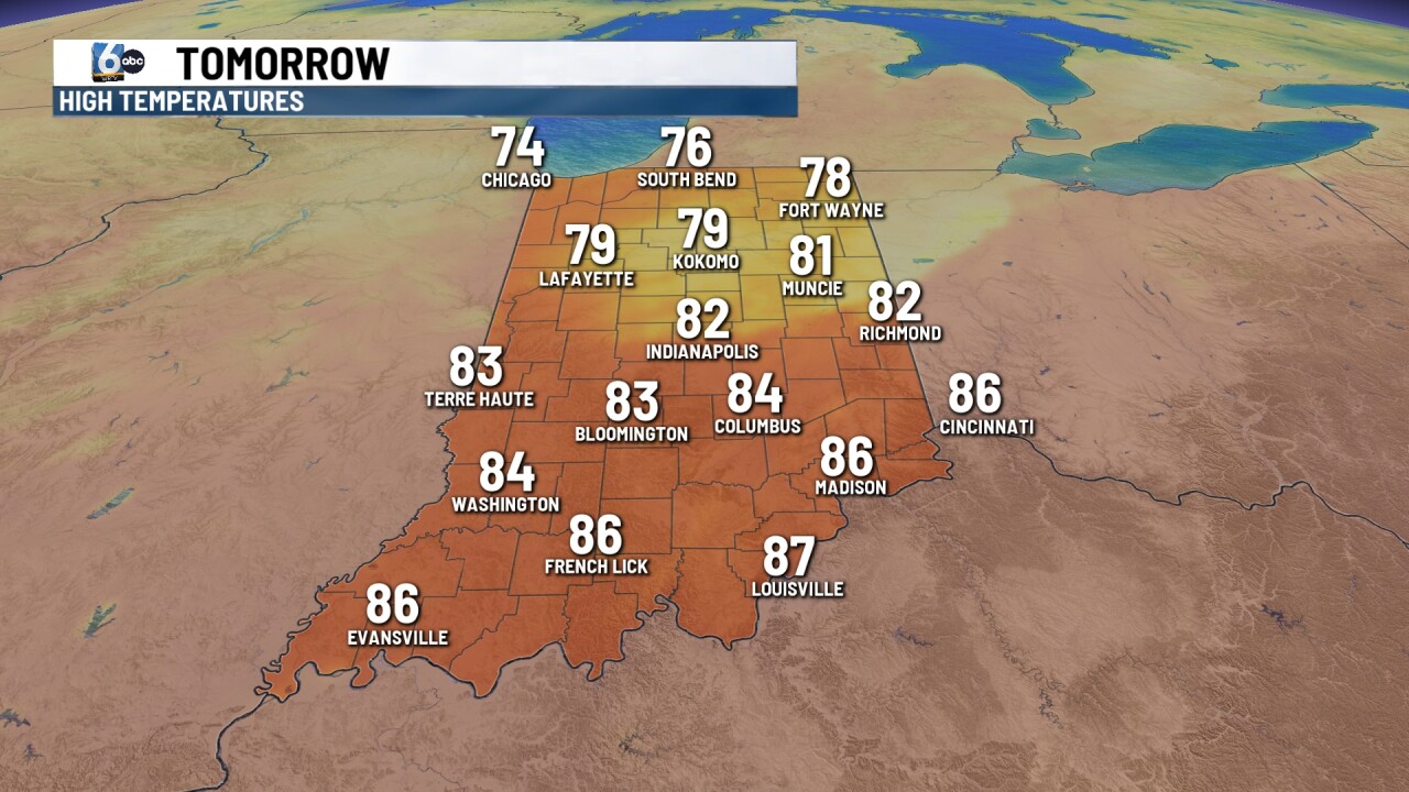
Scattered showers and storms, mainly in the afternoon and evening hours. A marginal (1/5) risk of severe storms is in place for wind. High temperatures in the low 80s.
THURSDAY
Scattered showers and storms. High temperatures in the mid to upper 70s.
7-DAY FORECAST

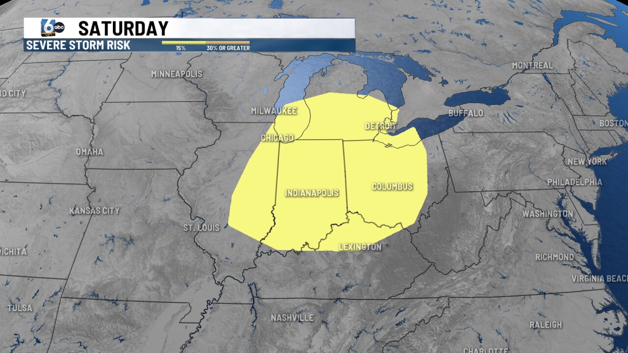
Friday looks to be dry in central Indiana with high temperatures pushing into the low to mid 80s. A slight risk of severe storms is in place on Saturday as a strong cold front pushes into the area. Much cooler air follows for Sunday & Monday. Low temperatures are expected to fall into the 30s on Monday morning.
__
